Victoria Gardens
Number/street name:
Victoria Mill
Address line 2:
Manchester Road/ Buckley Street
City:
Manchester
Postcode:
M43 6DU
Architect:
Ollier Smurthwaite Architects
Architect contact number:
Developer:
DeTrafford Estates Group.
Contractor:
N/A
Planning Authority:
Tameside Metropolitan Borough Council
Planning Reference:
15/00030/OUT
Date of Completion:
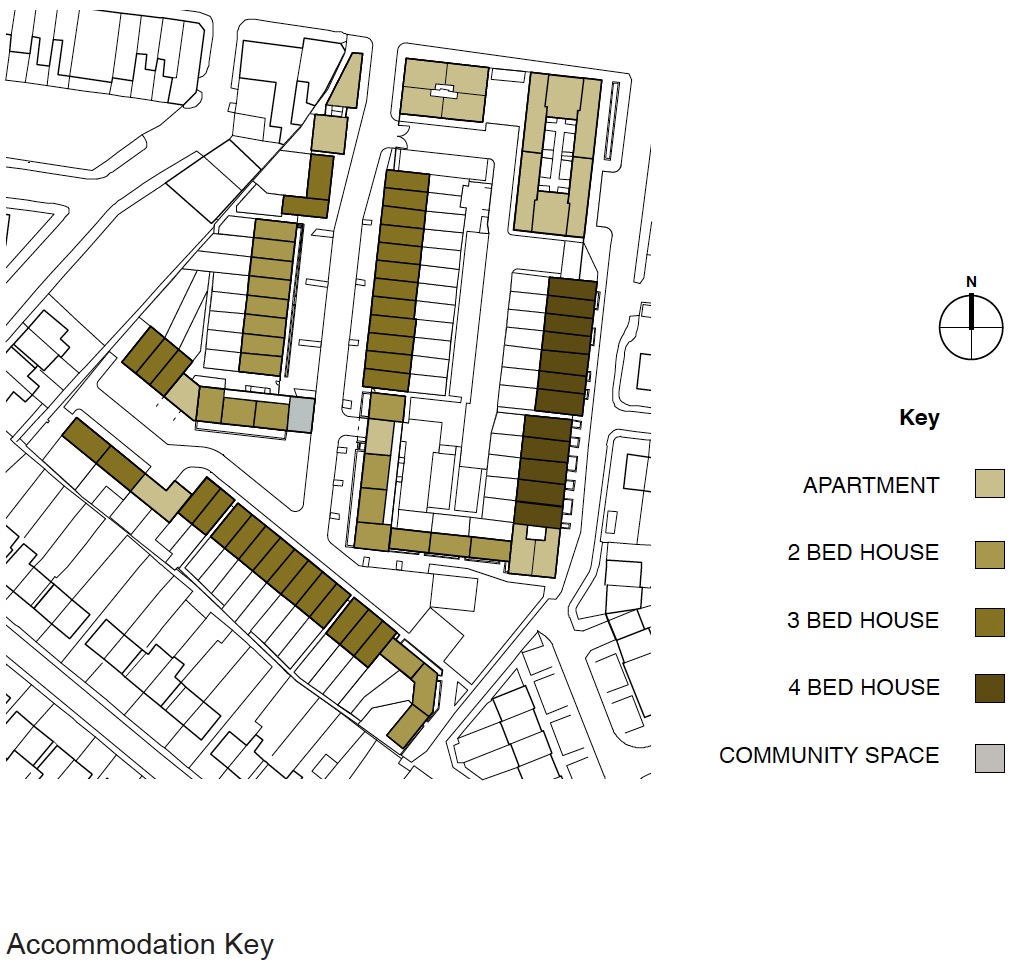
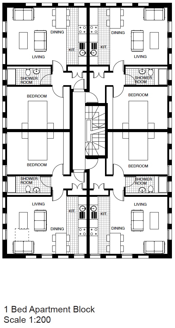
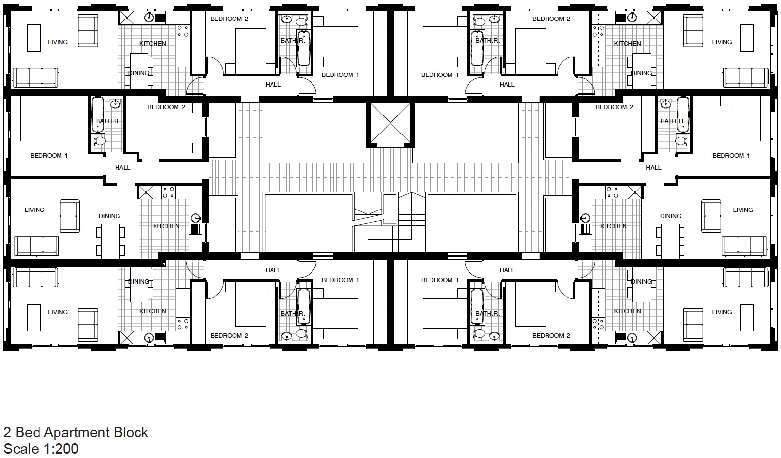
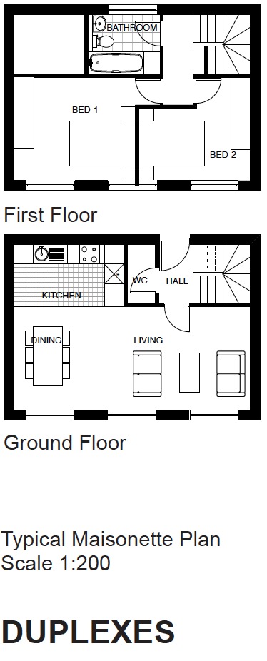
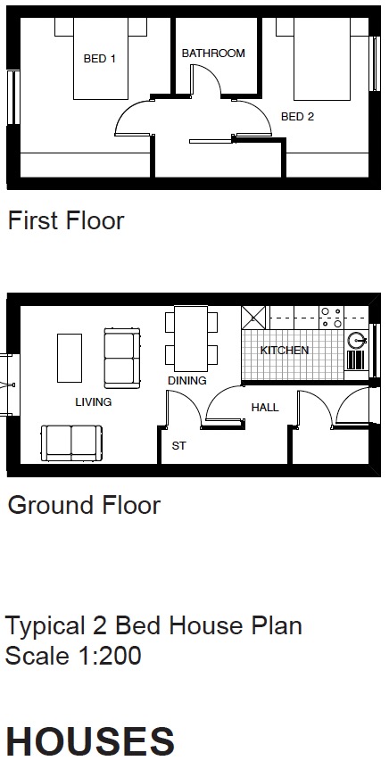
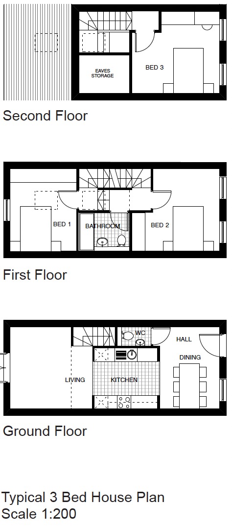
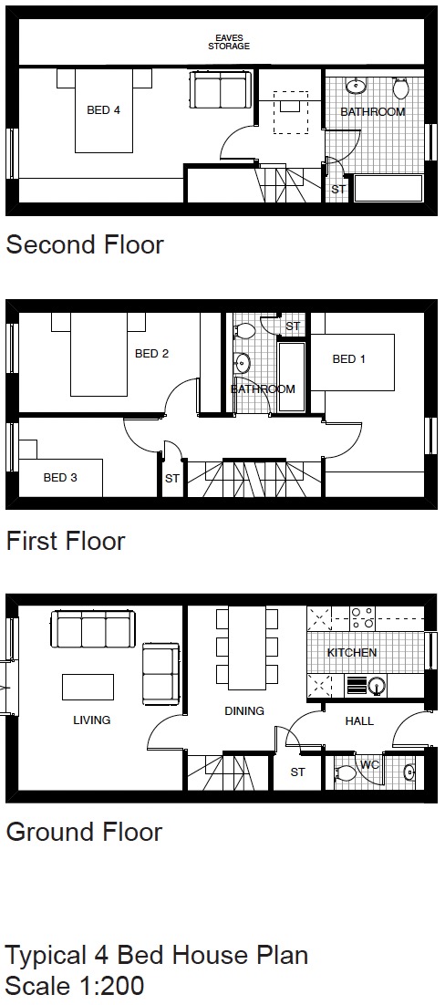
Schedule of Accommodation:
26 x 1 bed, 57 x 2 bed, 32 x 3 bed, 12 x 4 bed
Tenure Mix:
100% private dwelling
Total number of homes:
Site size (hectares):
1.2
Net Density (homes per hectare):
106
Size of principal unit (sq m):
85
Smallest Unit (sq m):
45.4
Largest unit (sq m):
113.6
No of parking spaces:
124
 Scheme PDF Download
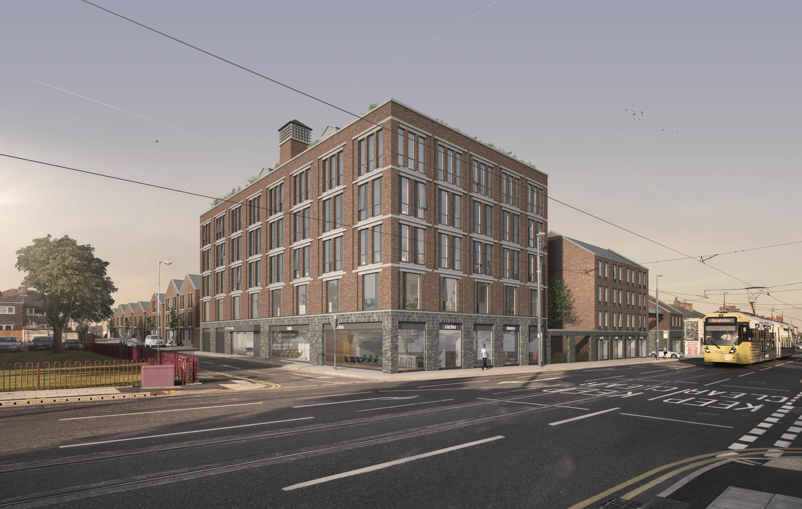
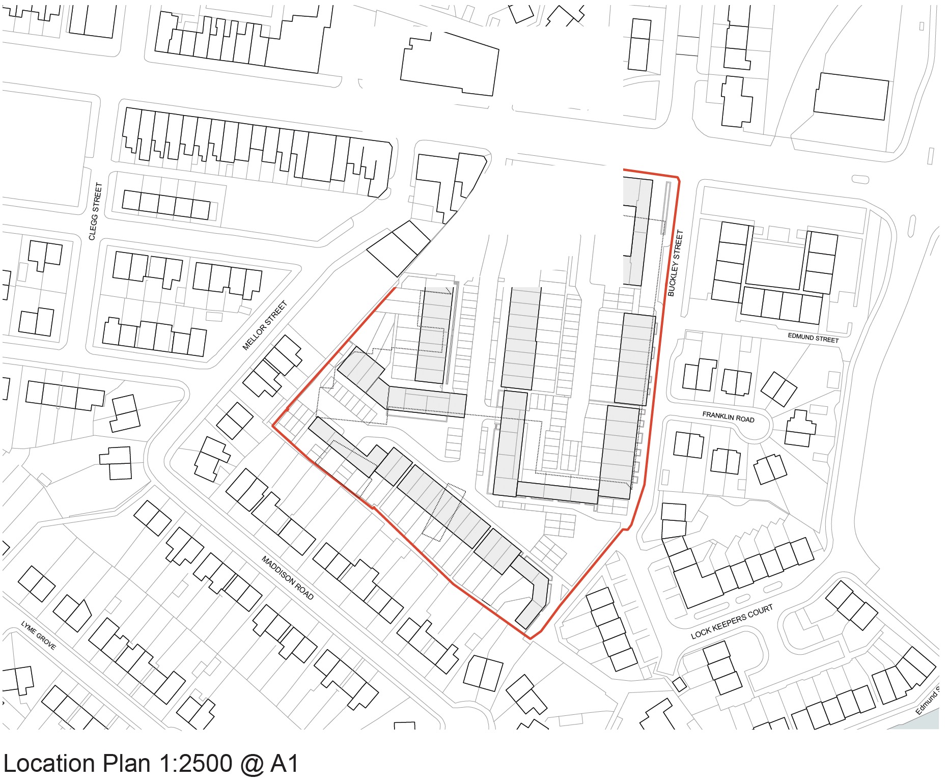
Planning History
Prior to submission of our planning application meetings were held with a Council planning officers to establish the principle and design of a residential scheme. An outline application was submitted by Ollier Smurthwaite Architects on 21st January 2015 (Ref: 15/00030/OUT). The submission detailed the proposals at a level commensurate with a full planning application and Planning permission was granted on 19th November 2015.
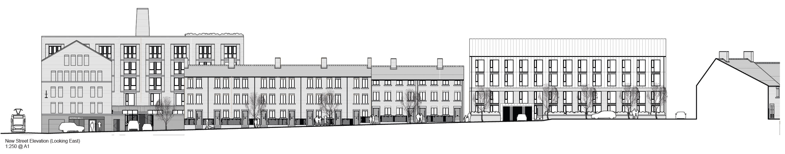
The Design Process
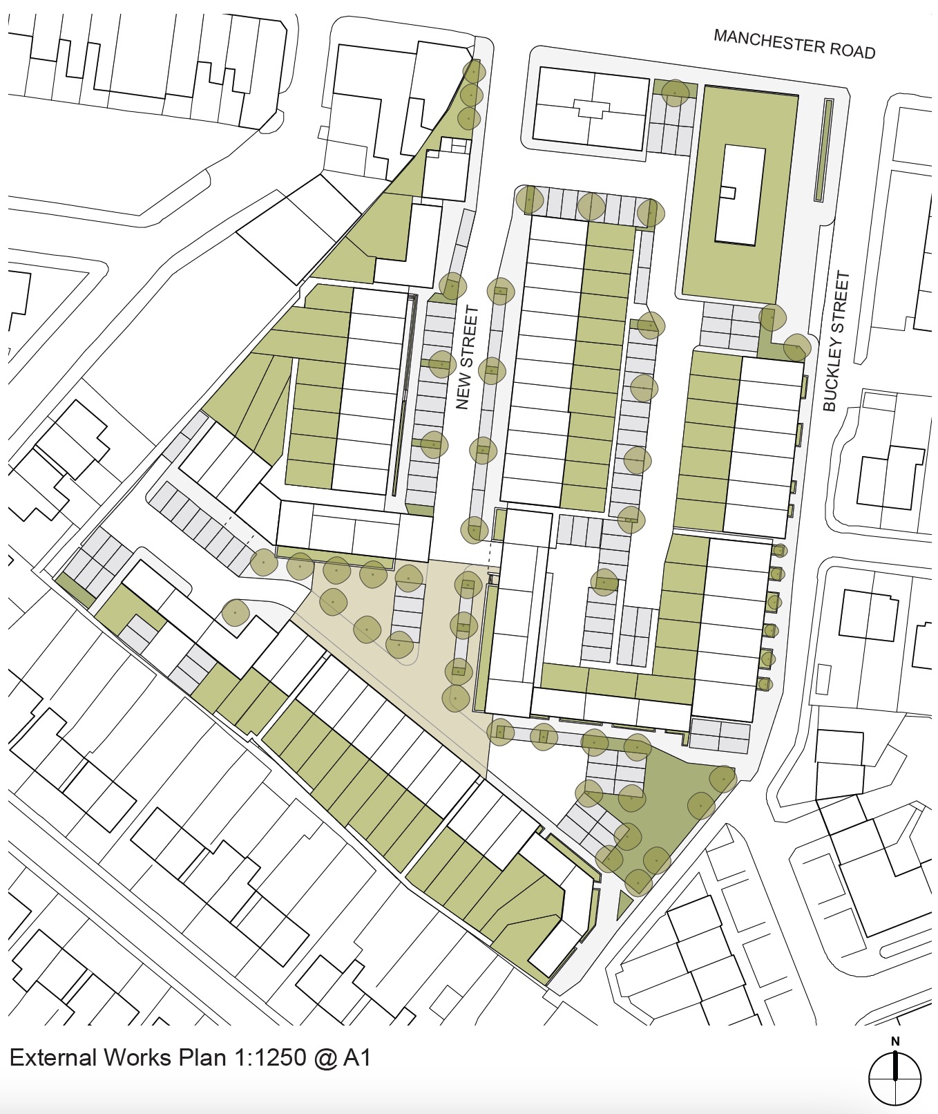
The proposed layout aims to create a welcoming and interesting urban landscape, by providing a range and hierarchy of streets and public spaces. Responding to its location adjacent to the Fairfield Conservation Area, the approach to the design and layout has been conceived with the view of creating an urban village, reminiscent of the character of the Moravian Settlement whilst also acknowledging it’s important location on Manchester Road as the gateway to Droylsden town centre, and its industrial heritage. The result is the formation of a number of distinct house types that are arranged in blocks to line new and existing streets with active frontages and create enclosure to new public squares and private courtyards. This wide main access street is intended to be reminiscent of the wide streets found in the nearby Moravian Settlement. A new public square is proposed at the terminus of the main street and is to be the main focal point for the development. This new square is further defined by the 3 and 4-storey blocks around its edge which helps define it and create enclosure. The secondary street, running roughly east to west provides access to further parking courtyards and tandem spaces. At its terminus at the southeastern corner of the site is a new public playground. The blocks lining the secondary street are also positioned at back-of-pavement the proposed new streets are intended to be read as a hierarchy of spaces rather than roads, widening in parts to form squares and narrowing elsewhere to create more intimate settings. The new public square at the centre of the development is at the junction of the main access road and secondary street. The roads passing through the public square will be a shared surface, encouraging low vehicle speeds. The majority of car parking spaces are located within secure private courtyards. This reduces the number of spaces from the main streets and will help to curtail the feeling of a car dominated environment. The proposed shared surfaced new public square and streets form the large part of the public areas. They are hard surfaced in block paving, punctuated with specimen trees of local provenance. Segments of soft planting separate areas of parking to prevent a dominance of vehicles. Larger areas of soft planting are proposed to define the play area. A contrasting surface of block paving is proposed to the new streets and within the private courtyard to mark a change of character.


