Ordnance Lane
Number/street name:
Ordnance Lane
Address line 2:
Fishergate
City:
York
Postcode:
YO10 4DY
Architect:
Mikhail Riches
Architect contact number:
2076081505
Developer:
City of York Council.
Planning Authority:
City of York Council
Planning consultant:
Tibbalds
Planning Reference:
21/02573/FULM
Date of Completion:
07/2025
Schedule of Accommodation:
24 x 1bed, 32 x 2 bed, 14 x 3 bed, 10 x 4 bed, 5 x 5 bed
Tenure Mix:
60% affordable (social rent and shared ownership) 40% market
Total number of homes:
Site size (hectares):
1.38 hectares
Net Density (homes per hectare):
62
Size of principal unit (sq m):
97
Smallest Unit (sq m):
50 sqm
Largest unit (sq m):
175 sqm
No of parking spaces:
28
 Scheme PDF Download
Planning History
Ordnance Lane was granted full planning permission in June 2022. The project team engaged fully with stakeholders and local residents for 2 years, prior to the application. Co-design workshops, public mid-stage reviews and online discussions ensured the scheme brought forward was one that met the need of the local community. This process highlighted a need that lead the client to change the brief to provide a range of intergenerational homes.
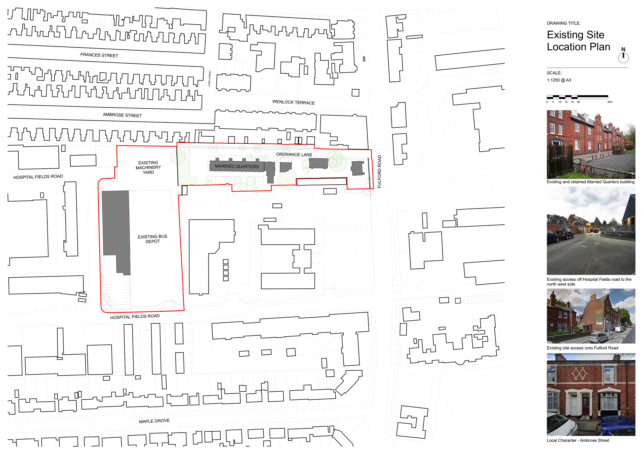
A previous application for part of the site (by others) was withdrawn. This was a proposed residential scheme, which demolished all existing buildings along Ordnance Lane.
The Design Process
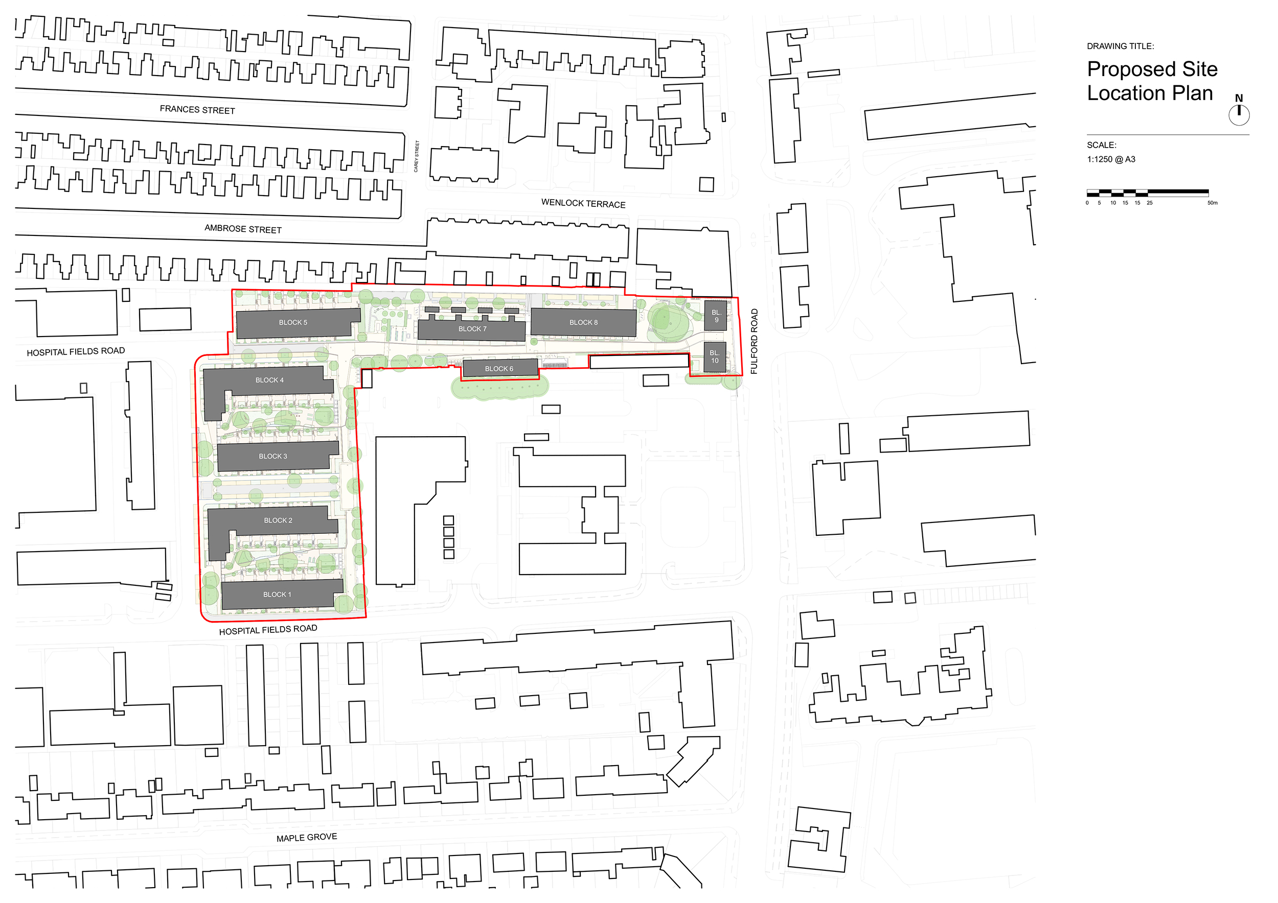
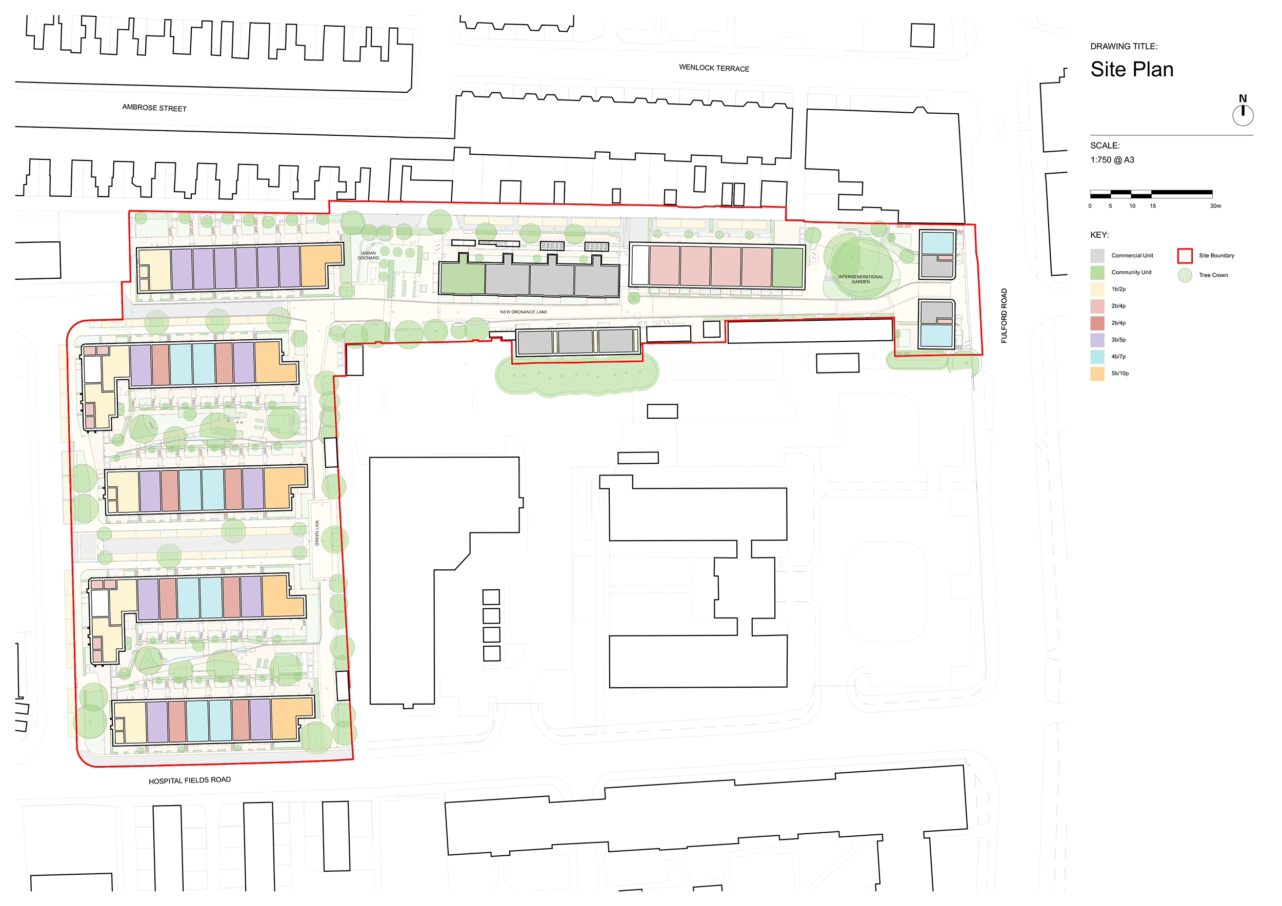
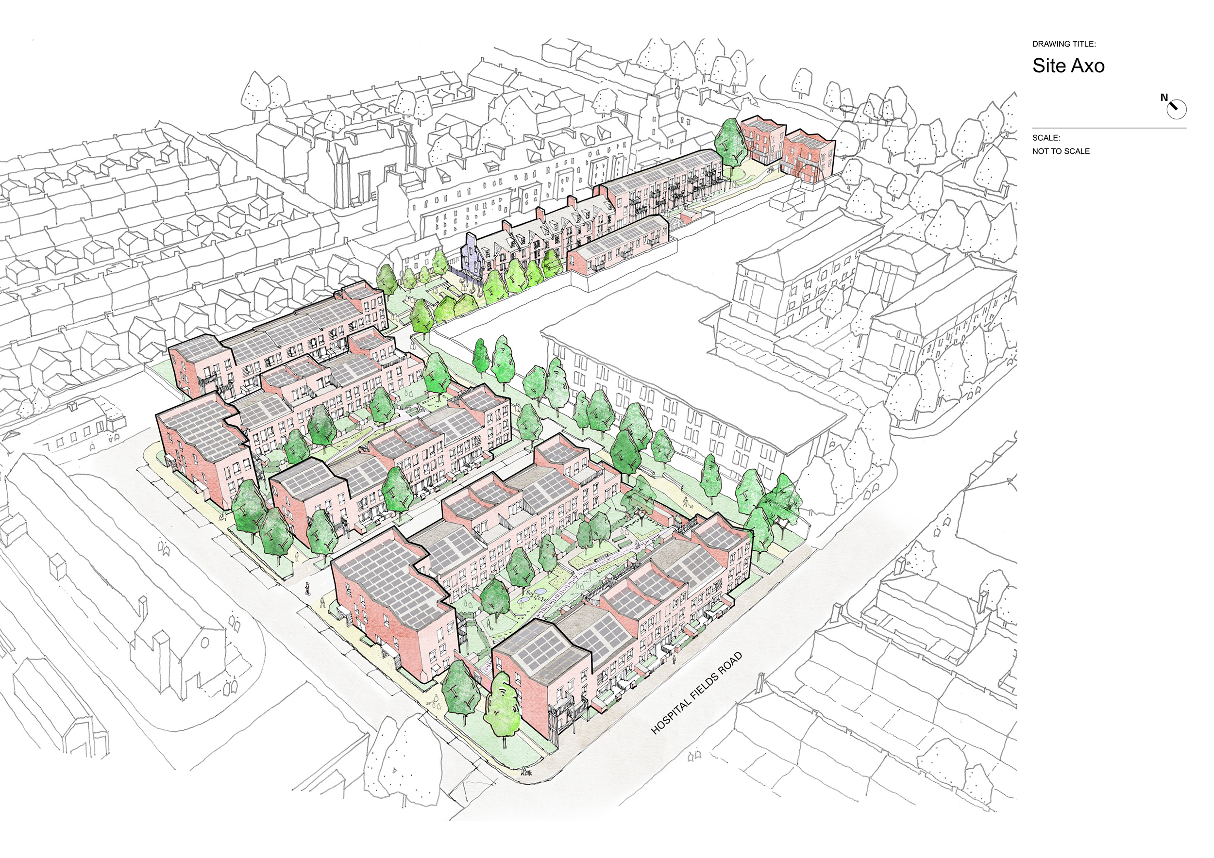
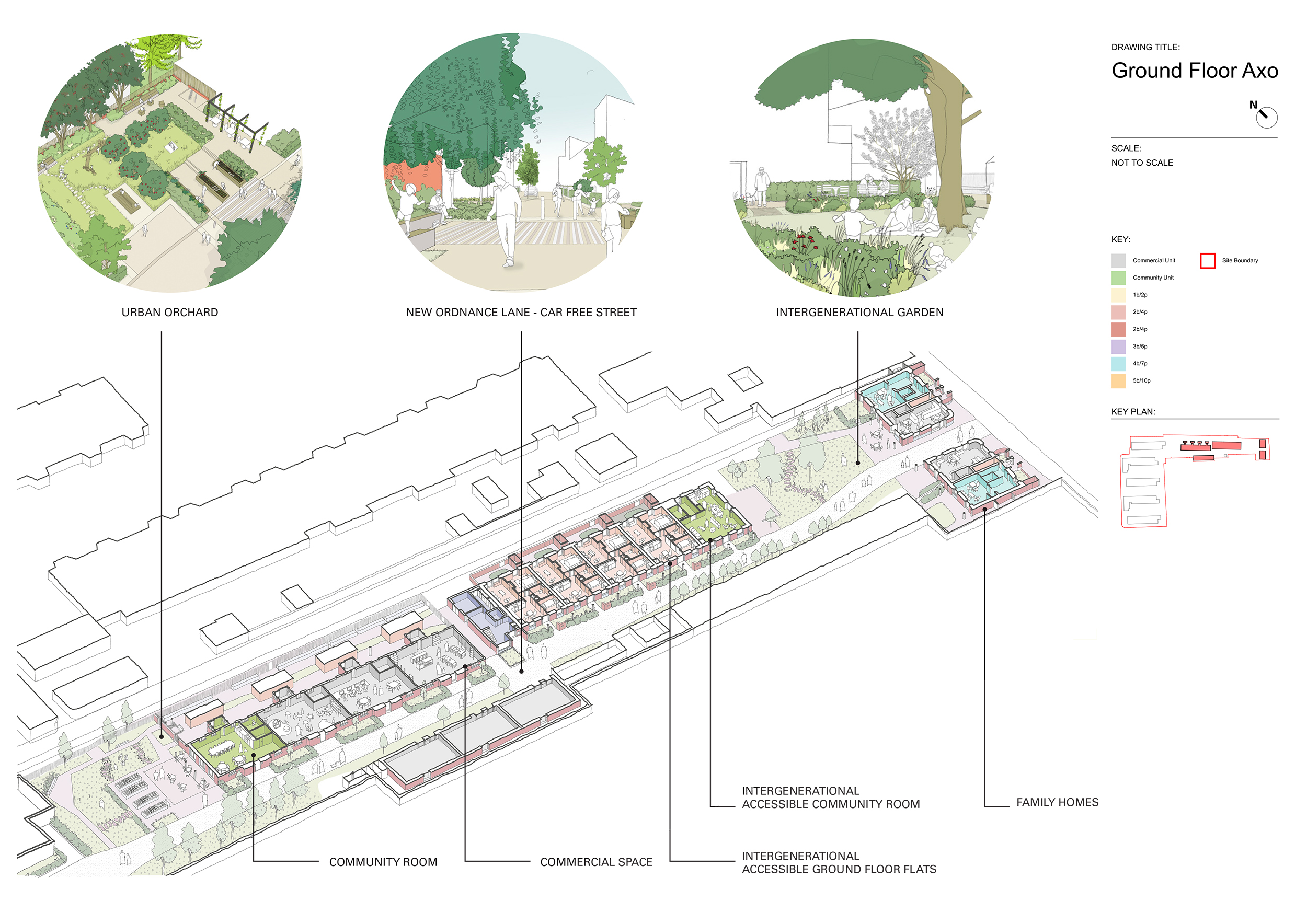
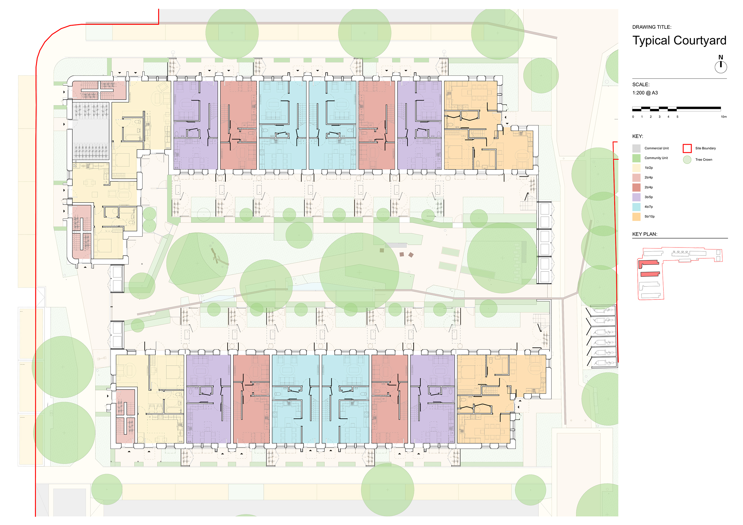
The new neighbourhood at Ordnance Lane knits together a previously disjointed part of the urban fabric to the south of York’s City Centre. The ‘New Ordnance Lane’, car free route connects the existing amenities of Fulford Road (to the east) with the nurseries, gyms, retail and office uses of the Hospital Roads trading estate (to the west). This east-west axis reinstates the original front of the retained building on site, a former military ‘Married Quarters’ and provides new homes, landscapes, community spaces and commercial spaces off this central street.
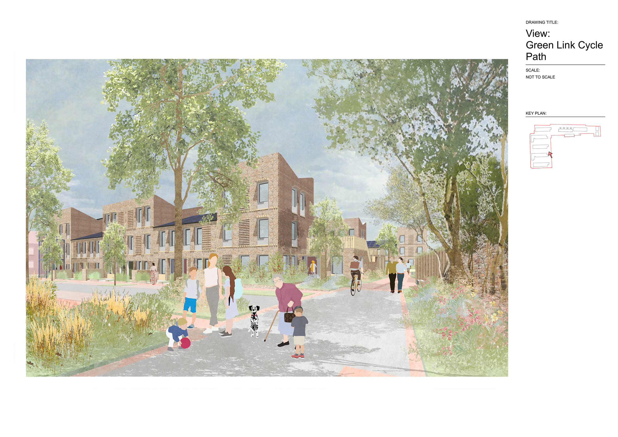
The green link, cycle and pedestrian route running along the east boundary, connects residential areas to the north and south of the site, and provides access to the city’s cycle highway which connects to the tow path of the river Ouze and leads to the city centre.
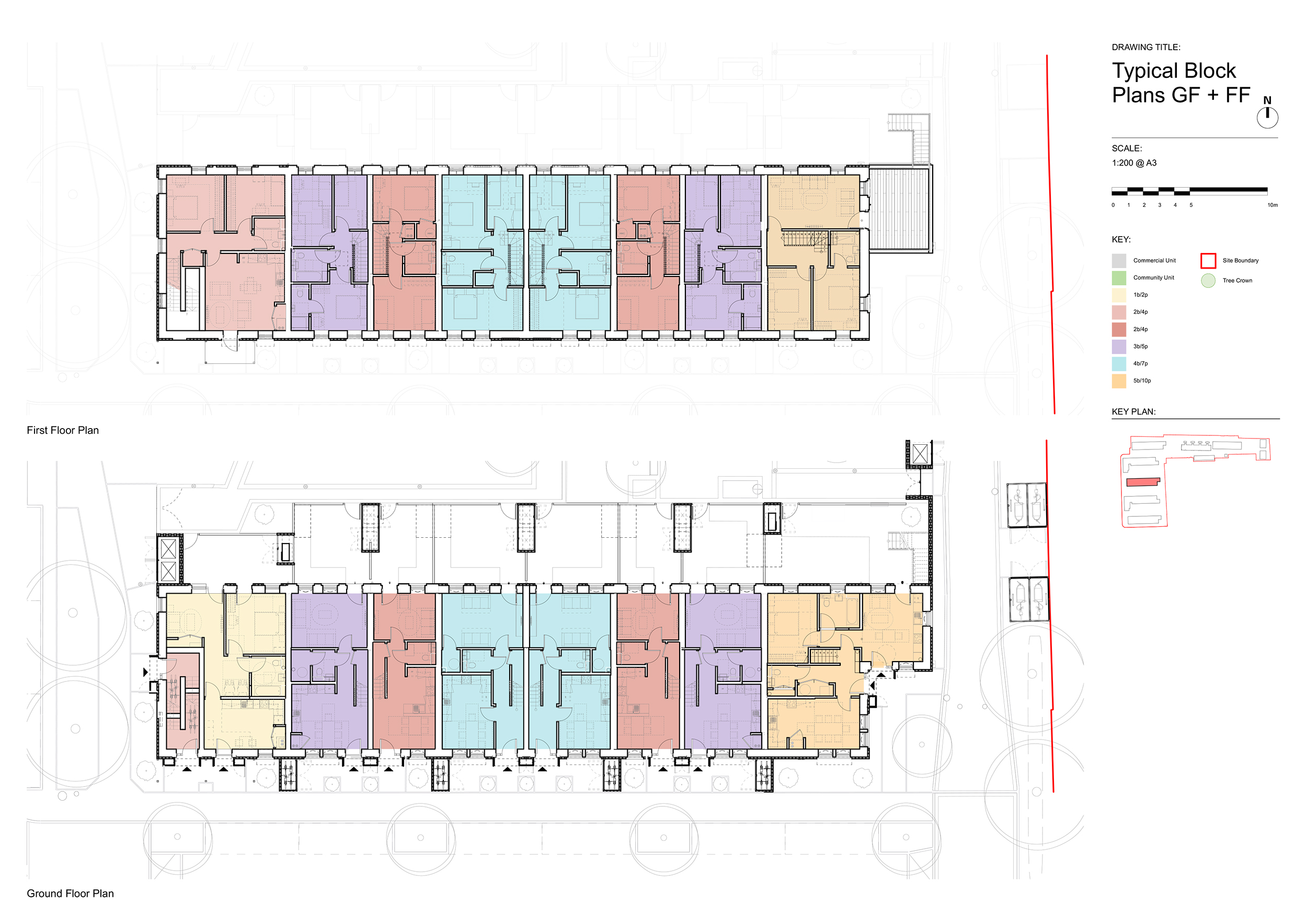
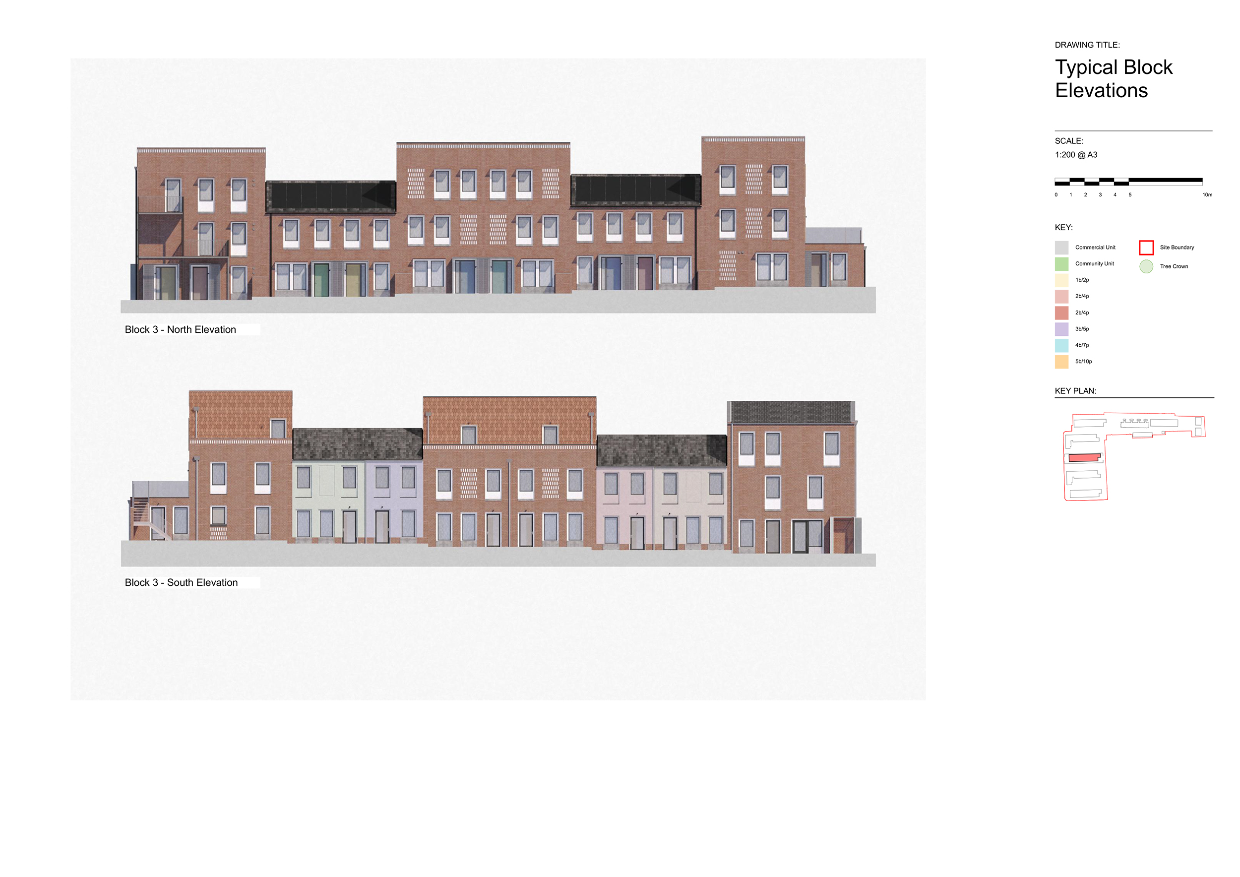
To the east of the site there are 5 rows of new terrace housing, bookended with 3-storey flats, each with their own front door. These streets are set out to reflect the urban grain of the Victorian terrace streets to the north.
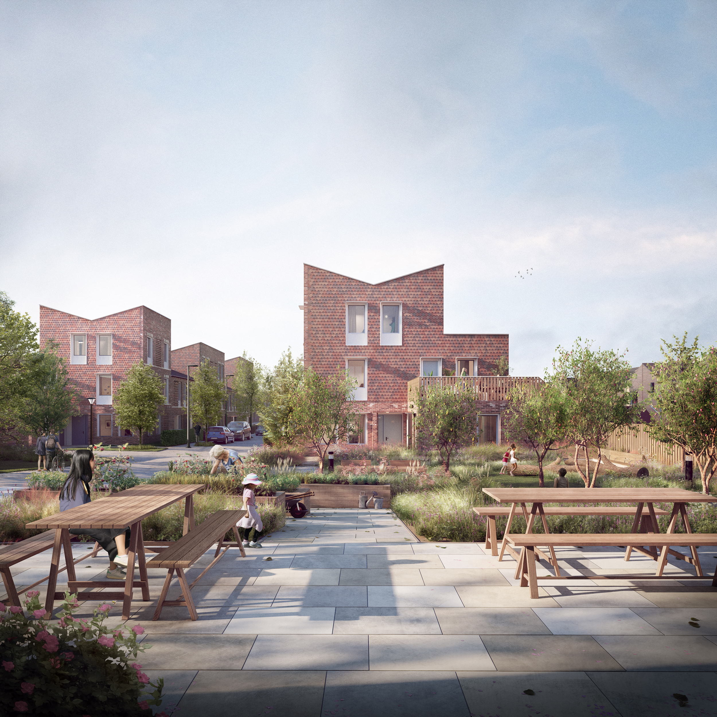
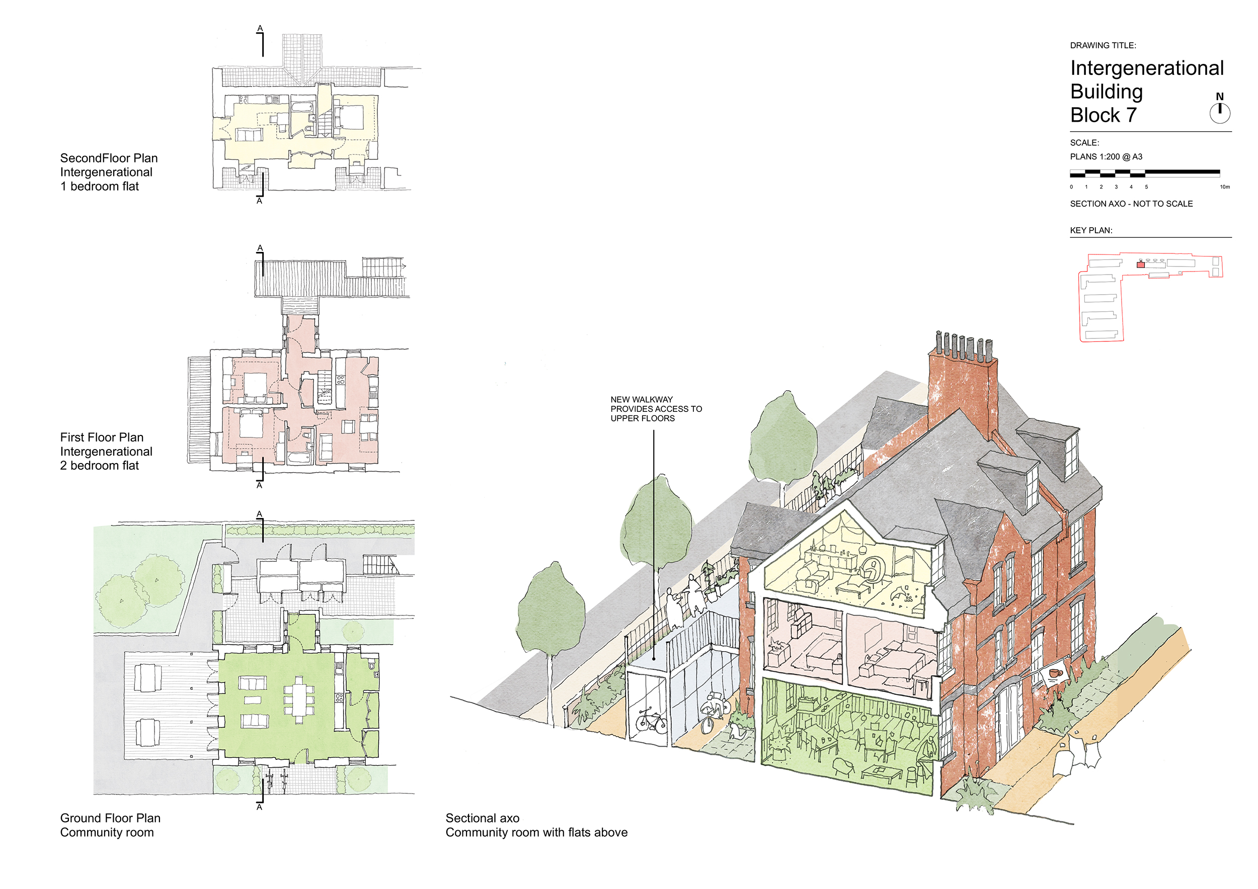
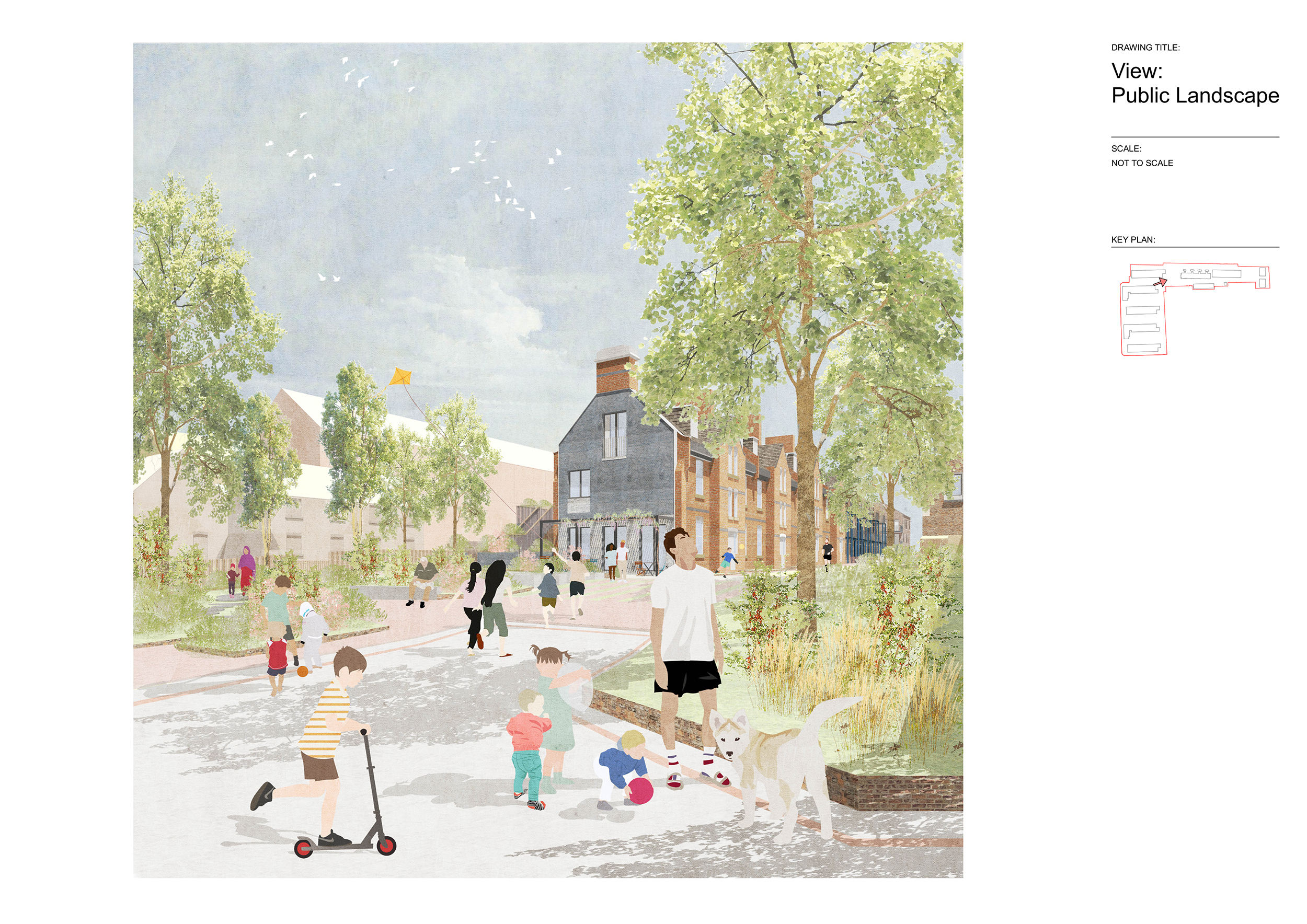
The landscape led design provides a range of external spaces, for the existing, surrounding residents and the new residents of the development. The Urban Orchard is the primary external amenity space, placed in the centre of the scheme, where the north/south, east/west axis meet. This space is located next to the community space on the ground floor of the retained Married Quarters building (block 7), allowing the community to access and connect to this important part of the retained local history. An intergenerational pocket garden, arranged around two existing trees is located off ‘New Ordnance Lane’ toward Fulford Road.
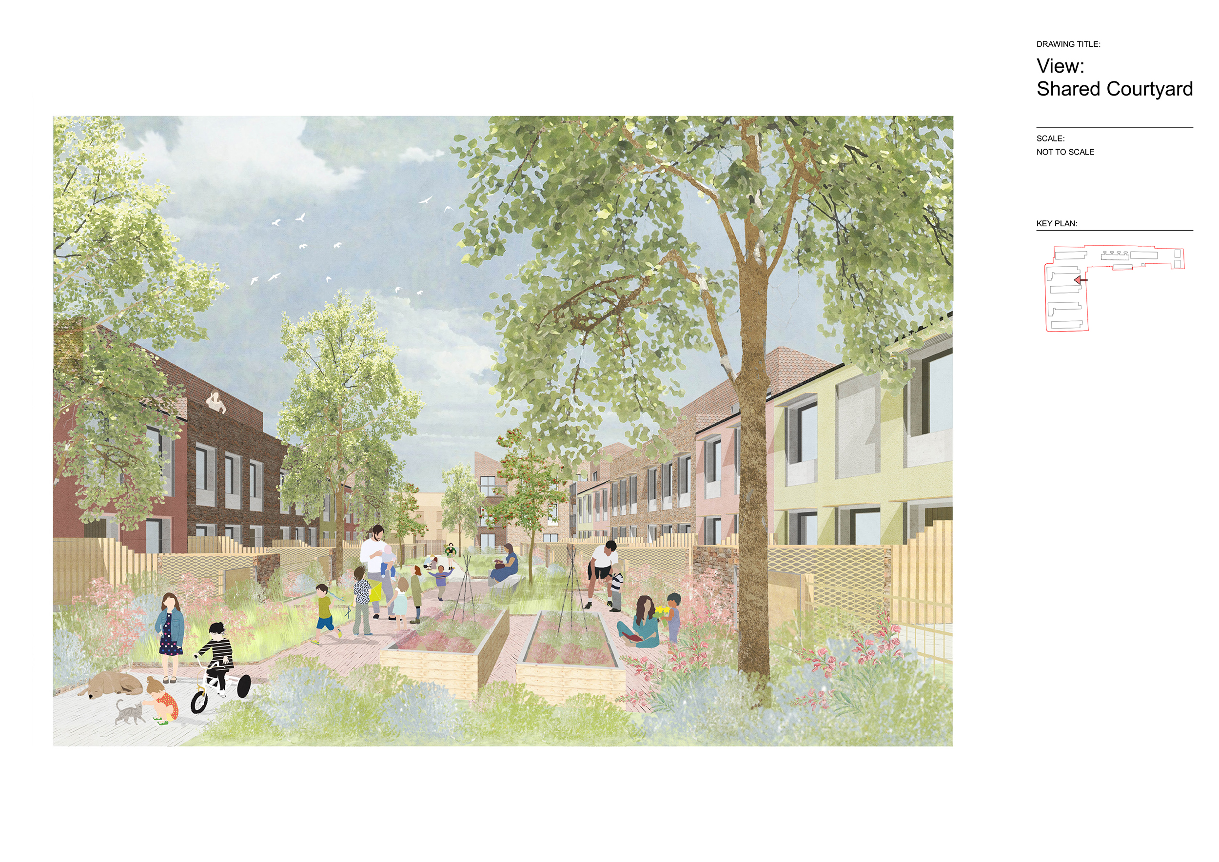
Shared courtyards are provided between the terraces, allowing for safe play accessed directly off rear gardens.
Key Features
Ordnance Lane is designed to promote intergenerational relationships, helping combat loneliness.
Typologies include:
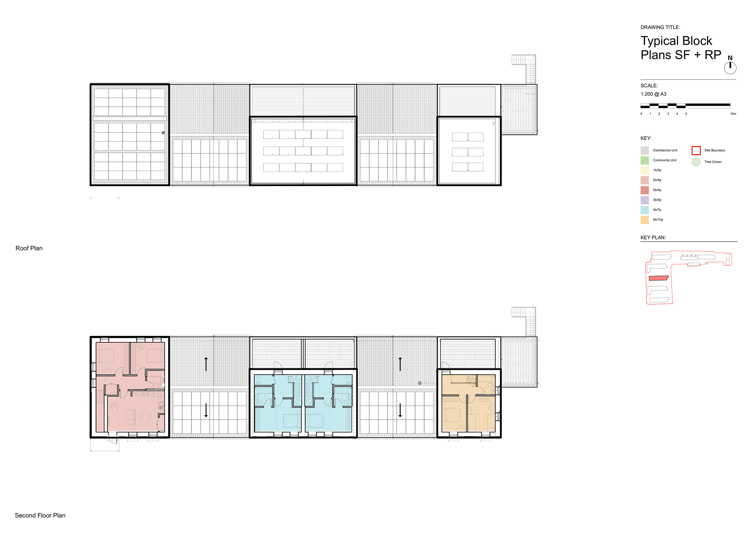
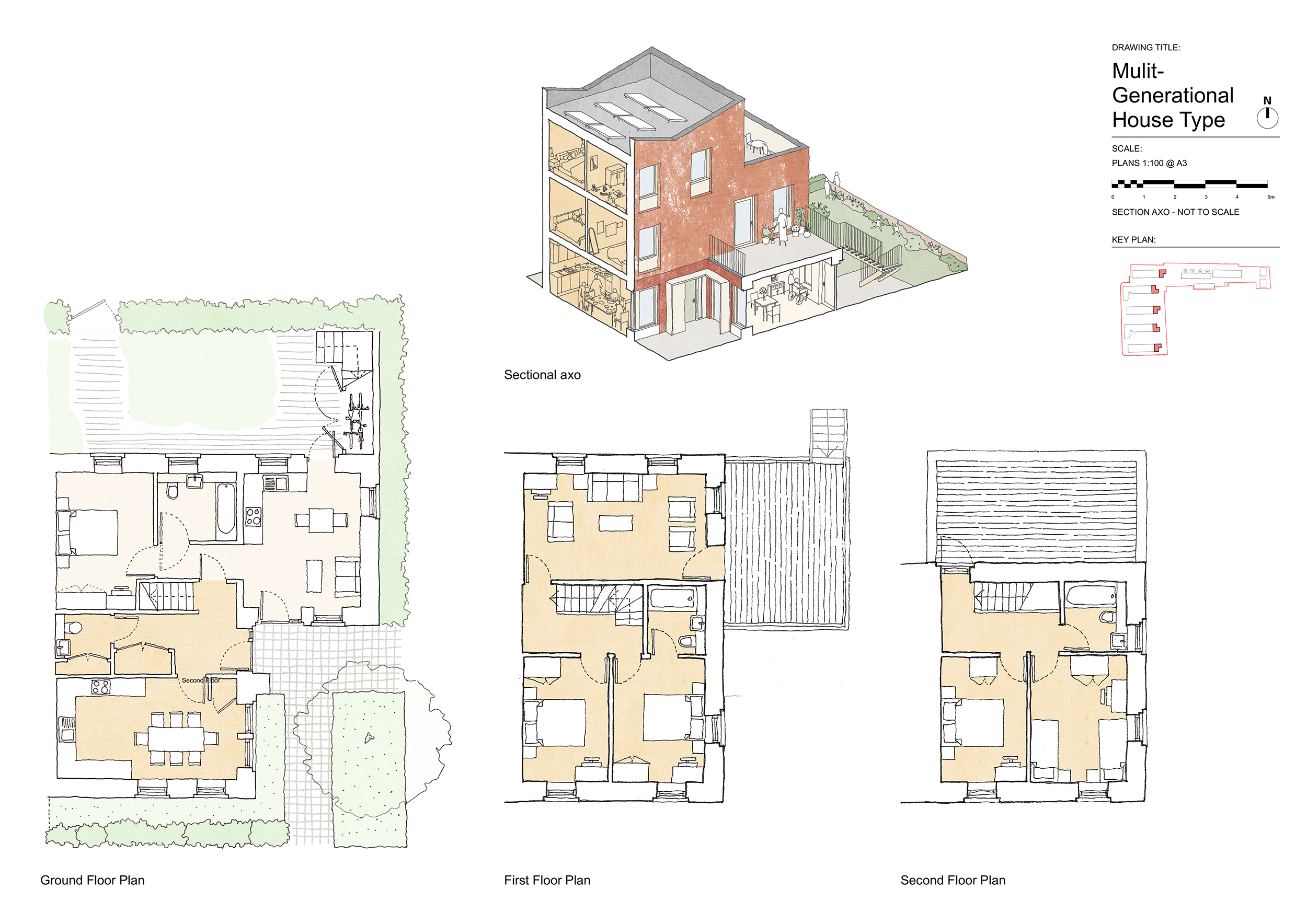
- Multi-Generational Home –designed for one extended family, where up to three generations can live, containing a 4 bedroom home and connected one-bedroom flat.
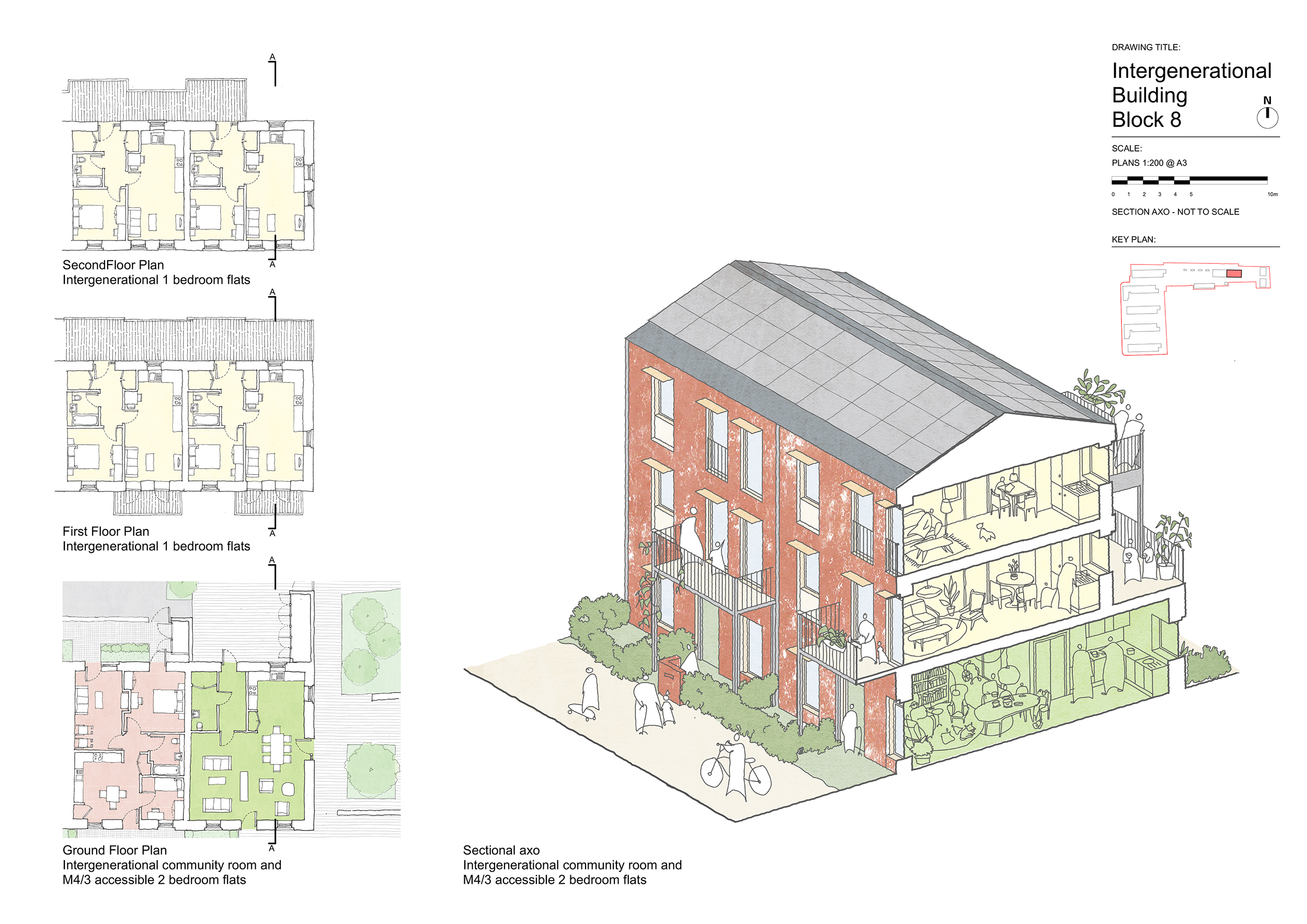
- Intergenerational building (upper floors of block 7 and all of block 8). Houses a mix of young and older people. Occupants live in their own flat but share several common facilities, encouraging people to form beneficial friendships.
Design interventions in the landscape increase spontaneous and planned interactions. Examples include paired front doors, low garden fences and raised growing bed.


