Love Wolverton
Number/street name:
Church Street
Address line 2:
Wolverton
City:
Milton Keynes
Postcode:
MK12 5LG
Architect:
Mikhail Riches
Architect:
Mole Architects Ltd
Architect contact number:
Developer:
Milton Keynes Council|TOWN.
Planning Authority:
Milton Keynes Council,
Planning consultant:
Urbed
Planning Reference:
20/03293/FUL
Date of Completion:
09/2025
Schedule of Accommodation:
2x 1b1p flat; 22x 1b2p flat; 27x 2b3p flat; 6x 2b4p flat; 5x 2b4p duplex; 4x 2b4p house; 4x3b5p flat; 8x 3b5p house; 1x 3b6p flat; 13x 3b6p house; 13x 4b7p house
Tenure Mix:
22% (25no.) private market sale; 52% (59no.) market rent; 23% (27no.) discounted market rent; 3% (4no.) social rent.
Total number of homes:
Site size (hectares):
1.17
Net Density (homes per hectare):
108
Size of principal unit (sq m):
82
Smallest Unit (sq m):
44 (1b1p)
Largest unit (sq m):
128 (4b7p)
No of parking spaces:
86
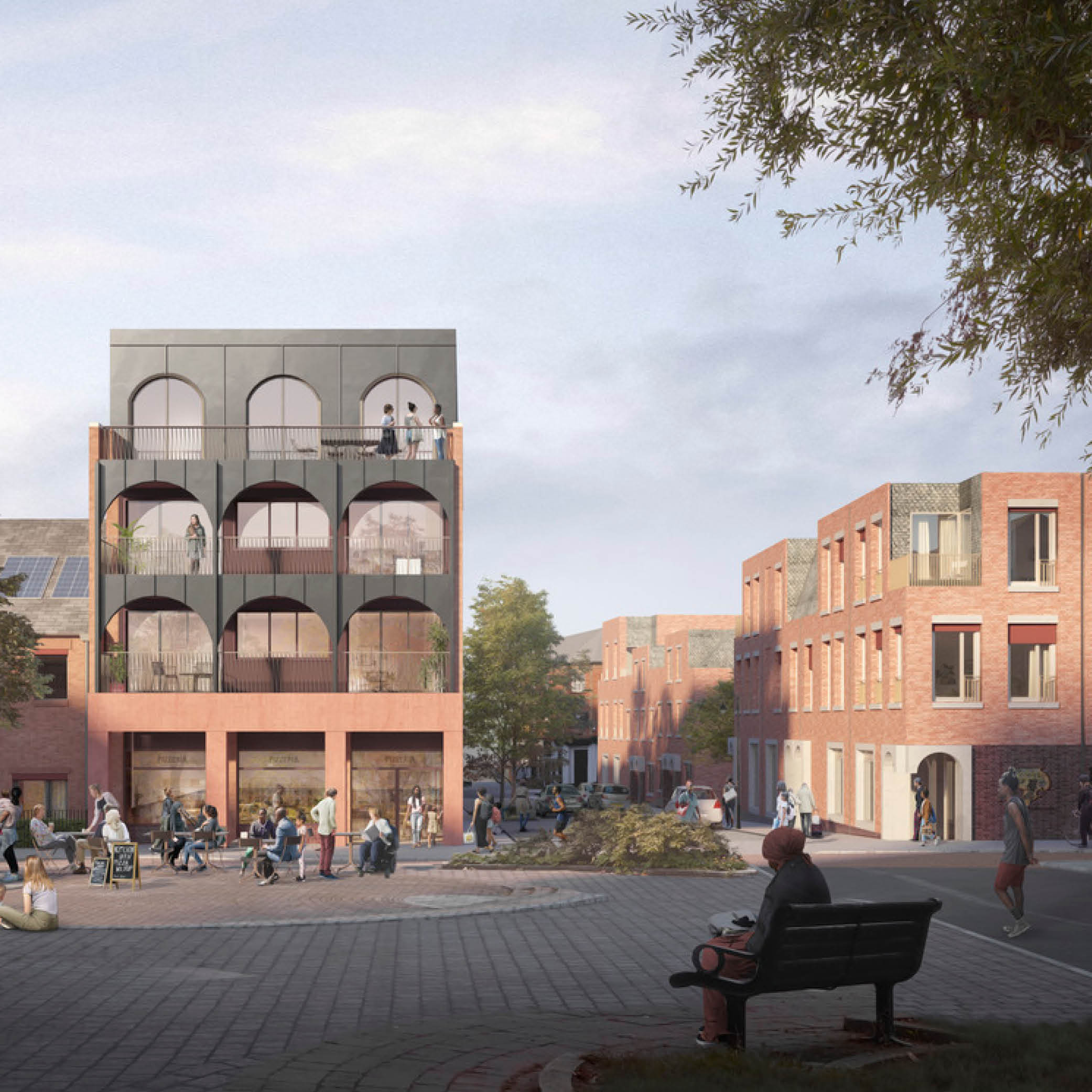
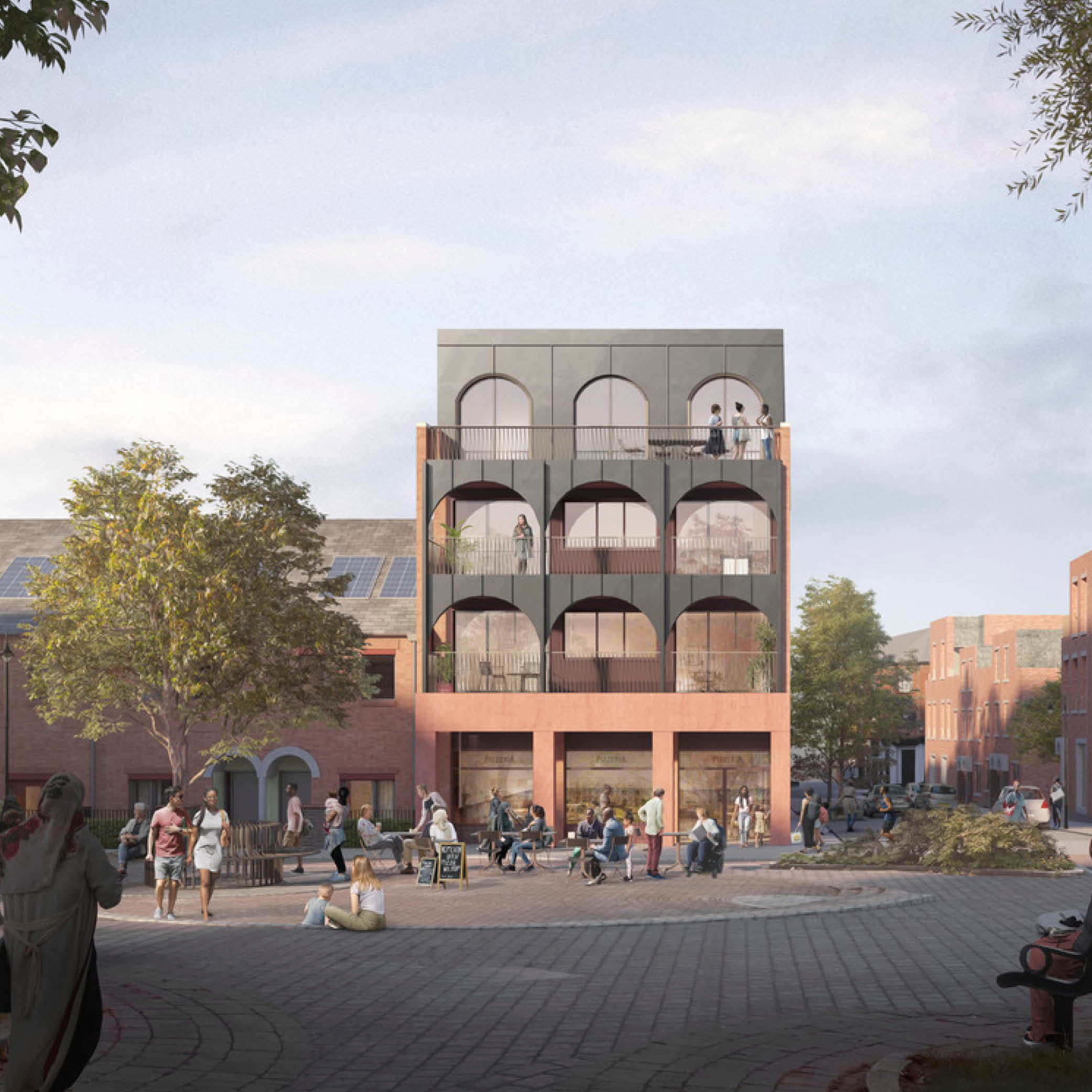
Planning History
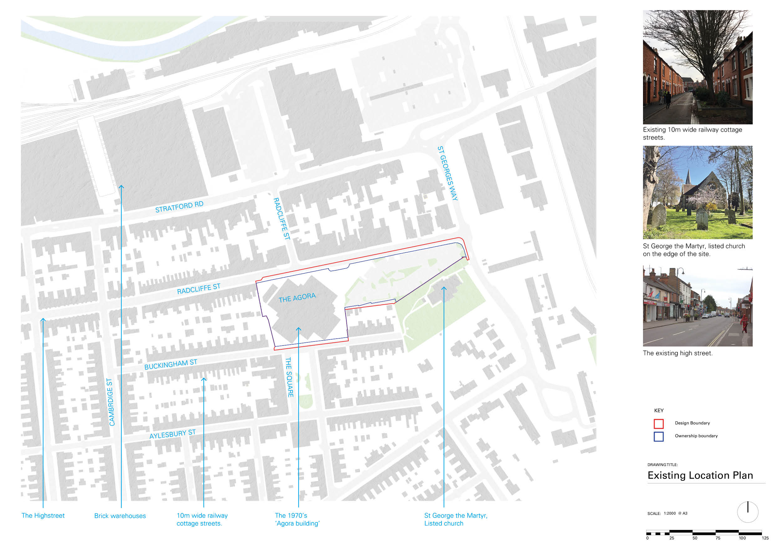
The Agora Centre and car park were developed by Milton Keynes Development Corporation in the late 1970s as a leisure and retail centre for Wolverton - a 'gift' from the New Town to the Victorian railway town it would absorb. After a brief heyday, the Agora declined and has been proposed for redevelopment since 2004. The focus of one of the first adopted Neighbourhood Plans in 2013, an abortive retail-led scheme was proposed before the site was acquired by Love Wolverton Ltd (led by TOWN) in 2018 and the current scheme developed in close consultation with the community and Council.
The Design Process
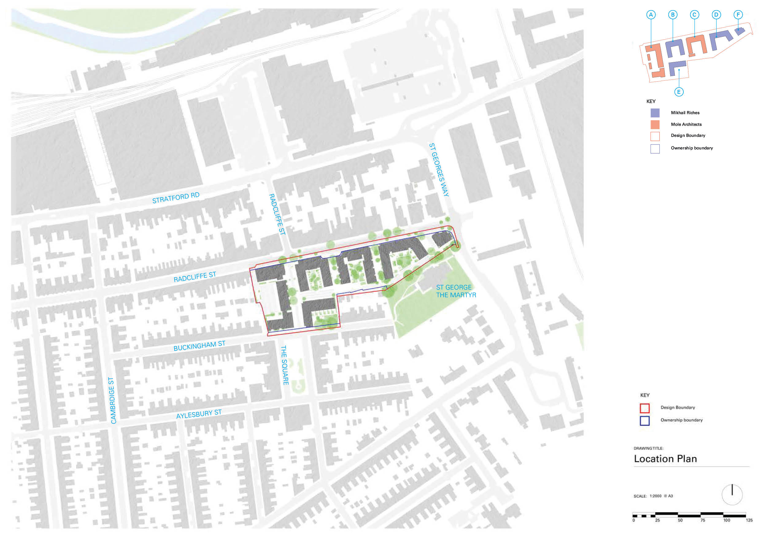
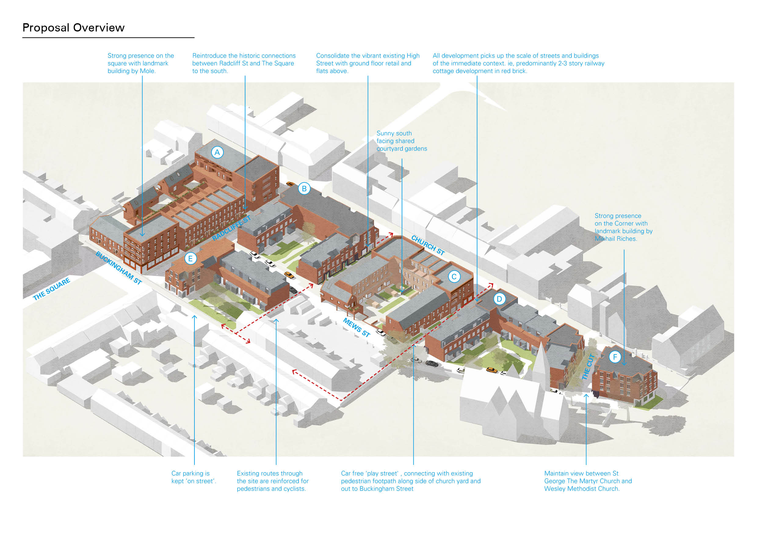
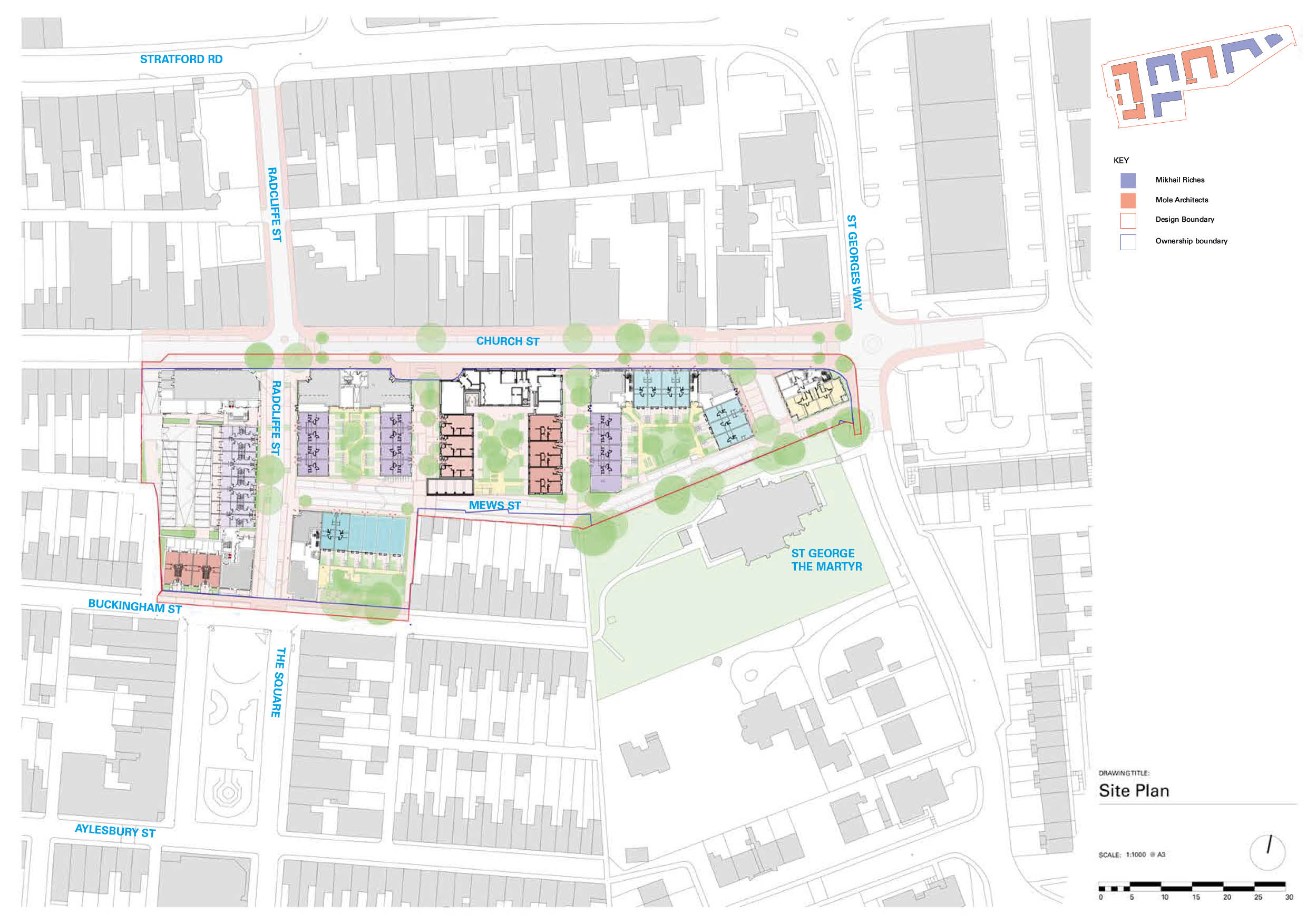
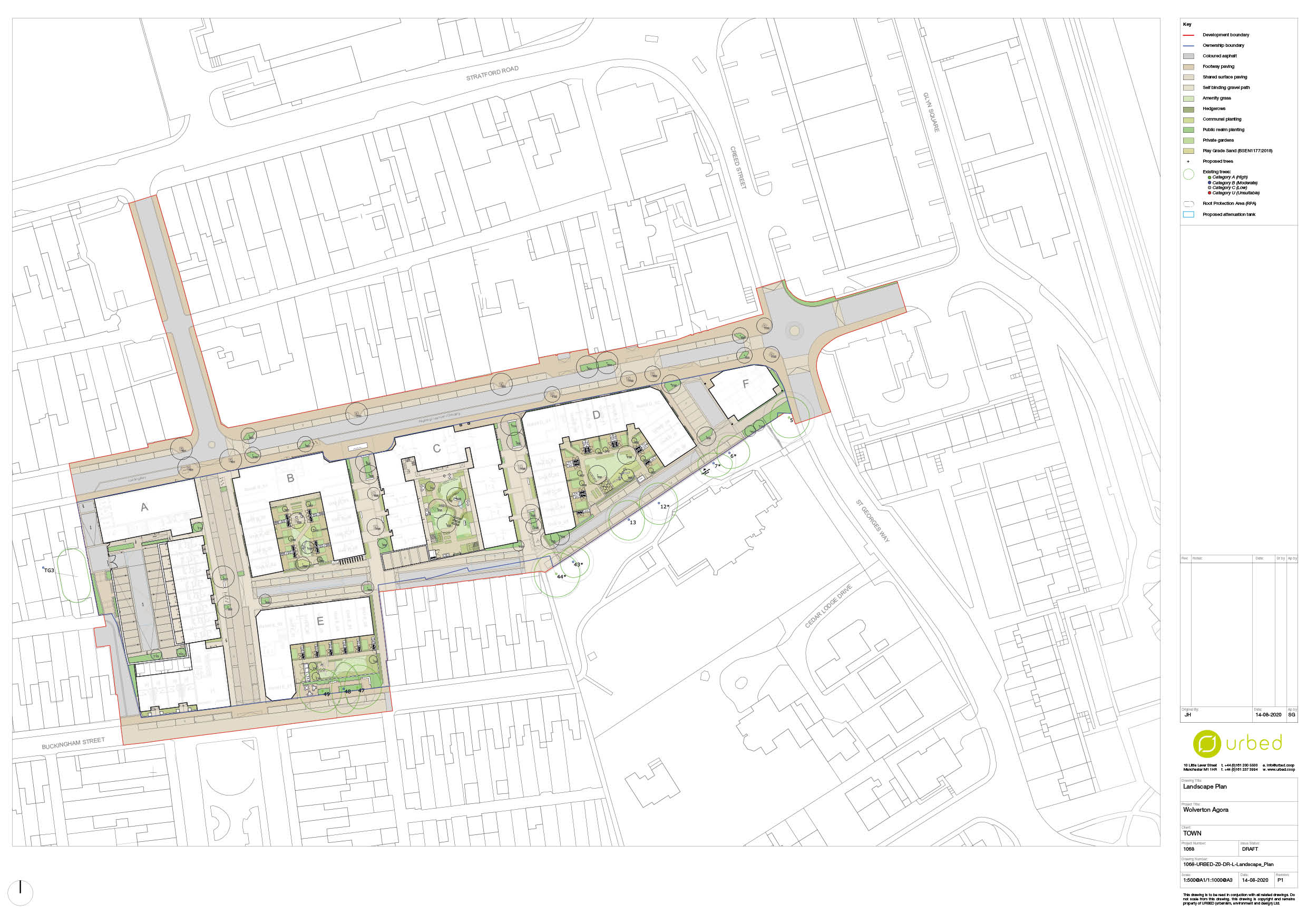
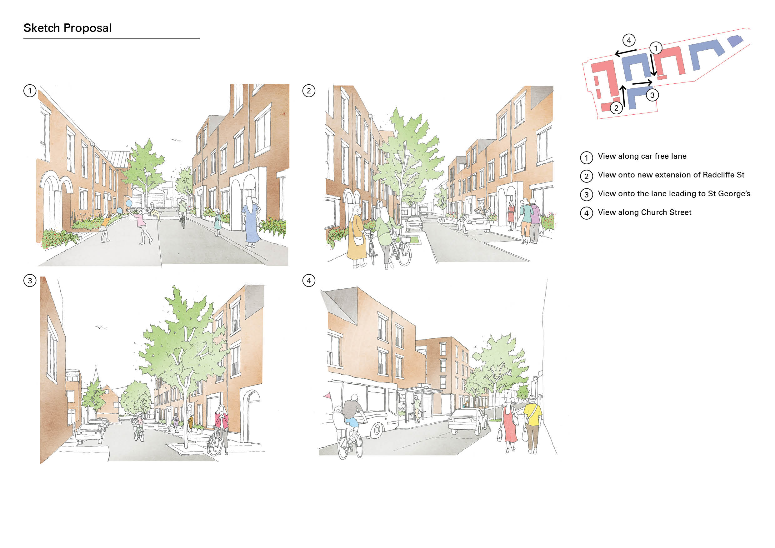
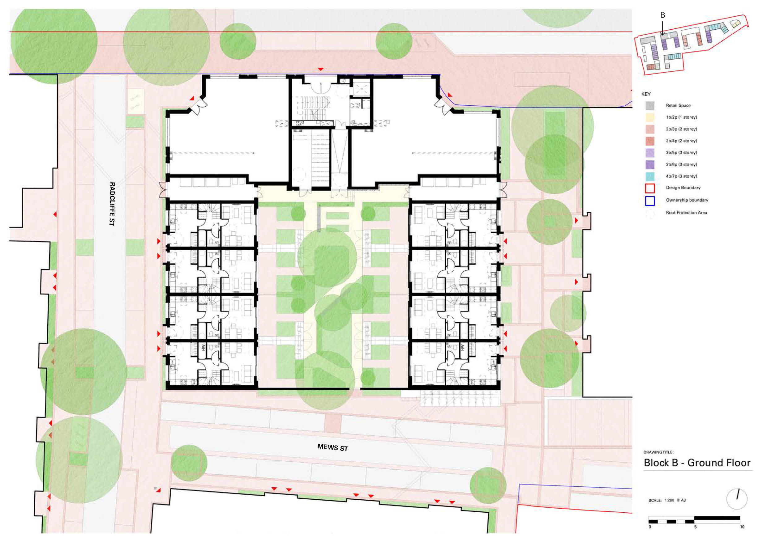
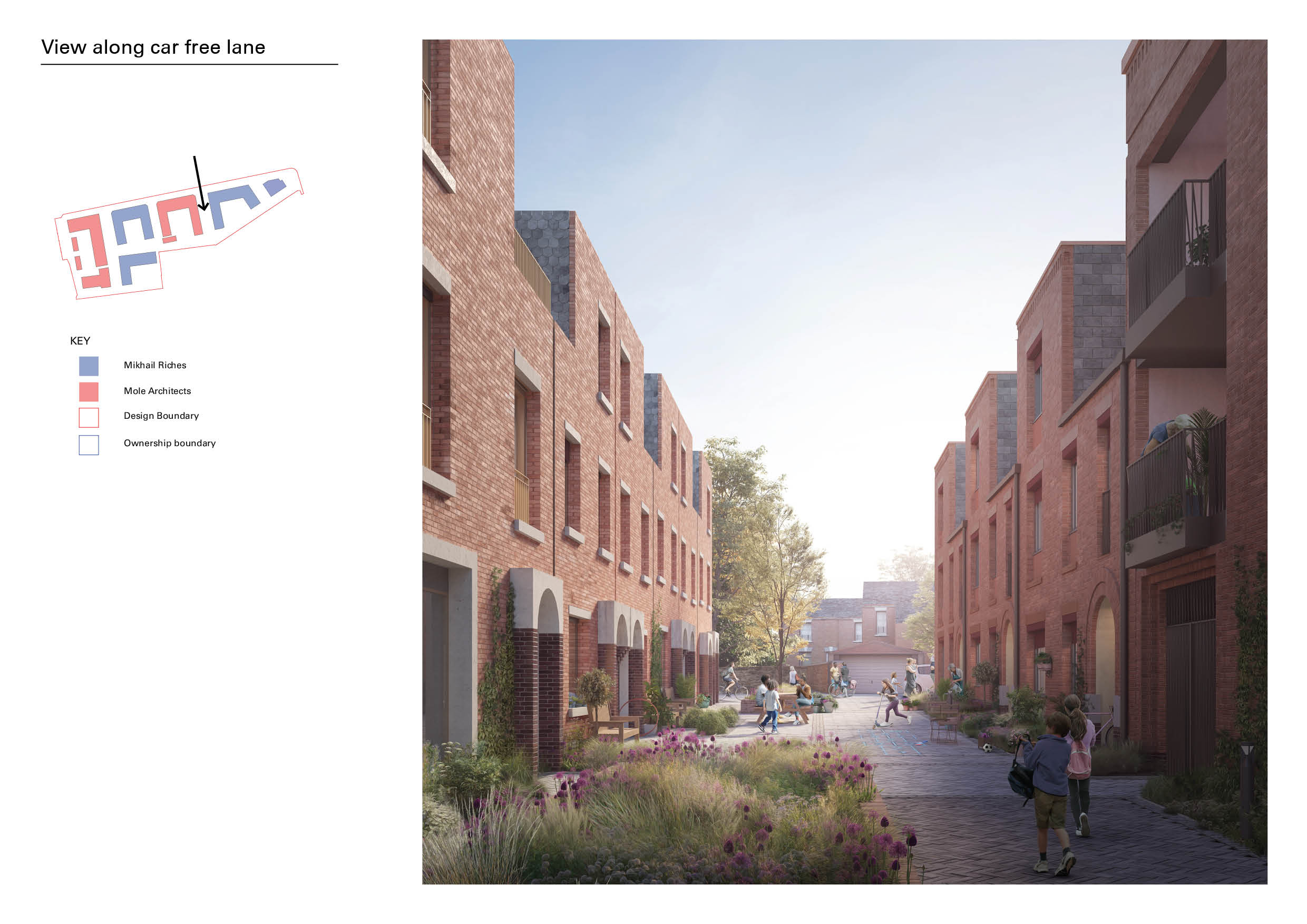
The design reinstates Radcliffe Street, lost beneath the Agora, as the principal north-south axis between Wolverton's high street (Church Street) and Market Square. A smaller network of landscaped car-free 'little streets' (echoing a longstanding Wolverton typology) and a ‘woonerf’-like mews street connect to other pedestrian paths, knitting the site back into the Victorian grid. A public pocket park is provided beneath retained mature London plane trees.
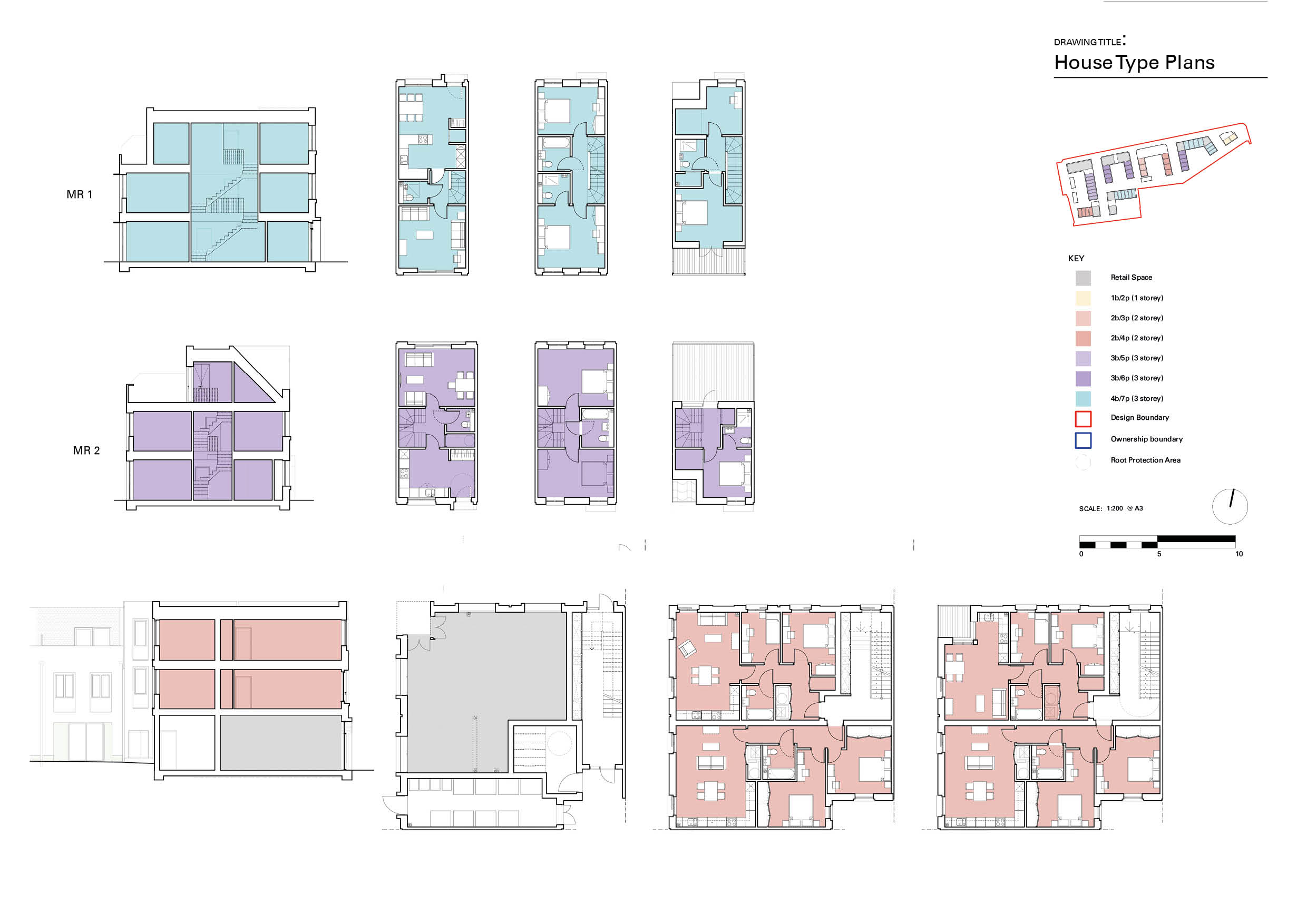
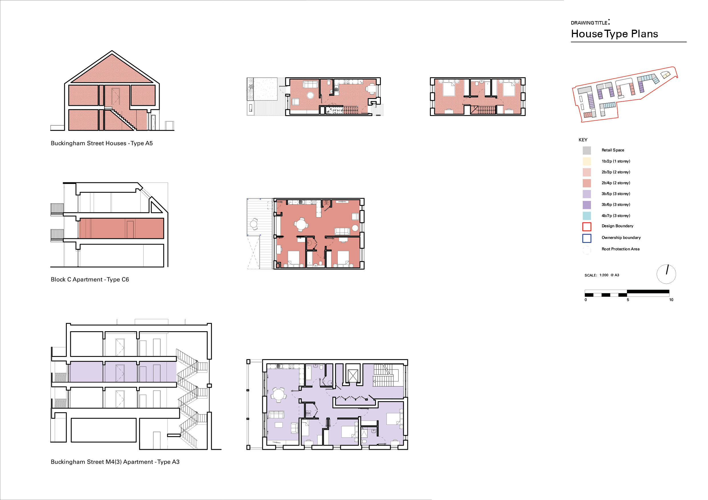
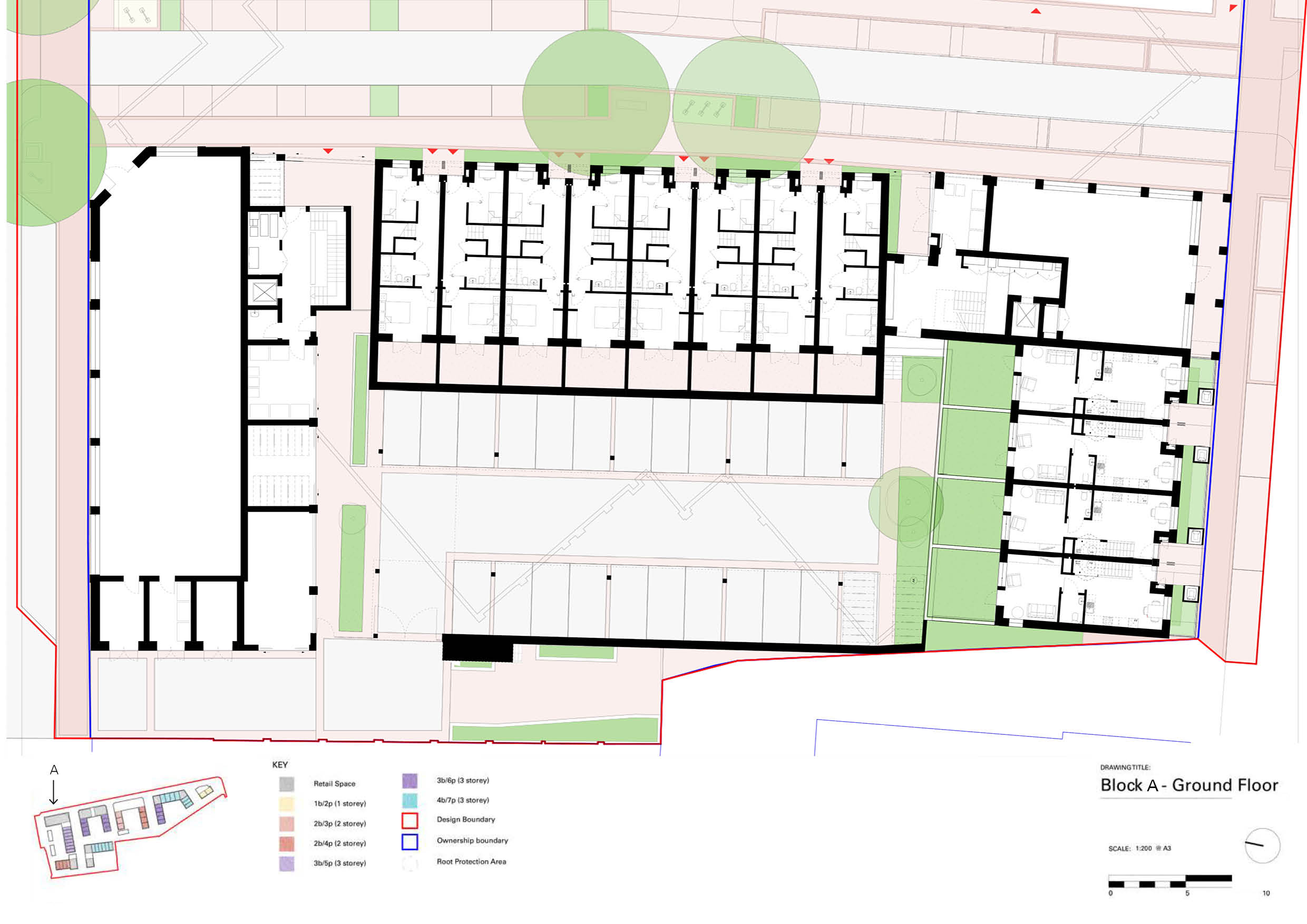
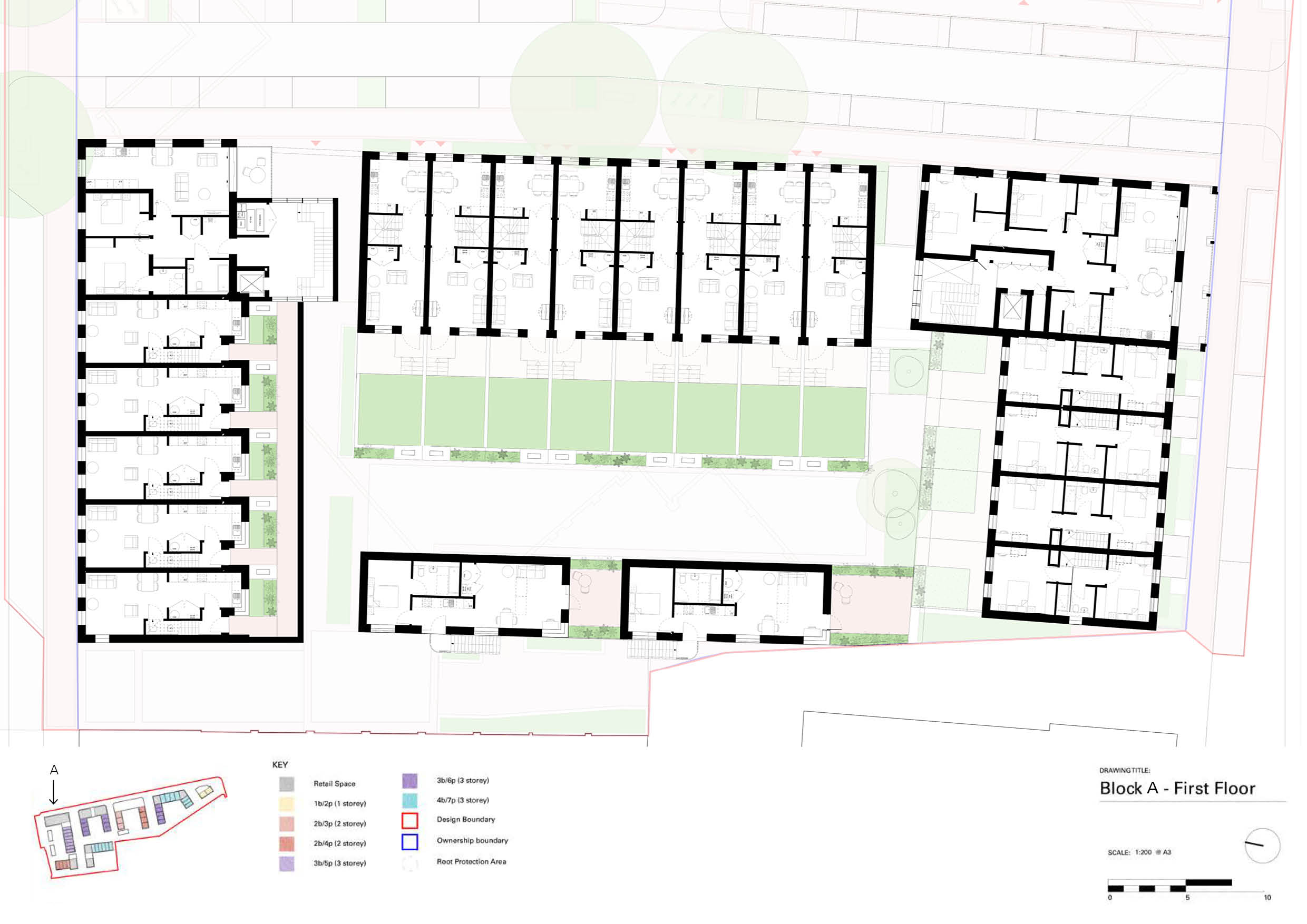
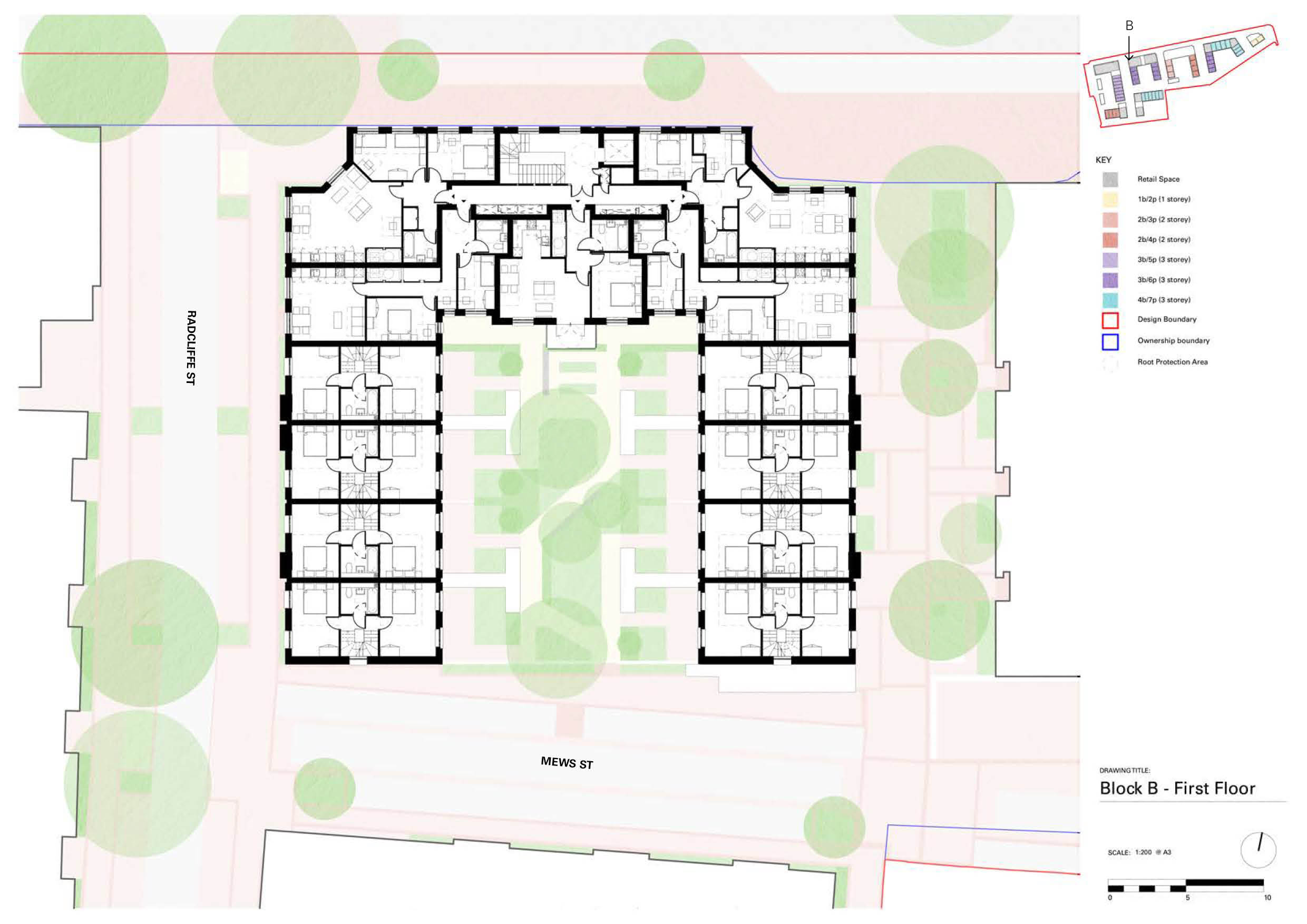
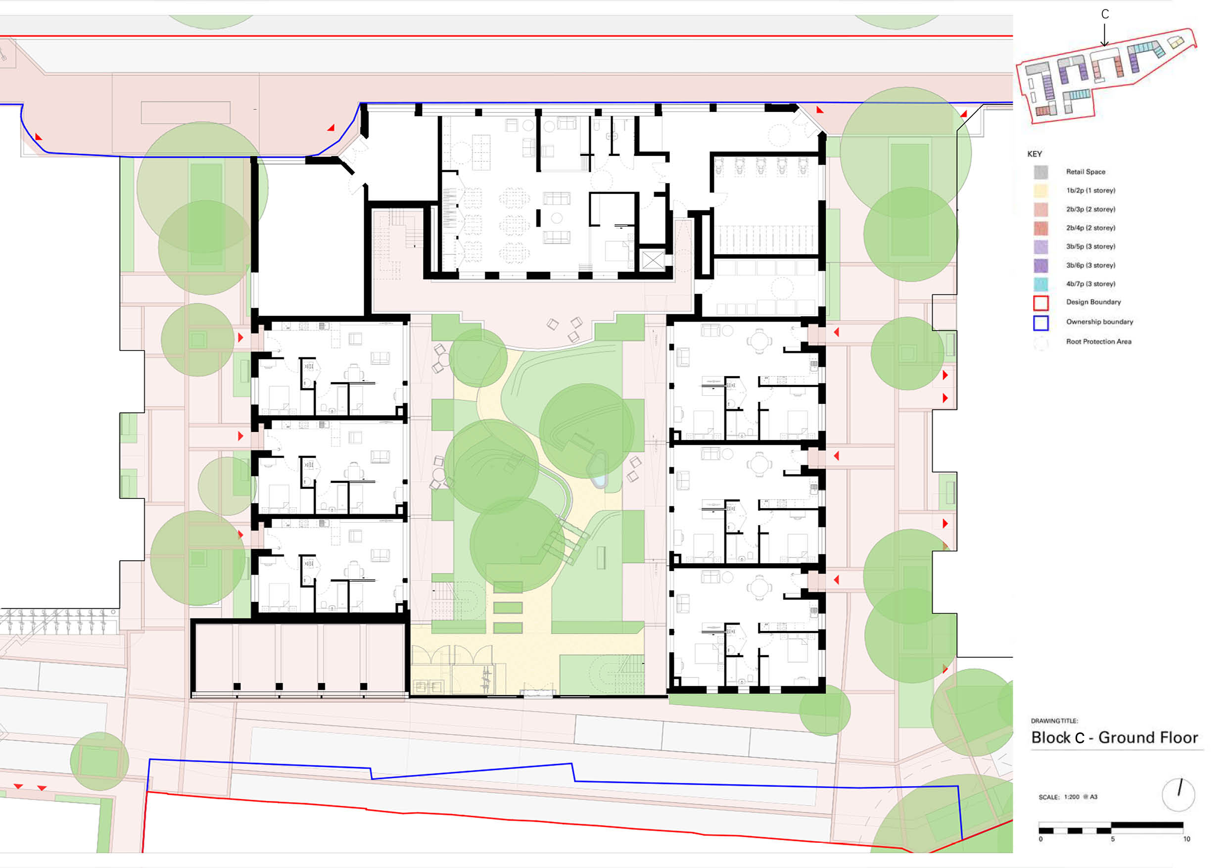
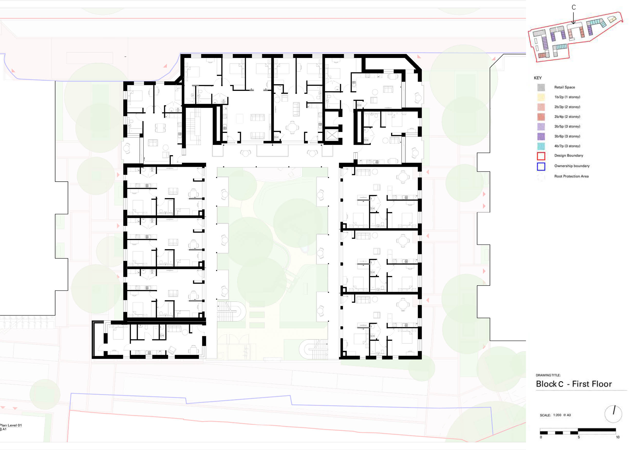
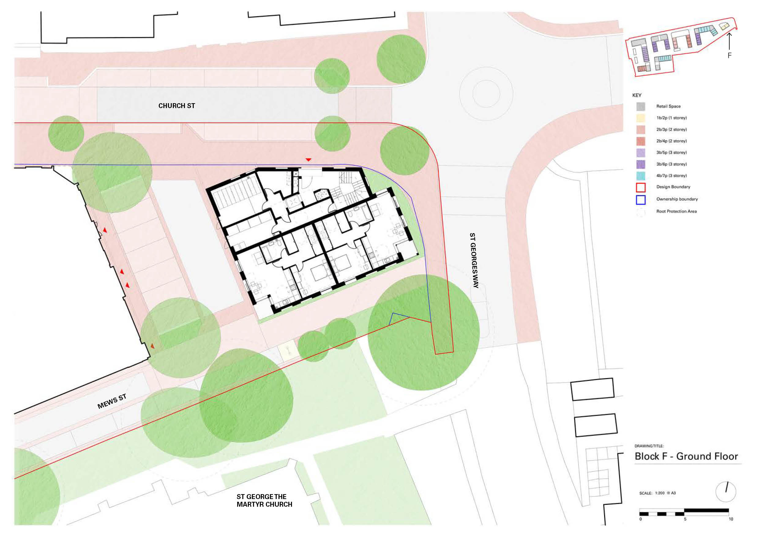
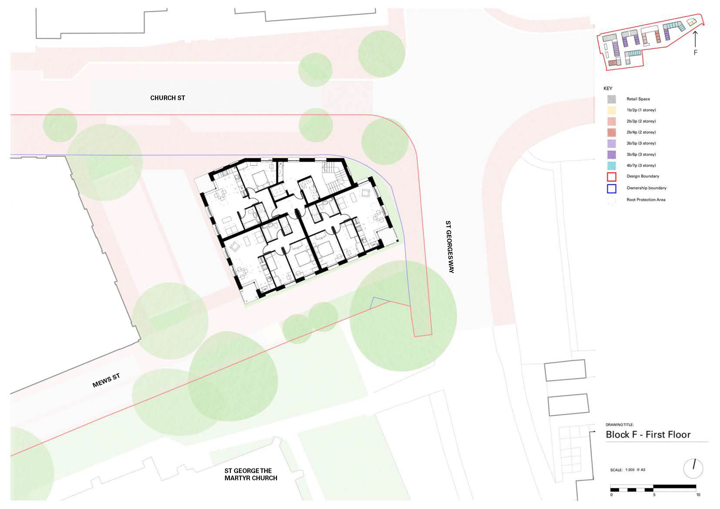
This street network defines six small urban blocks. Blocks B, D and E comprise terraced family houses and apartments over street-corner retail around shared south-facing courtyard gardens. The larger Block A exploits the level change created by the Agora's slab to provide a semi-basement car park serving a mix of houses, wheelchair-user flats, and duplex apartments above a small supermarket. Block F is a smaller flatted pavilion block marking the end of Church Street. Block C provides 29 one, two and three-bed apartments for Still Green, an over-50s cohousing group, together with a 'common house' containing shared amenities (kitchen, dining room, lounge, laundry, guest bedrooms), and a high-street community space to be leased free of charge to Future Wolverton, a social enterprise, for work with young people.
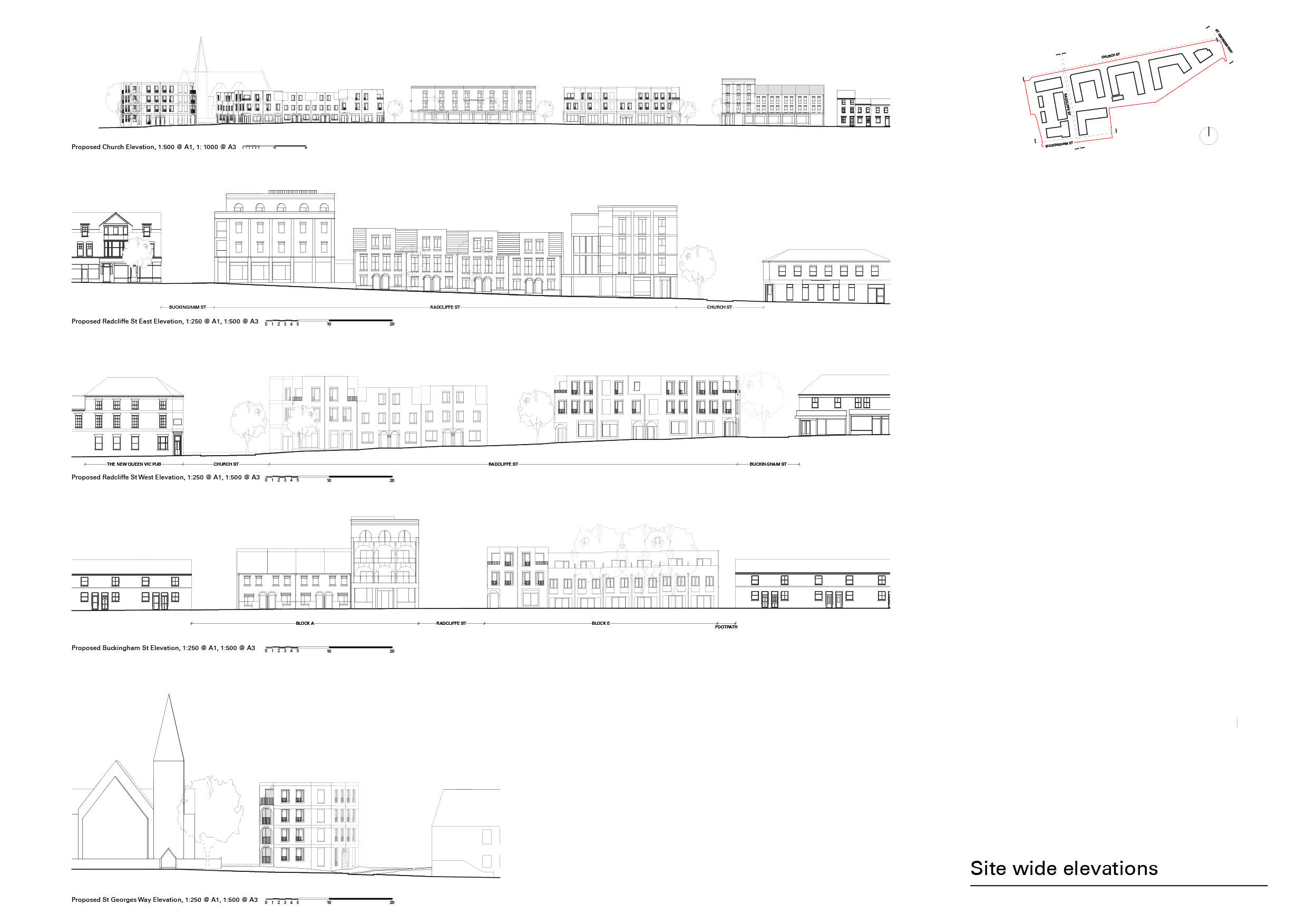
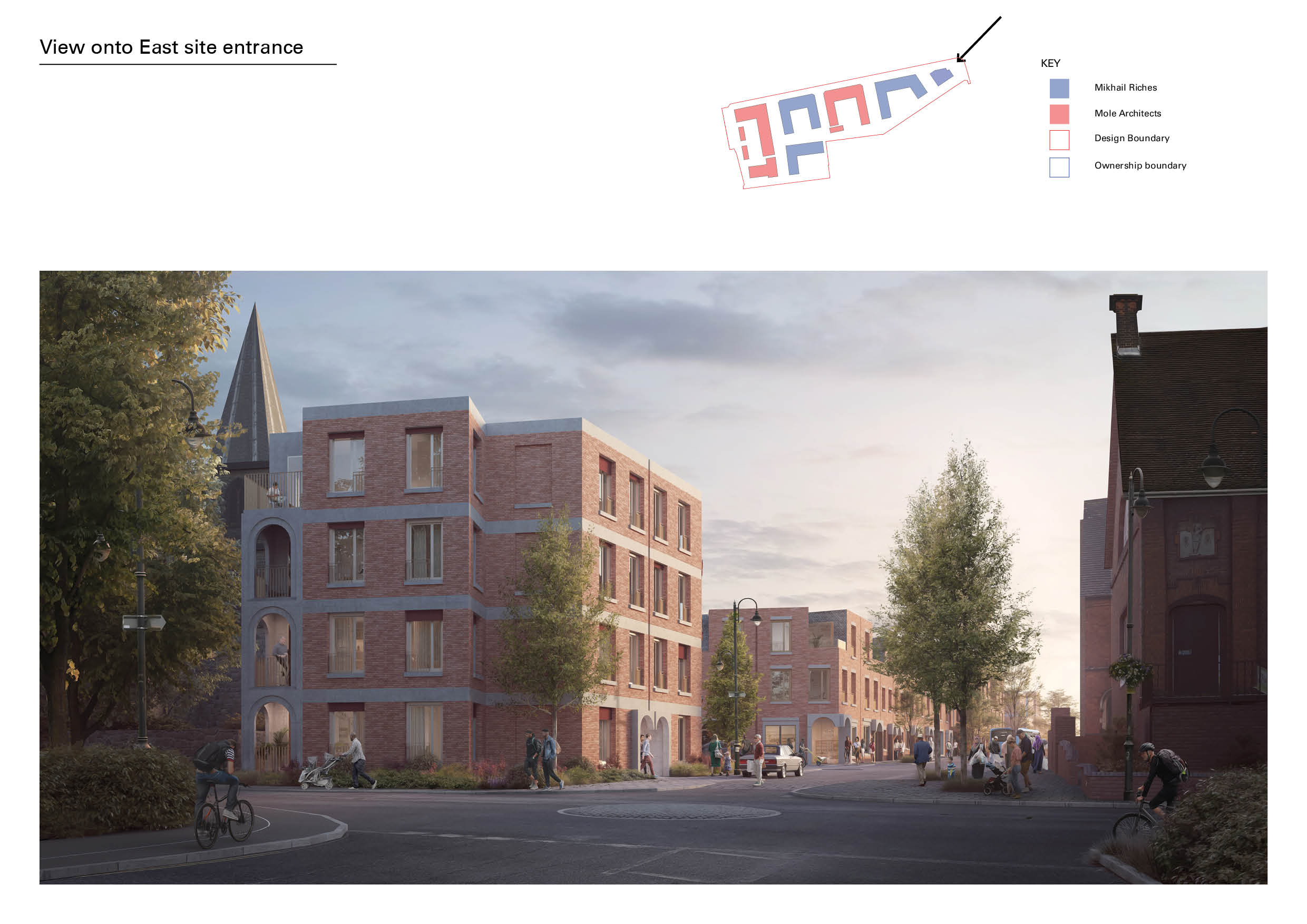
The scale of two-to-four storeys respects the context set by the conservation area and adjacent listed churches, while facilitating a density appropriate to the location. The provision of corner shop units for small-scale retail will help to reinforce Wolverton's independent high street offering, draw people into the site and add to residents' amenity. The architecture references redbrick Victorian housing in its materials, proportions and details - porches, lintels, glazed bricks. The layout provides for 98% dual-aspect dwellings and for all to have private terraces and balconies and/or shared courtyard amenity space. All homes achieve the relevant NDSS, exceeding it by 7% on average.
Key Features
Community-led, developer-enabled regeneration of Milton Keynes's original railway town.
 Scheme PDF Download


