Harrier Way
Number/street name:
(Land East of) Harrier Way
Address line 2:
City:
Petersfield
Postcode:
GU31 4RQ
Architect:
Re-Format
Architect contact number:
01730778778
Developer:
McCarthy & Stone.
Planning Authority:
South Downs National Park Authority
Planning consultant:
The Planning Bureau Ltd.
Planning Reference:
SDNP/22/04472/FU L
Date of Completion:
11/2023
Schedule of Accommodation:
20 x 2 bed chalets, 19x 2 bed bungalows, 32 x 1bed apartments, 26 x 2bed apartments. 97 units total.
Tenure Mix:
100% Private
Total number of homes:
97
Site size (hectares):
3.15 ha
Net Density (homes per hectare):
31
Size of principal unit (sq m):
111.8
Smallest Unit (sq m):
50.28
Largest unit (sq m):
111.8
No of parking spaces:
43 x associated with bungalow / chalets, 33 x associated with the apartments. 76 total.
 Scheme PDF Download
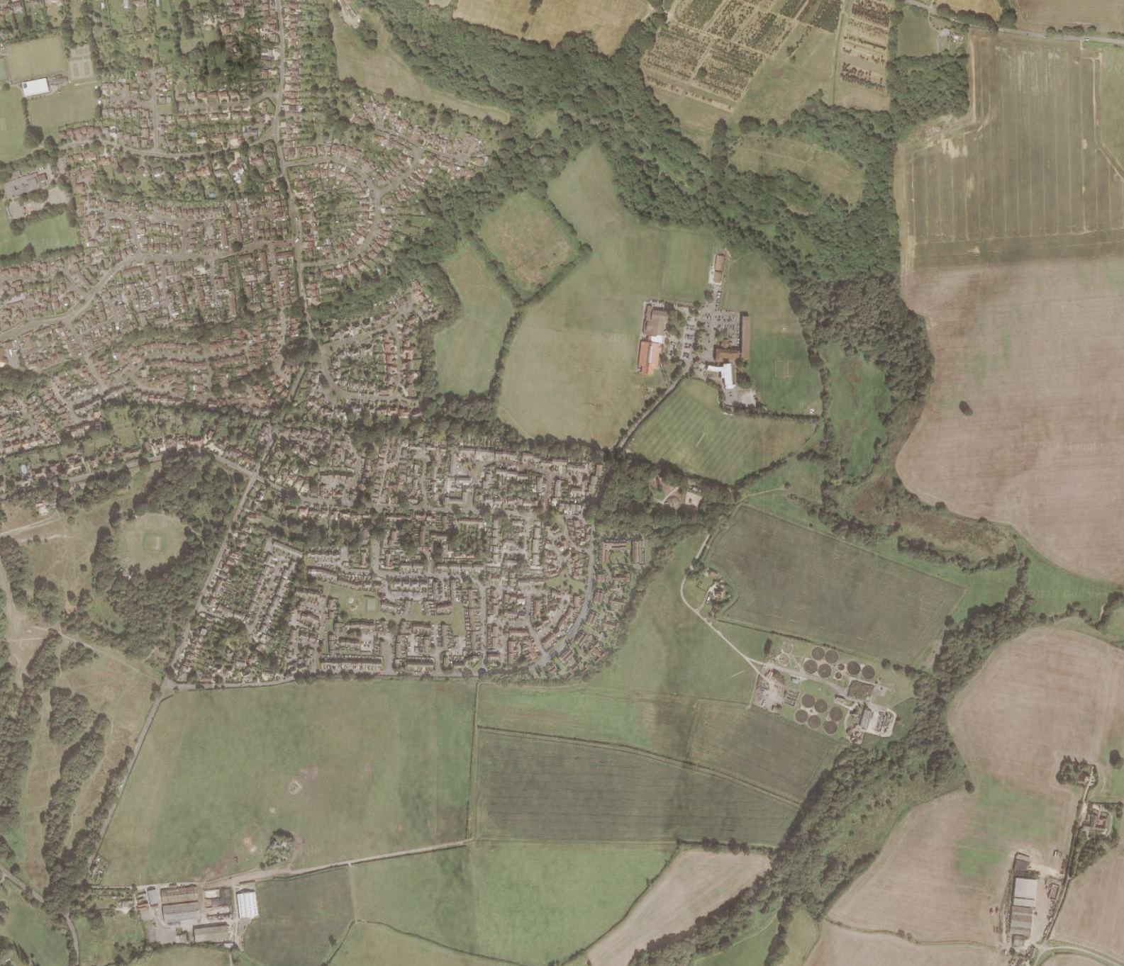
Planning History
Situated in the South Downs National Park, the site had extant permission not aligned with current SDNPA contextual design aspirations and was unsuitable for the clients, McCarthy Stone.
Extensive consultation with the SDNPA, local stakeholder groups, statutory consultees and resident associations on the new design response, significant site issues, highway design, flood risk, ecology and arboriculture was undertaken.
SDNPA workshops were key to the evolution of the landscape led design approach and helped the team produce sensitive proposals that responded to the unique challenges of this important transitional site.
The proposal had officer’s support and was unanimously approved at committee.
The Design Process
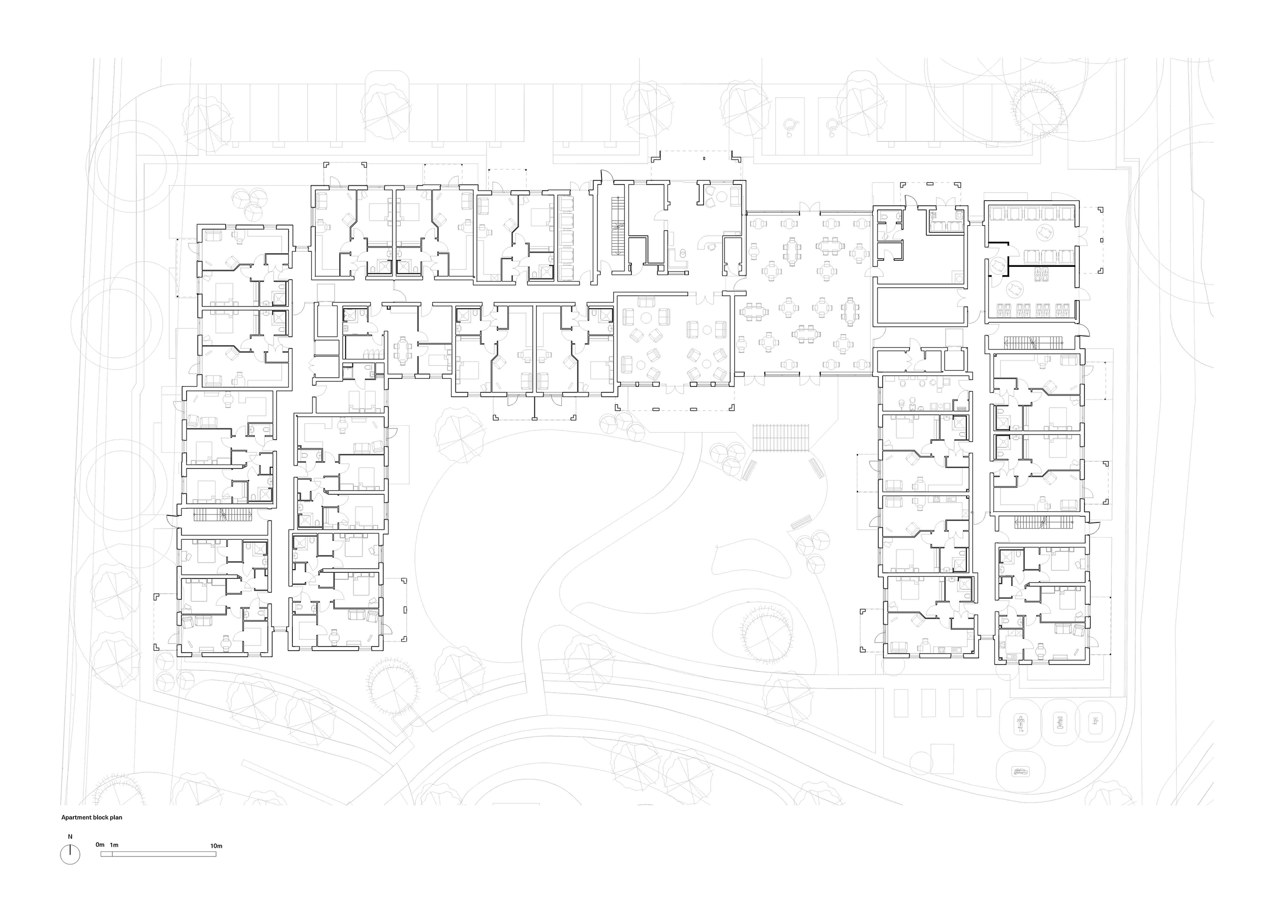
The client brief was to create a new retirement village comprised of chalets, bungalows & apartments with communal facilities and parking. The challenge was to place that on a site in an edge of countryside location in a way that spoke to the countryside and the existing settlement.
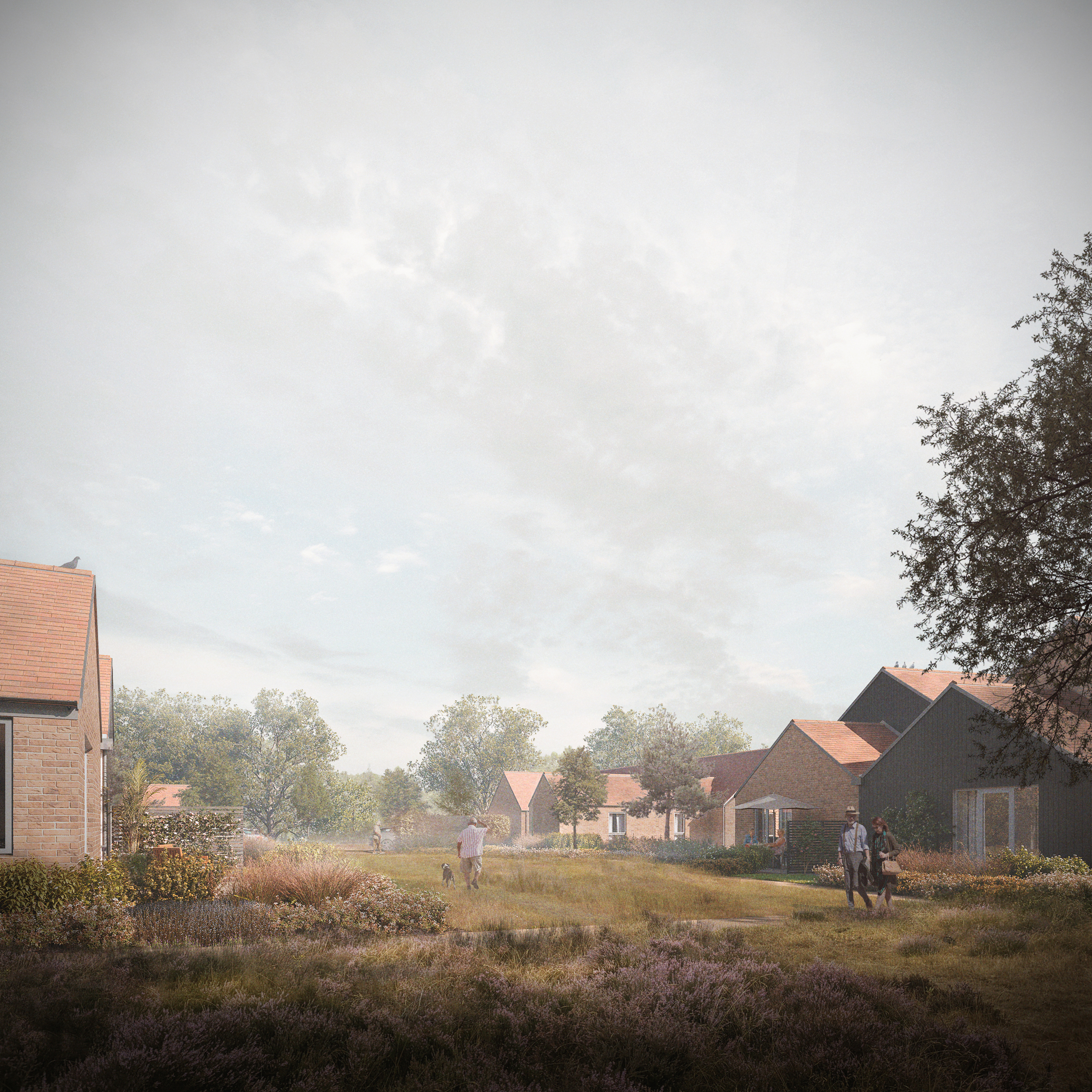
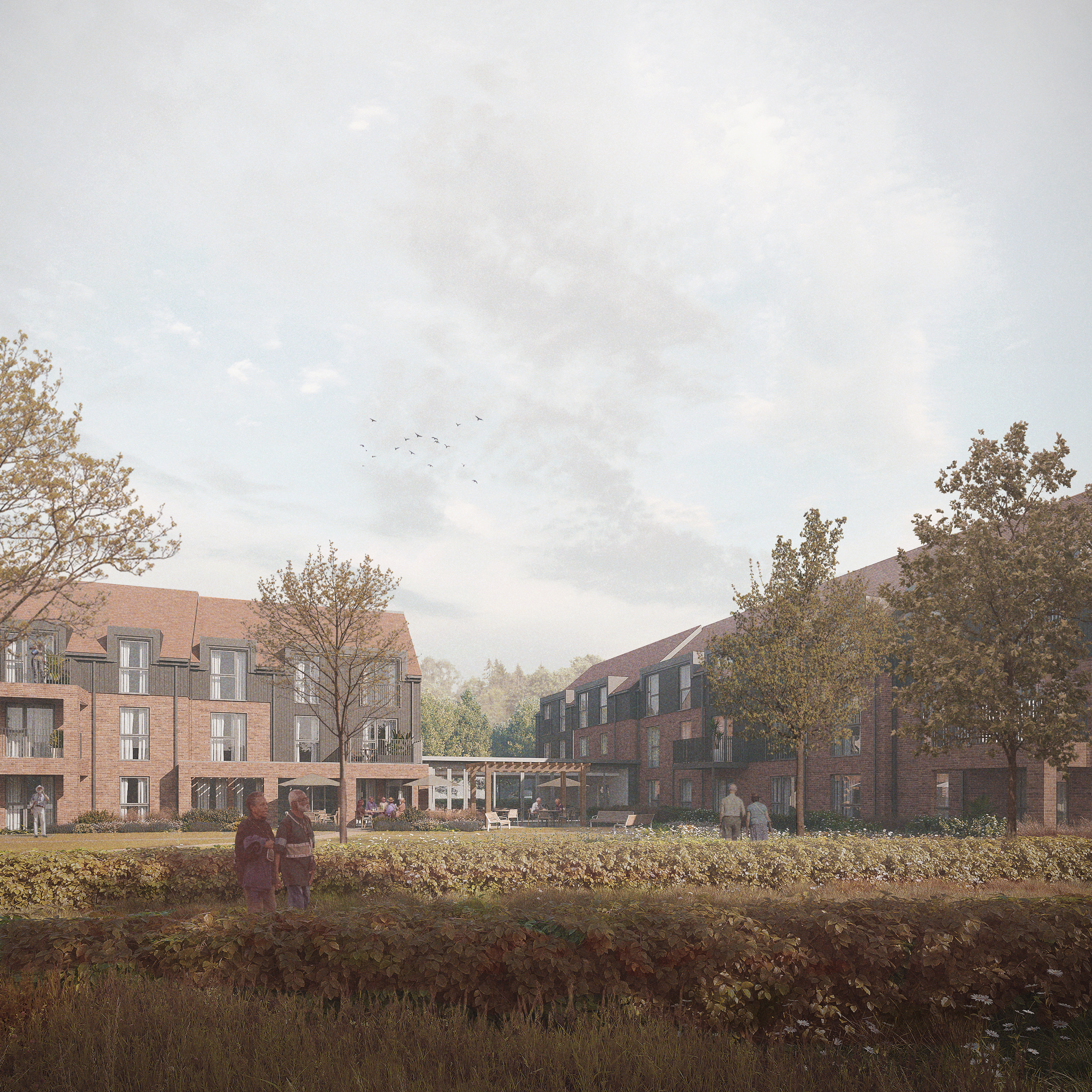
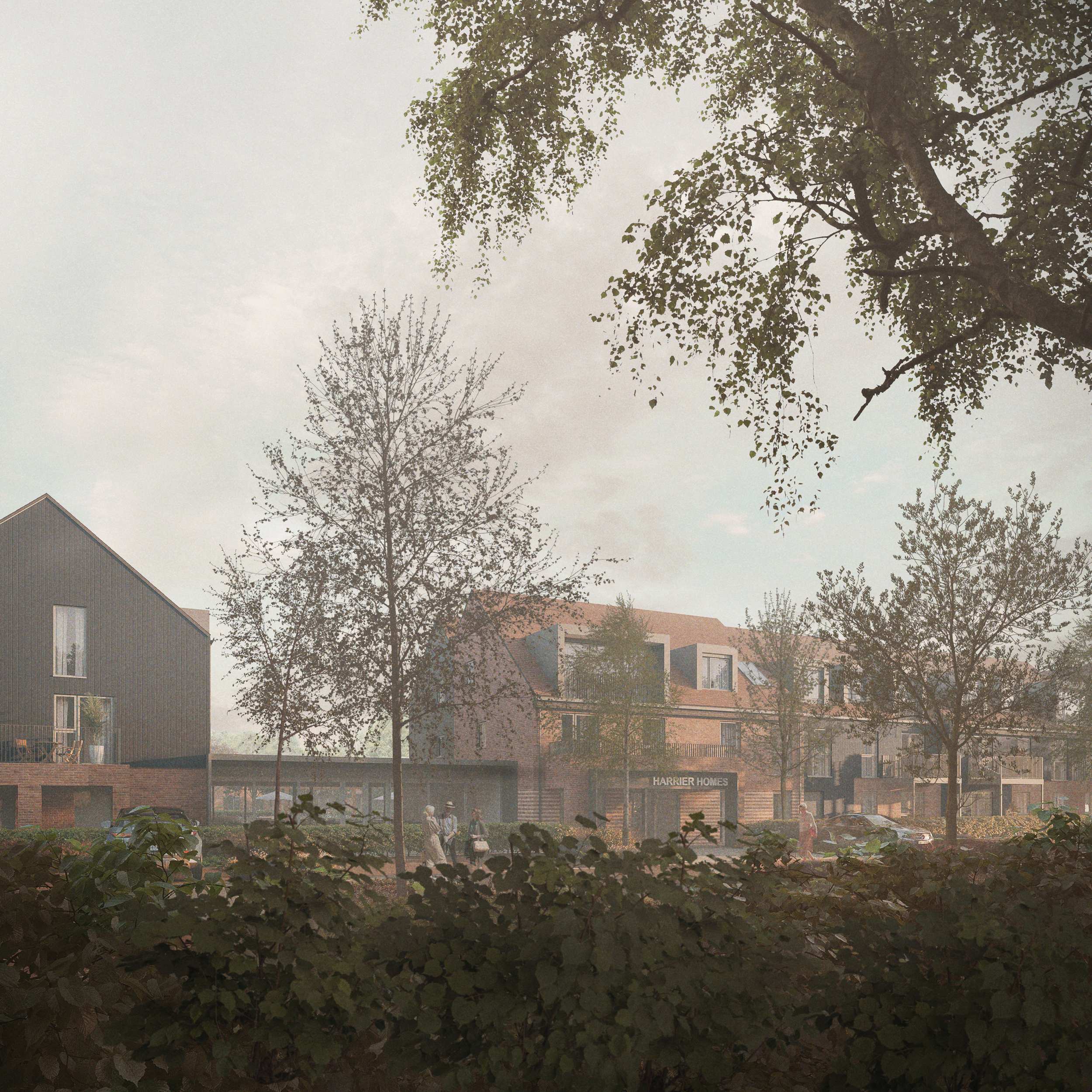
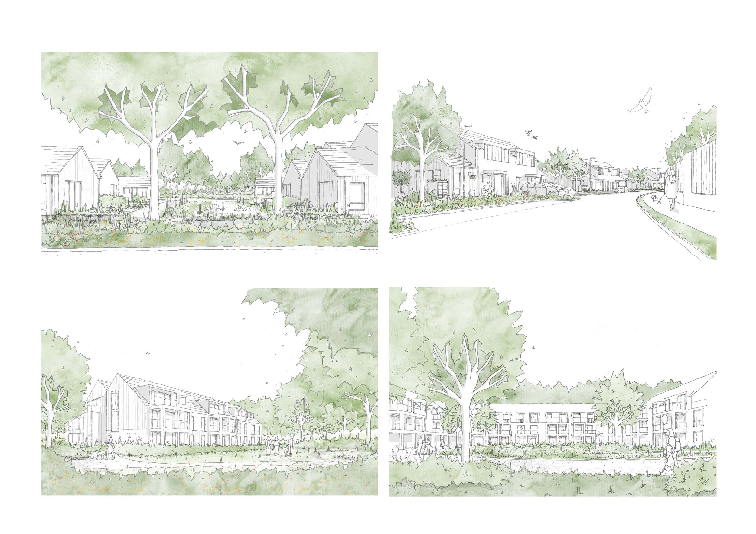
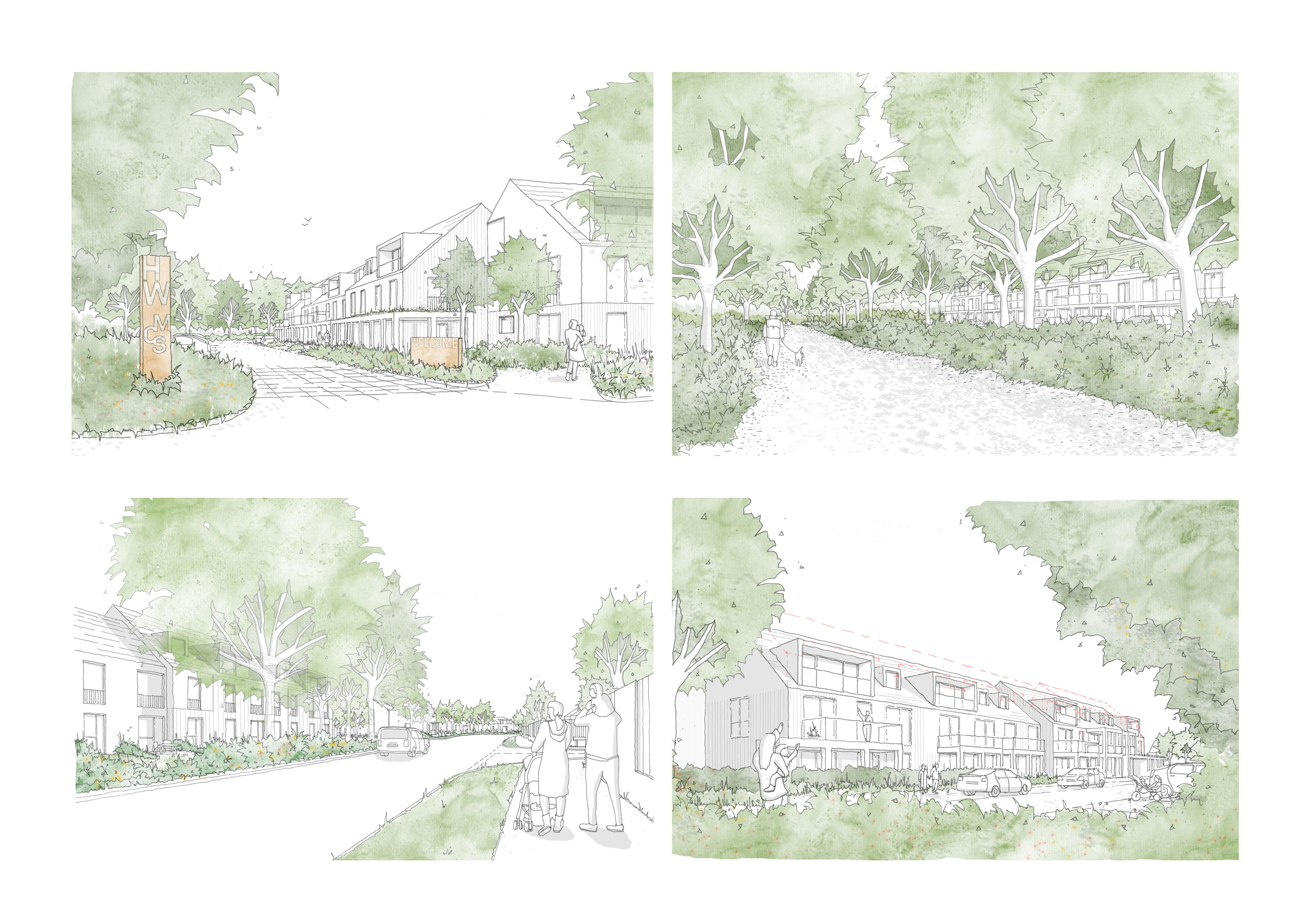
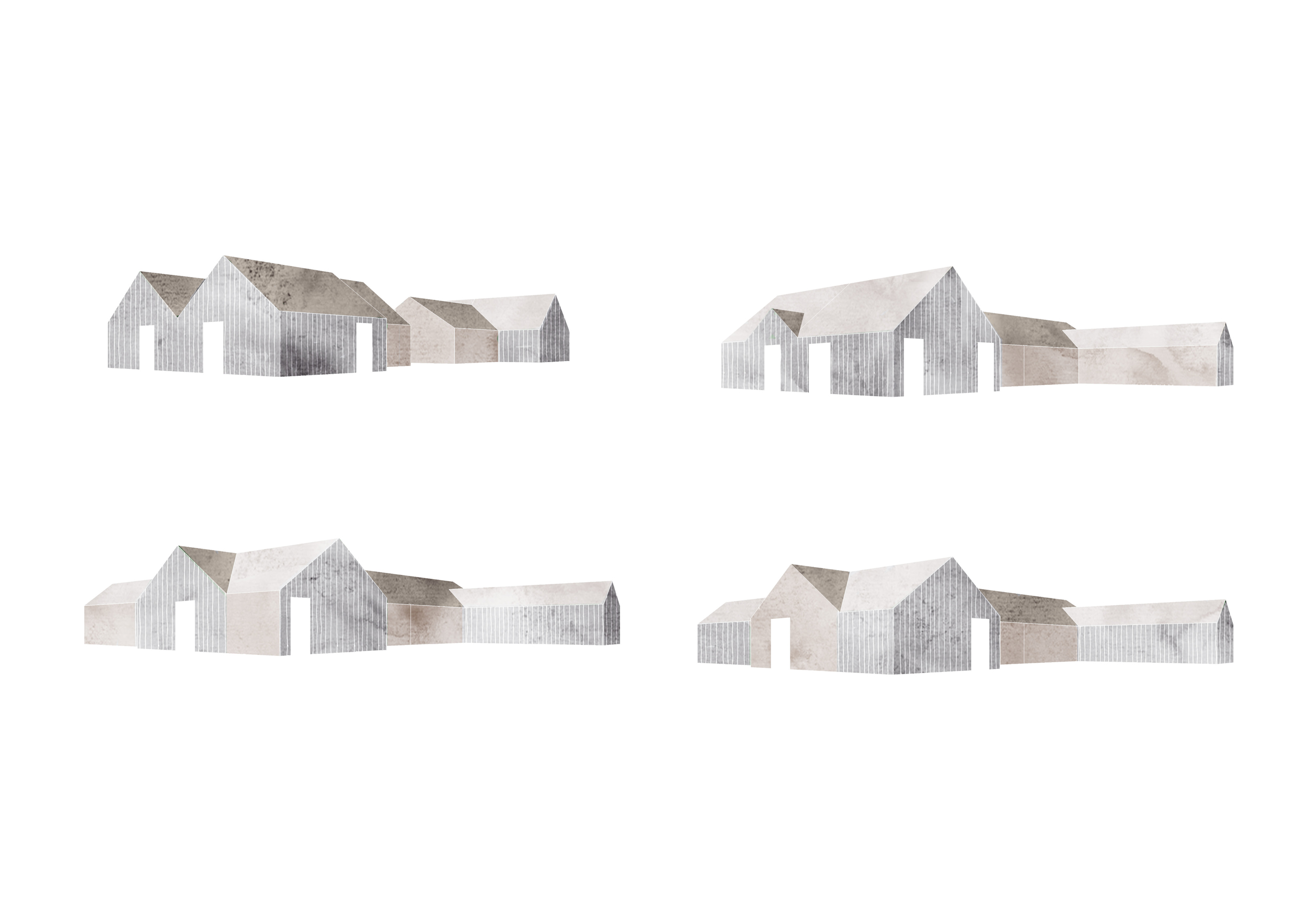
The design uses modern vernacular language, familiar forms and materials to create a new village that transitions from a low quality suburban estate to the edge of countryside.
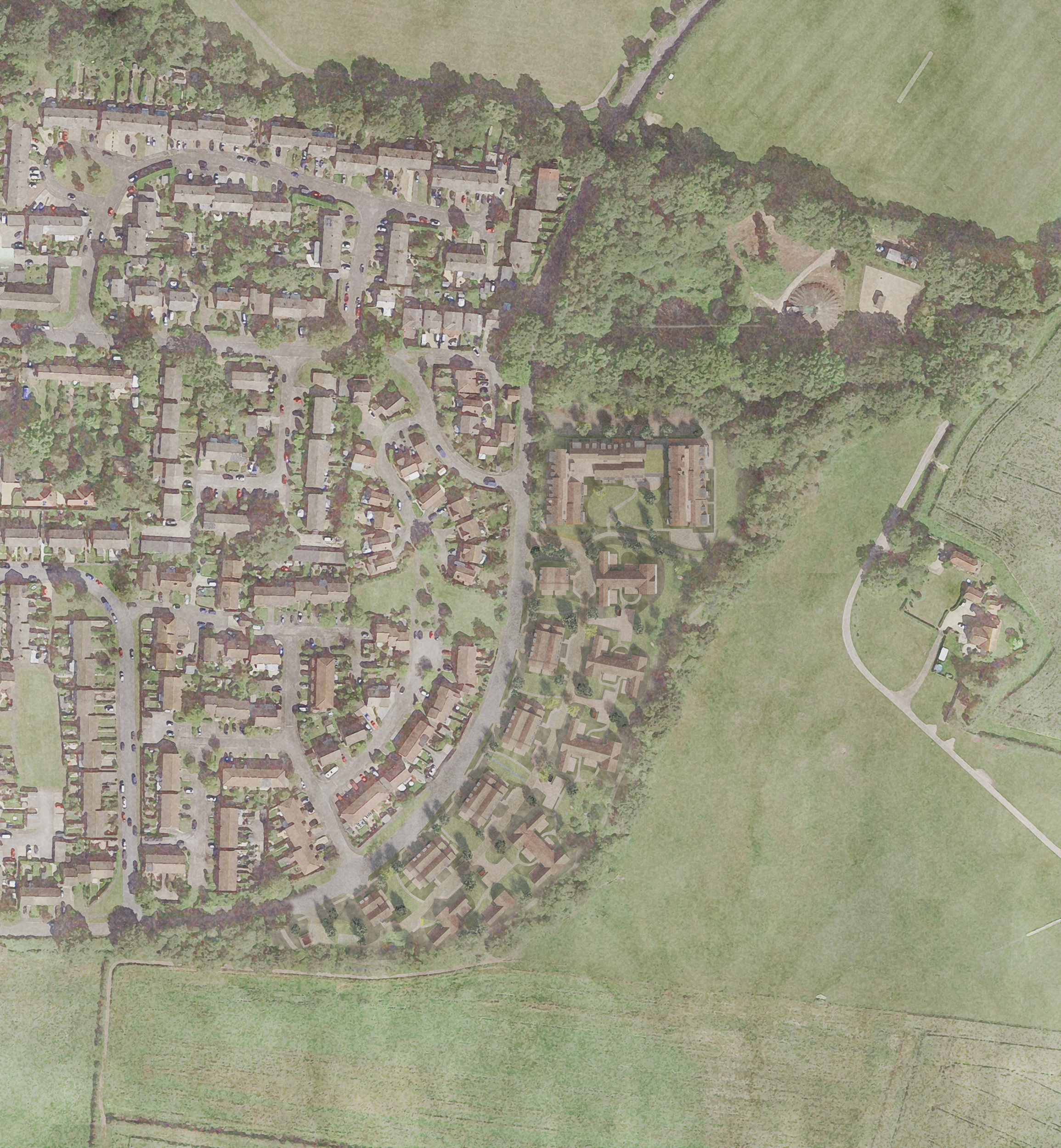
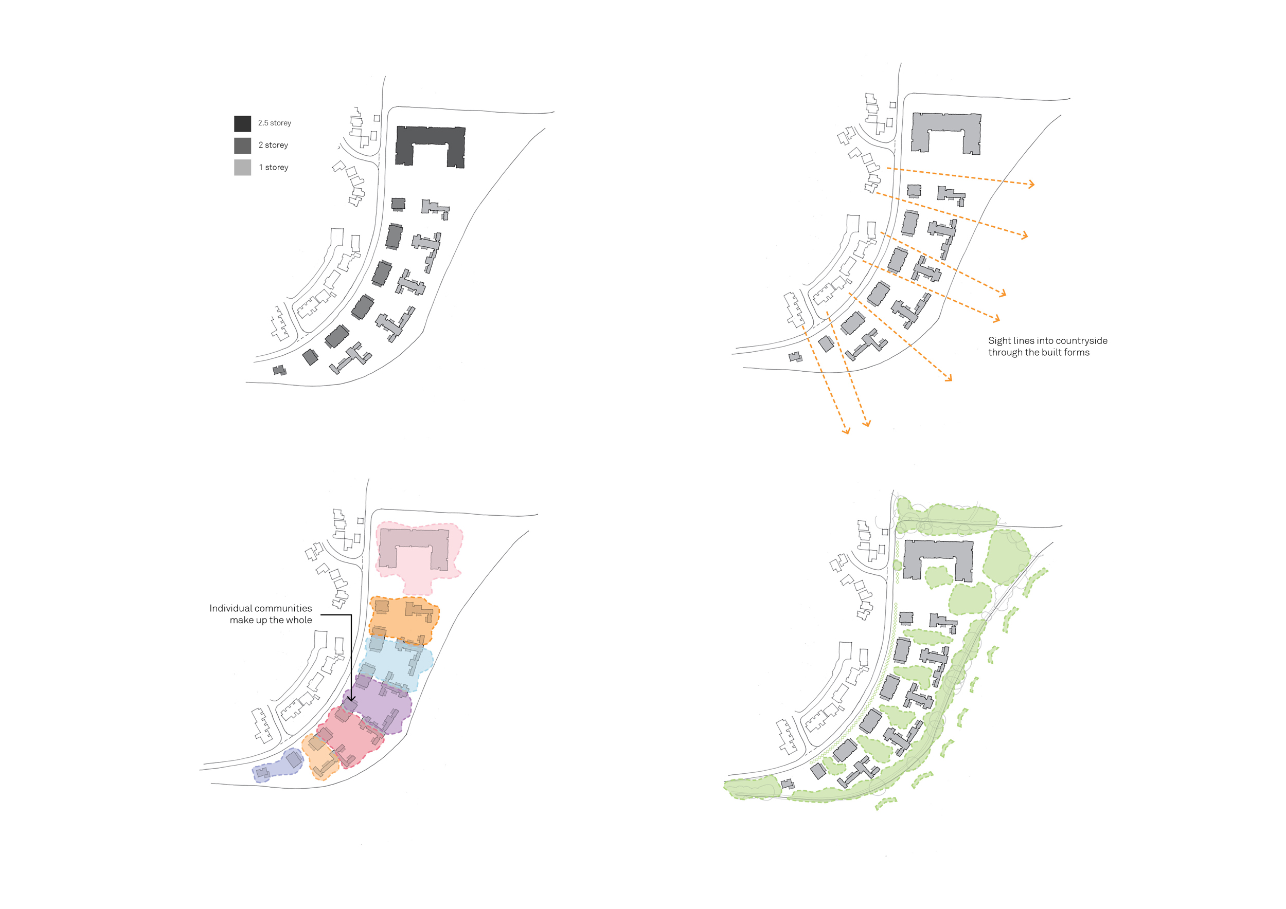
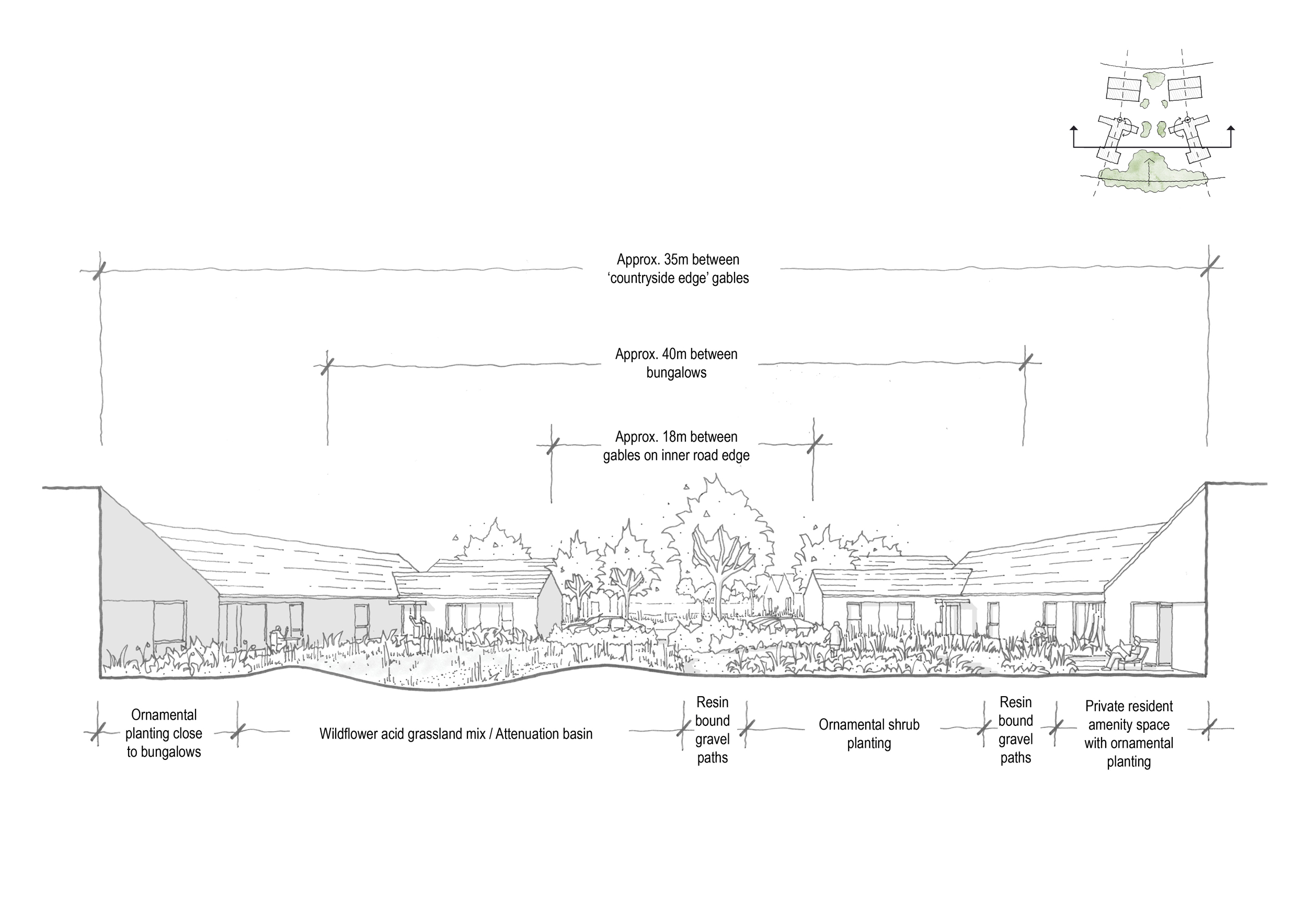
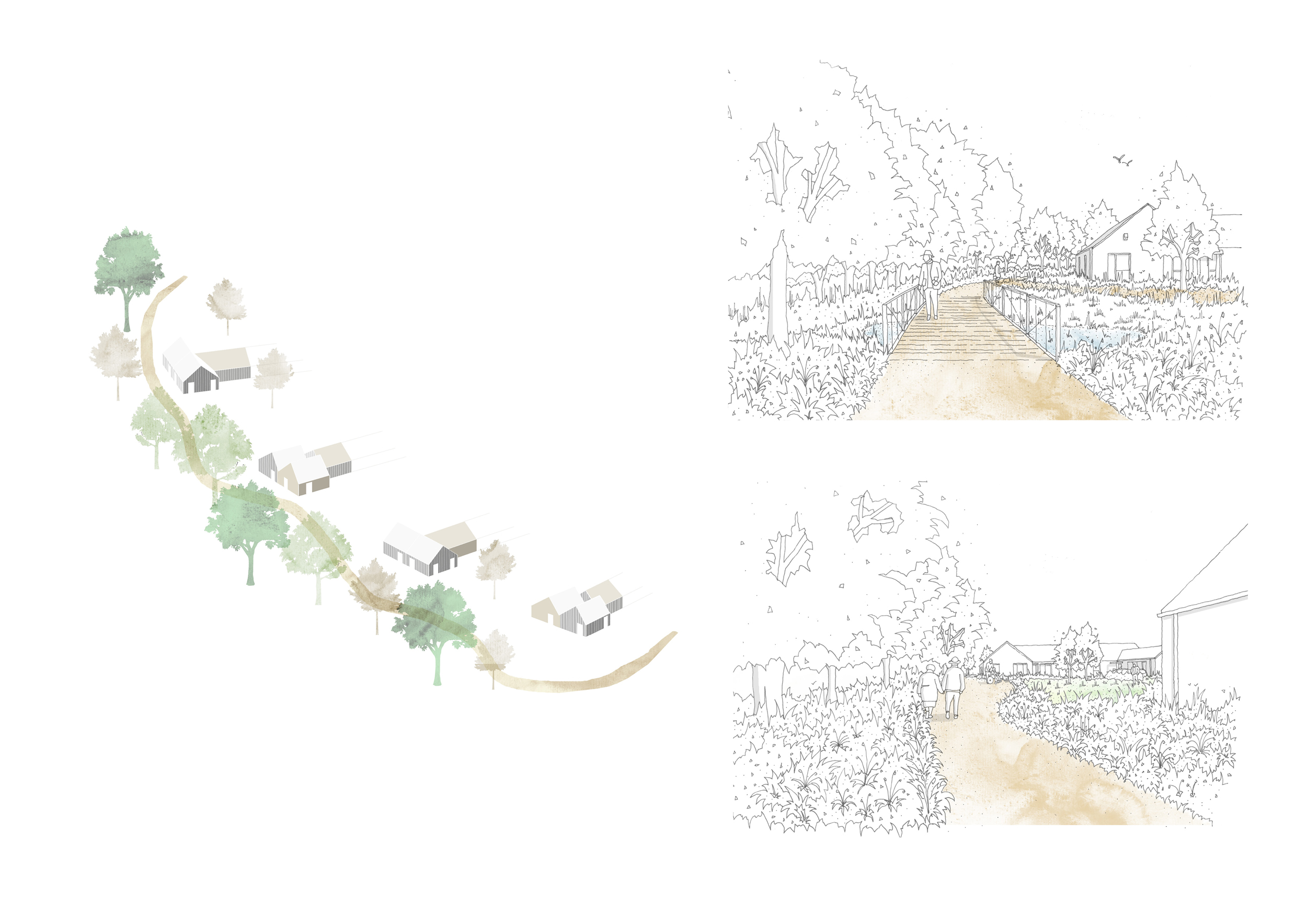
Uniquely, the village layout utilises back to back units to enable a ‘fence free’ landscape, opening up views and routes through the site. Where usually private curtilage would dominate and obscure, a ruralisation which avoids domestication of the landscape is enabled by low key infrastructure and contextual landscaping utilising local species.
The site is vertically bisected by a single direction narrow lane serving small, landscaped parking courts and informal roadside parking in a home zone type environment where cars are secondary to pedestrian and cycle activity.
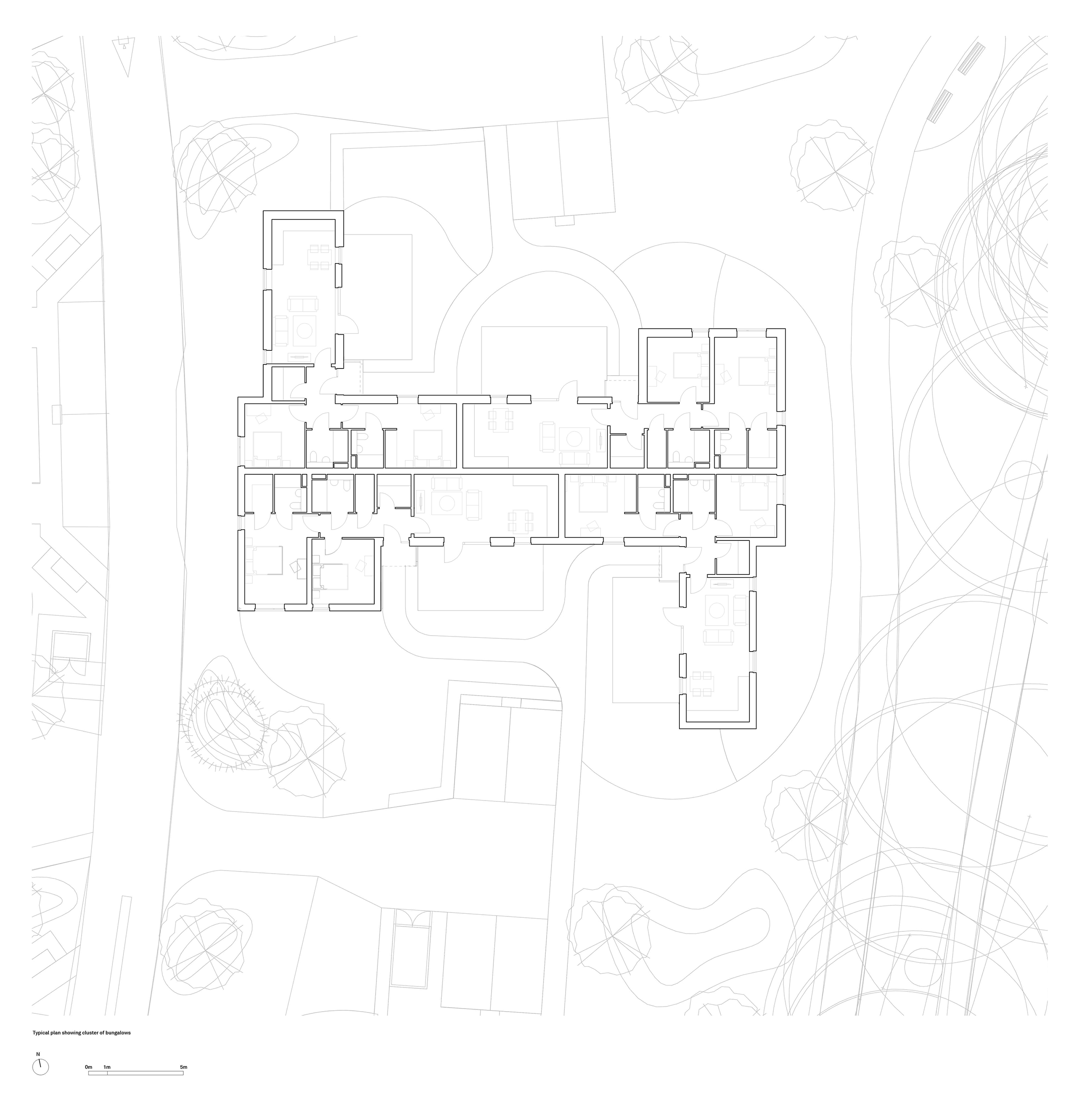
The chalets and bungalows initially formed farmstead courtyards enabling the larger community to be broken down where residents could identify simultaneously with smaller and larger communities. Through consultation with the SDNPA these courtyards were opened up to allow more site permeability.
Chalet units present a street scene to Harrier Way and a broken rhythm of individual, non-repeating facades to the countryside.
Residents enjoy the external environment from private terrace areas and can walk along various routes through shared landscape, including a path and bridge along the eastern boundary adjacent the stream overlooking open countryside.
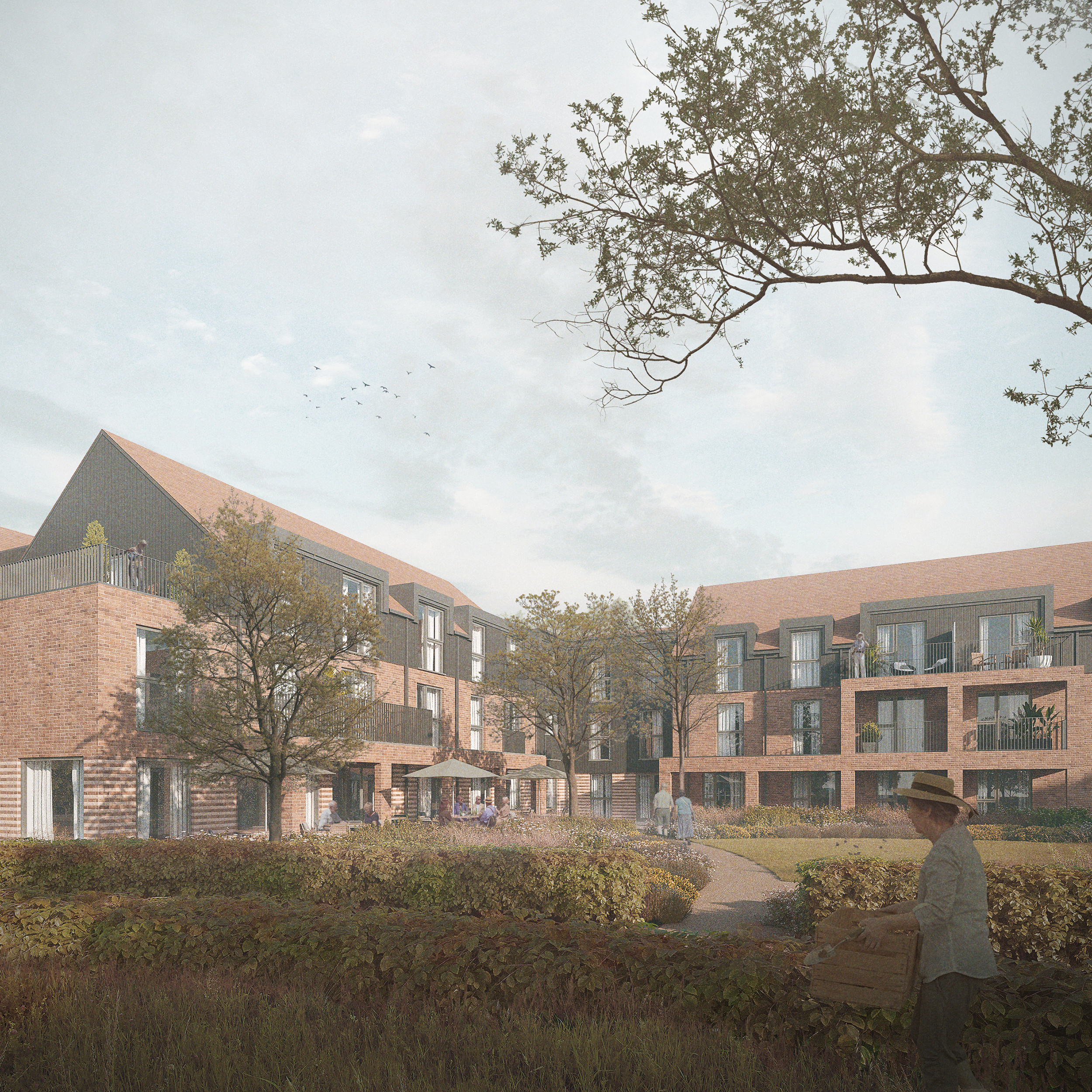
The apartment building is designed as a broken form to mediate scale and acts as a full stop at the northern boundary, nestled into the dominant tree line. It encloses a courtyard and provides communal facilities for the whole retirement village.
Key Features
Significant to the success of this development is the open grain which enables landscape to move through and dominate the setting, allowing the development to not ‘block’ the countryside or continue the suburban sprawl, instead creating a unique and stimulating naturalistic environment in which to enjoy a controlled slice of rural Hampshire.
The ideas of modulating scale from private, through semi private to public is a key driver throughout the scheme, with spaces interacting and enlivening the experience. Patios, terraces and balconies all relate to semi-public shared landscape providing controlled public access and unfettered public views through to the countryside.


