Beaulieu
Number/street name:
Beaulieu Park, (Zone C)
Address line 2:
City:
Chelmsford
Postcode:
CM1
Architect:
TateHindle
Architect contact number:
Developer:
Countryside Zest.
Contractor:
N/A
Planning Authority:
Chelmsford City Council
Planning Reference:
15/02072/REM
Date of Completion:
Schedule of Accommodation:
7 x 1 bed apartments, 18 x 2 bed apartments, 1 x 3 bed apartments. 40 x 2 bed houses, 71 x 3 bed houses, 96 x 4 bed houses, 23 x 5 bed houses
Tenure Mix:
71% Private Rent, 29% Affordable Rent
Total number of homes:
Site size (hectares):
12.38
Net Density (homes per hectare):
22
Size of principal unit (sq m):
161
Smallest Unit (sq m):
50
Largest unit (sq m):
283
No of parking spaces:
586
 Scheme PDF Download
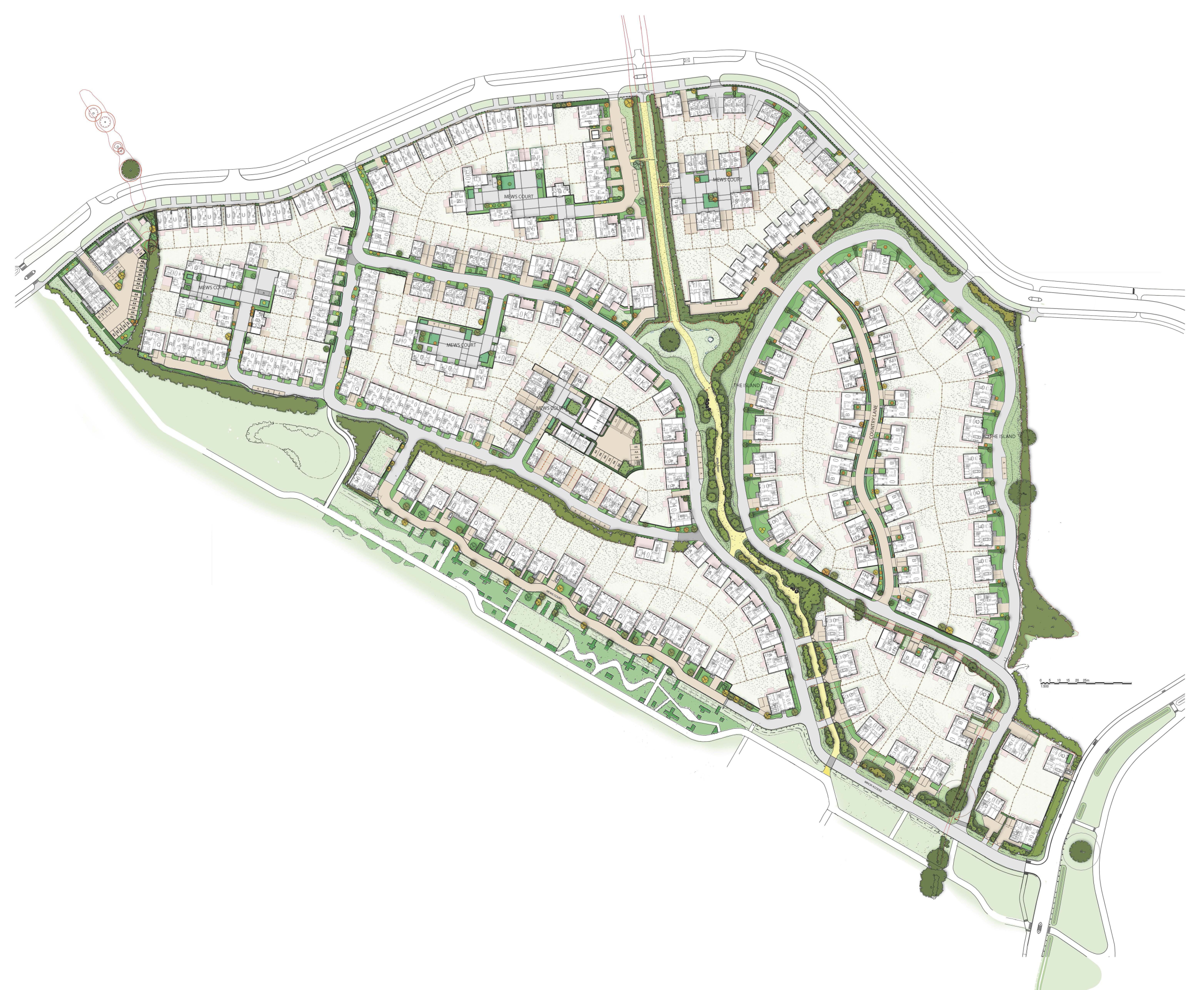
Planning History
The design for Beaulieu Zone C was developed in close consultation with Chelmsford City Council's Planning Authority, and Officers from their respective Technical departments as well as Essex County Council Highways. The pre-application process commenced in February 2012 and included two design reviews with the Essex Design Review Panel in December 2012 and March 2013. Two Public Consultations were also held in December 2012 and June 2013. Following continued consultation with Chelmsford City Council Planning Authority a planning application was submitted in December 2015.
The Design Process
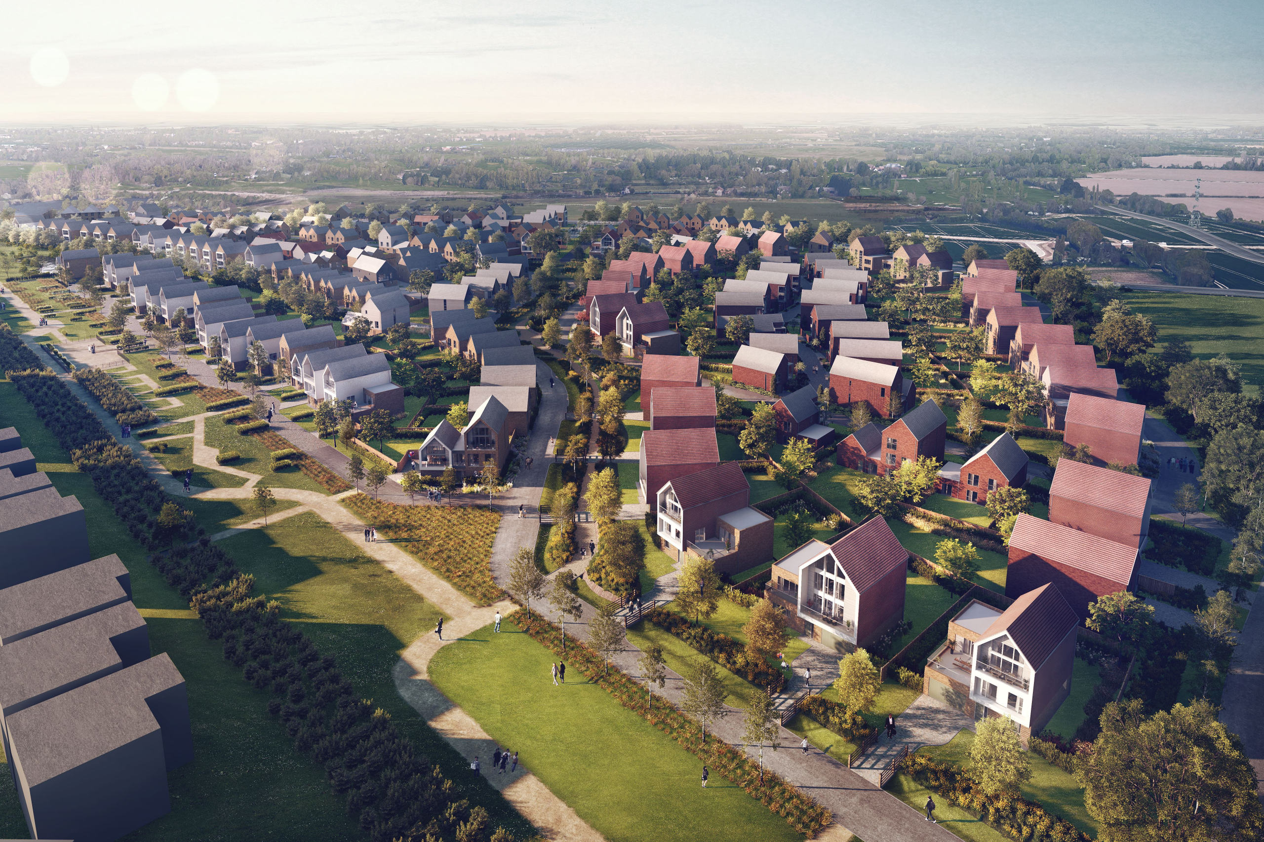
The Beaulieu masterplan adjoins the residential district of Springfield and is well connected to the existing local highways network, providing good access to the immediate locale. A link road to the south-east of the site provides a vehicular and public transport connection to White Hart Lane (A130). A link road to the north provides connection to Essex Regiment Way heading north towards Braintree, Stanstead Airport and the M11 (towards Cambridge). Two key entry points at the north-west and southeast corner of Zone C provide vehicular access to the development. A network of streets and lanes organised in an informal pattern complete the journey to individual homes.
Public transport
Once constructed, a regular bus services will operate on the road network to the north and south of Zone C, linking Beaulieu and the neighbouring Channels development to Chelmsford City Centre. In addition to this, a new local train station will be built as part of the wider masterplan. This is located directly off of the A12 and will offer services between Norwich/ Ipswich and London Liverpool Street.
Facilities and services.
In addition to vehicular routes, a number of public footpaths and cycle wavs run through and around the site. On the southern boundary, the Linear Park provides a focus for the overall development and includes play facilities, cycle and pedestrian routes, SUDS features and a large balancing pond. The Greenlink on the eastern boundary makes similar provision for cycles and pedestrians in a less formal landscape setting.
An existing Bridleway that runs through the site has been enhanced to provide year round access for horse riding, cycles and pedestrians. This provides a safe route for residents to connect to the Neighbourhood Centre, shops and schools situated at the entrances to Beaulieu Park.
Meeting local housing requirements
A variety of dwelling types of different size, arrangement and tenure contributes to creating a sustainable neighbourhood and community. In total there are 256 dwellings on the site comprising of 230 Houses and 26 apartments ranging from 1 Bedroom apartments to 5 Bedroom family homes. The site provides 74 affordable dwellings distributed across the site, and 3% of the total number of dwellings on site are wheelchair adaptable. All dwellings are designed in an equitable and tenure neutral helping to create a balanced community.
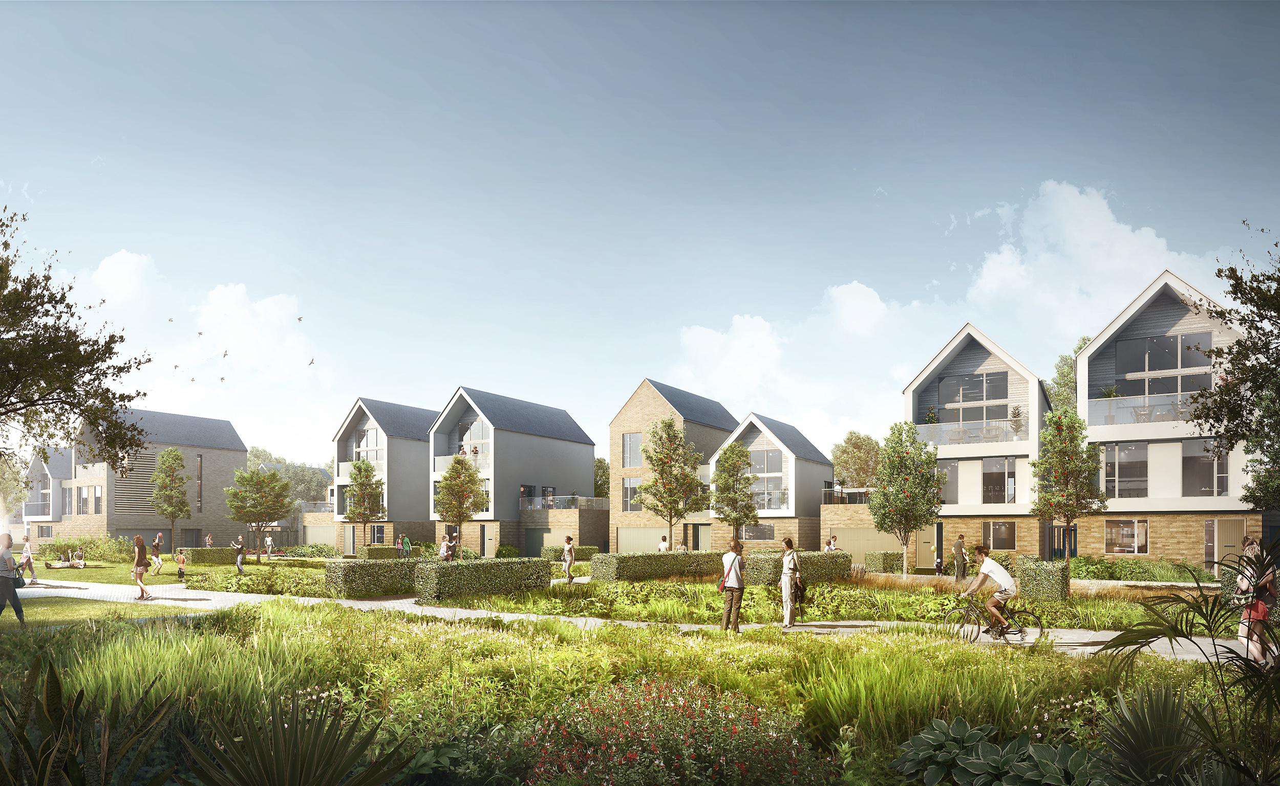
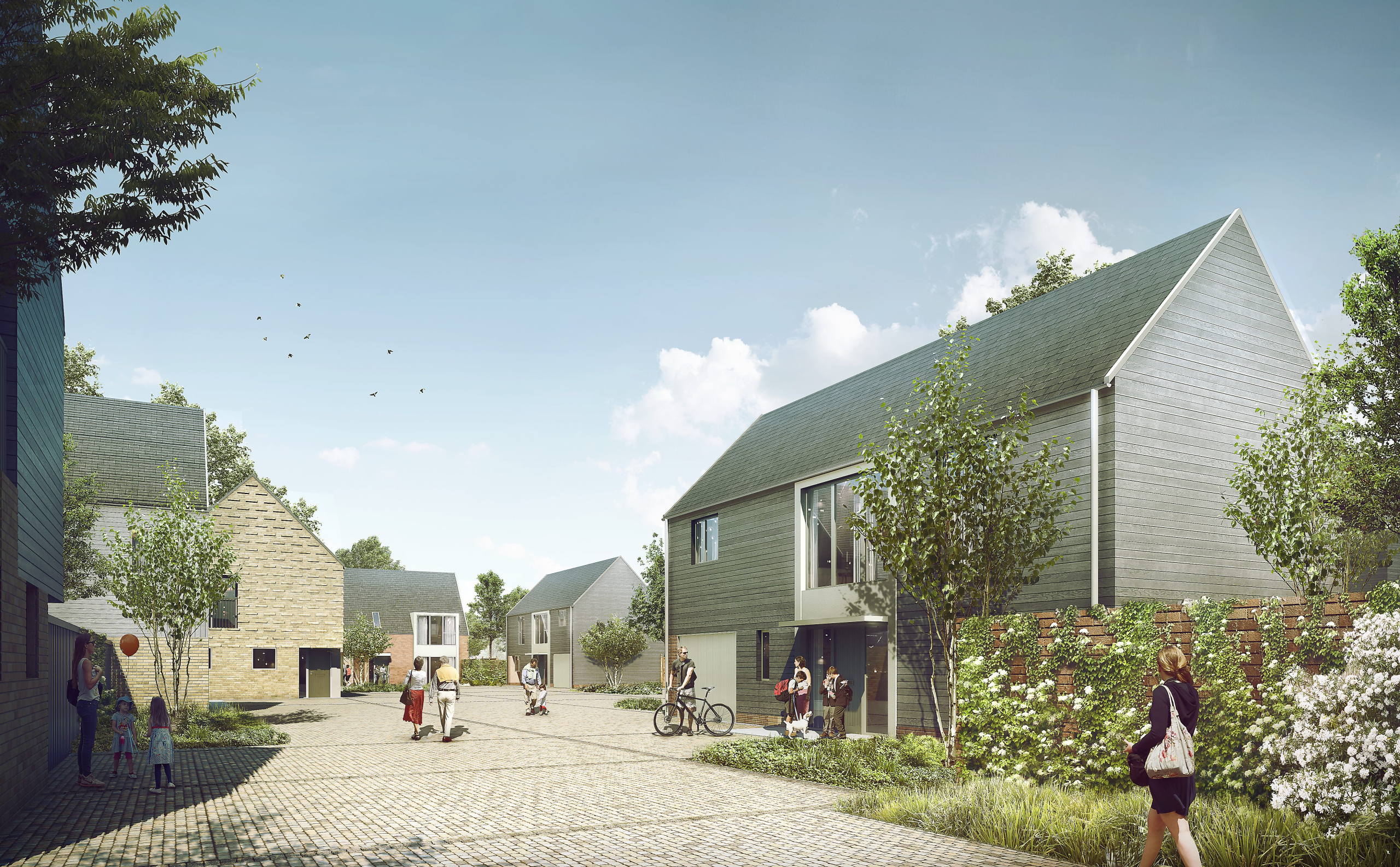
Creating a place
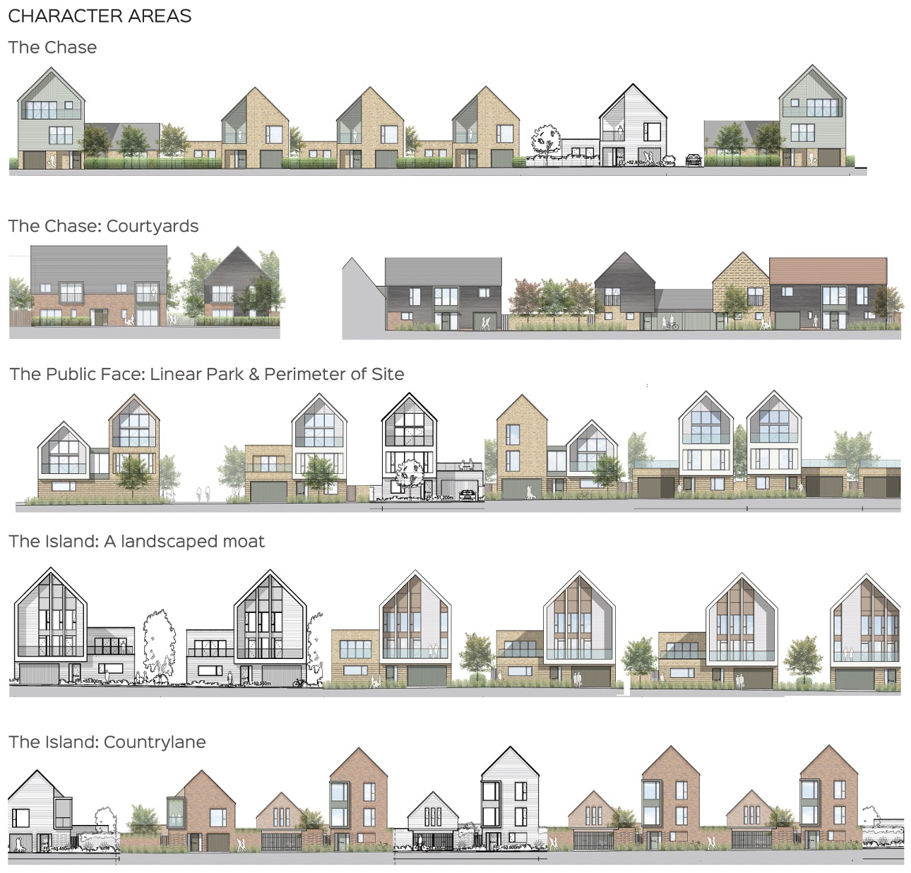
Character
The overall scheme integrates into existing landscape but creates distinct character areas formed by historic fields/ boundaries and retaining existing landscape features e.g. the Bridleway and hedgerows.
Character areas;
The Island: Landscape Moat
A collection of larger houses is located on a piece of land historically known as the Moat field. The proposal is to connect into the existing SUDS and hedgerows to create a moat like perimeter.
The Island: Country Lane
More intimate in scale the Country Lane draws its characteristics from an Essex village with brick gables collected by a continuous wall.
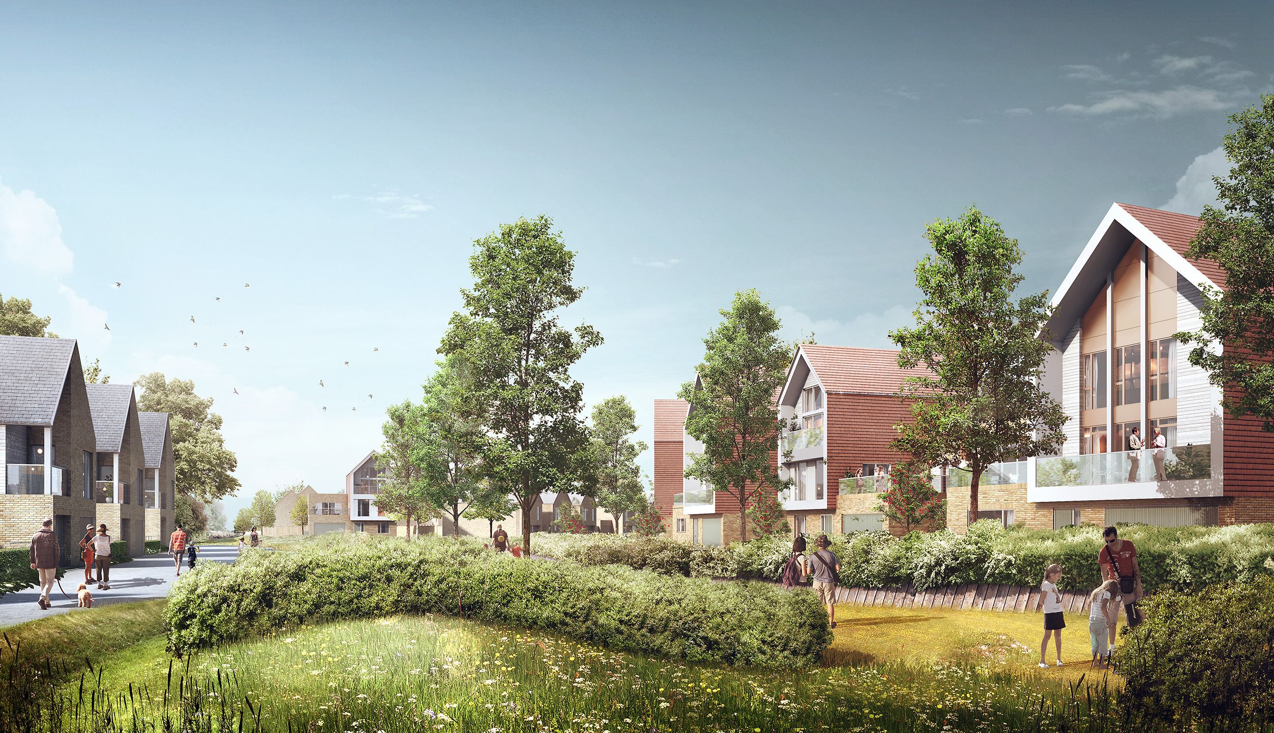
Interface with Zone A: Linear Park
The length of the south-facing aspect of the scheme forms the north edge of the Linear Park. This is one place on the site where houses form part of a vista viewable at a distance so it is very much the public face of the development. Villas, fronting the Linear Park, sit within a parkland setting with interlocking hedgerows which disguising the access road.
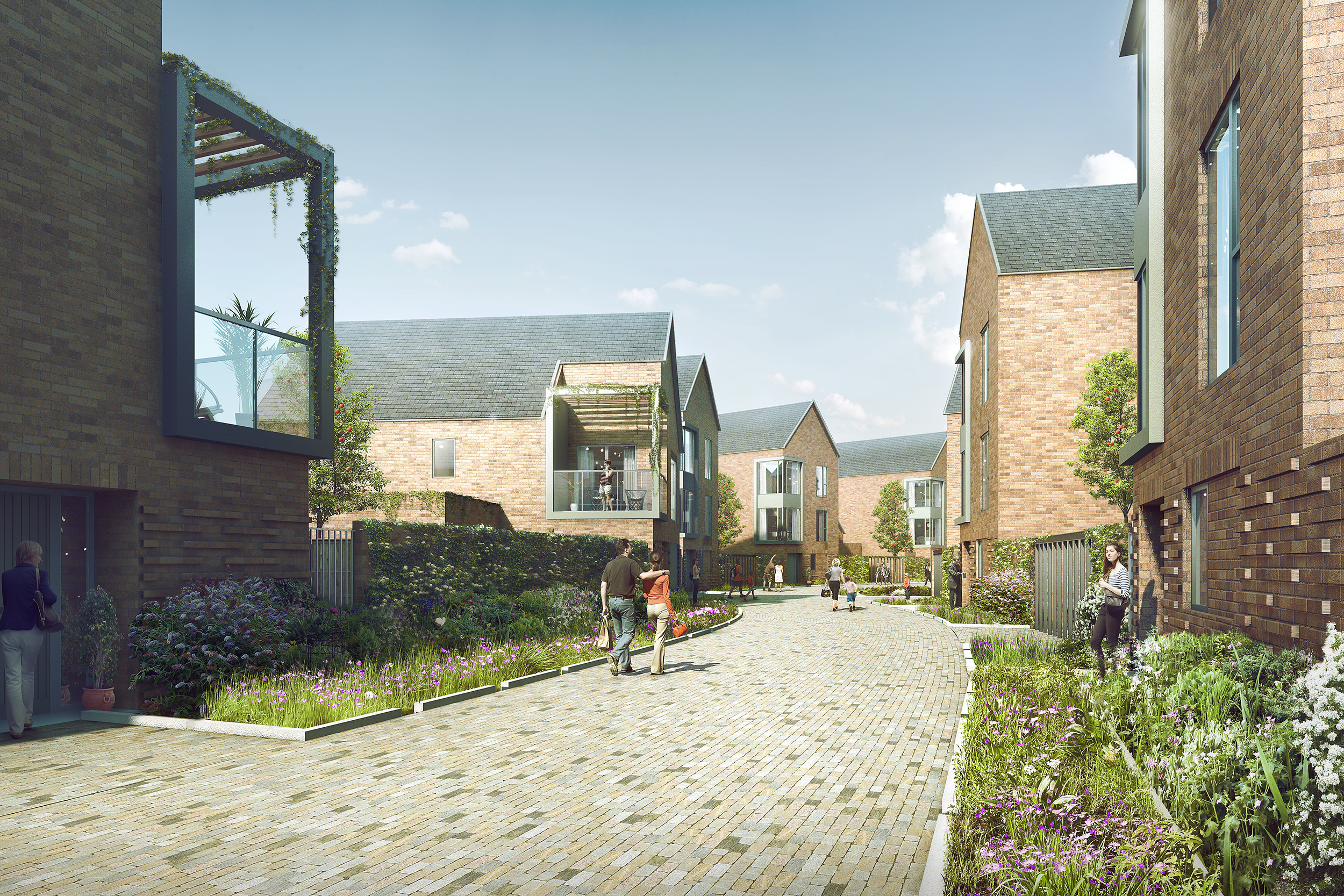
The Chase: Lanes & Courtyards
This parcel, sited on land historically known as The Chase, is significantly the largest subdivision. A denser approach is adopted here. This is achieved with village lanes and farmstead courtyards. The courtyards derive their form from Essex farmsteads to create a space conducive to community (perhaps suited to young families or the aging population).
Working with the site and its context
The scheme integrates into the topography and existing landscape features of the site, in particular existing ditches and hedgerows which are used to define pedestrian and vehicular routes. The existing Bridleway is retained and integrated into site, acting as both public amenity and a thoroughfare through the site. The Linear Park to the south acts as an interface with earlier and future phases, terminating views into the site with key marker buildings.


