Arnos Grove
Number/street name:
Arnos Grove
Address line 2:
City:
London
Postcode:
N111AM
Architect:
MaccreanorLavington
Architect contact number:
2073367353
Developer:
Connected Living London|Grainger plc|Transport for London.
Planning Authority:
London Borough of Enfield
Planning Reference:
20/01049/FUL
Date of Completion:
Schedule of Accommodation:
84 x 1 bed, 64 x 2 bed, 14 x 3 bed
Tenure Mix:
100% build to rent. 40% let at below market rate
Total number of homes:
Site size (hectares):
1.40
Net Density (homes per hectare):
115
Size of principal unit (sq m):
60.8
Smallest Unit (sq m):
51.2
Largest unit (sq m):
88.2
No of parking spaces:
5 accessible resident parking spaces, 6 accessible public parking spaces – to serve AG station, 10 TfL staff parking spaces
Planning History
Submission of an application for full planning permission, alongside a listed building consent, alterations and repair of curtilage listed structures was submitted in May 2020.The planning application was reported to the Council’s planning committee in January 2021 with planning officer recommendation for approval. The committee resolved to refuse the application.In August 2021, the Council wrote to the Planning Inspectorate advising that it would not be defending these reasons for refusal at the Inquiry.The proposals were granted planning permission at appeal in March 2022.
The Design Process
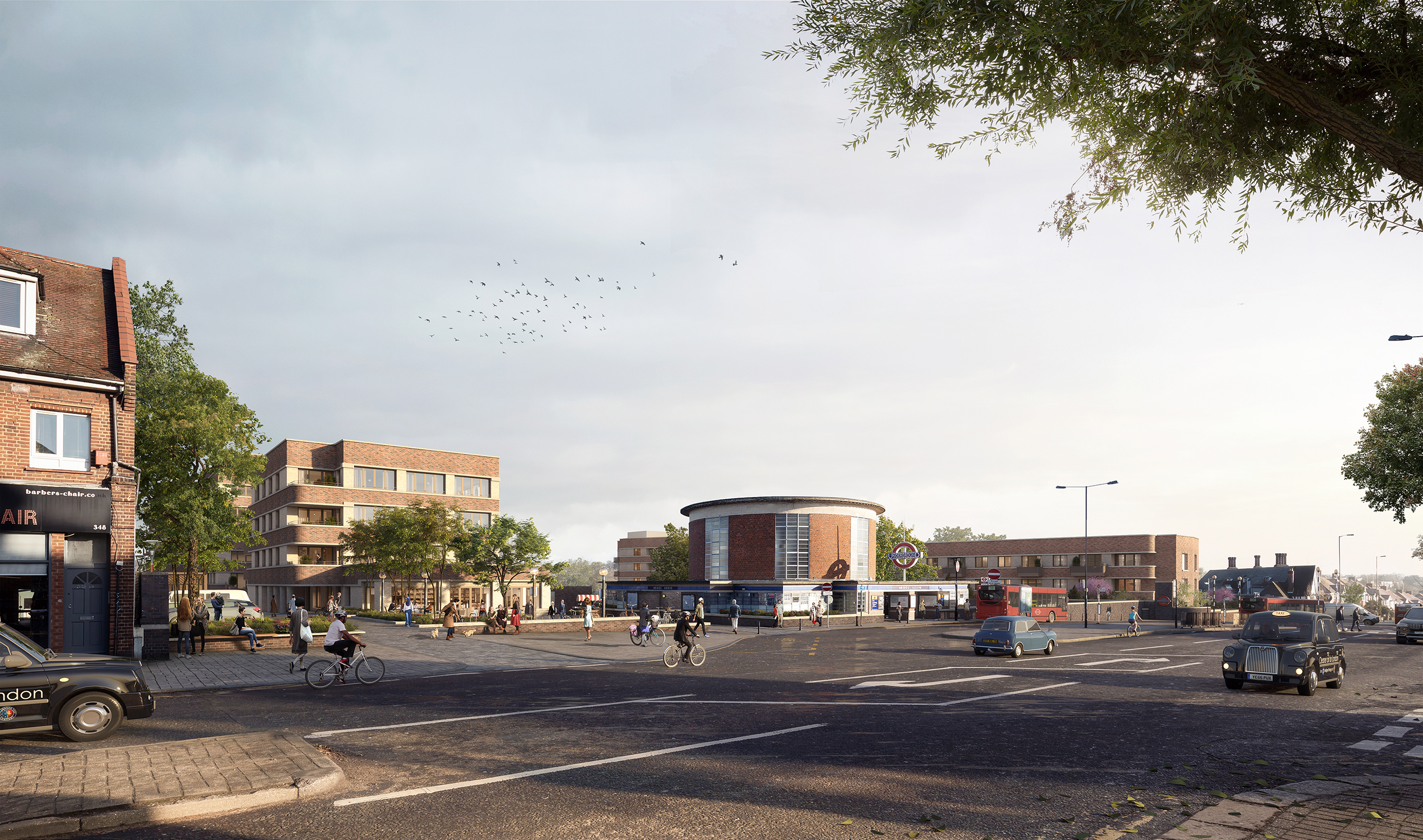
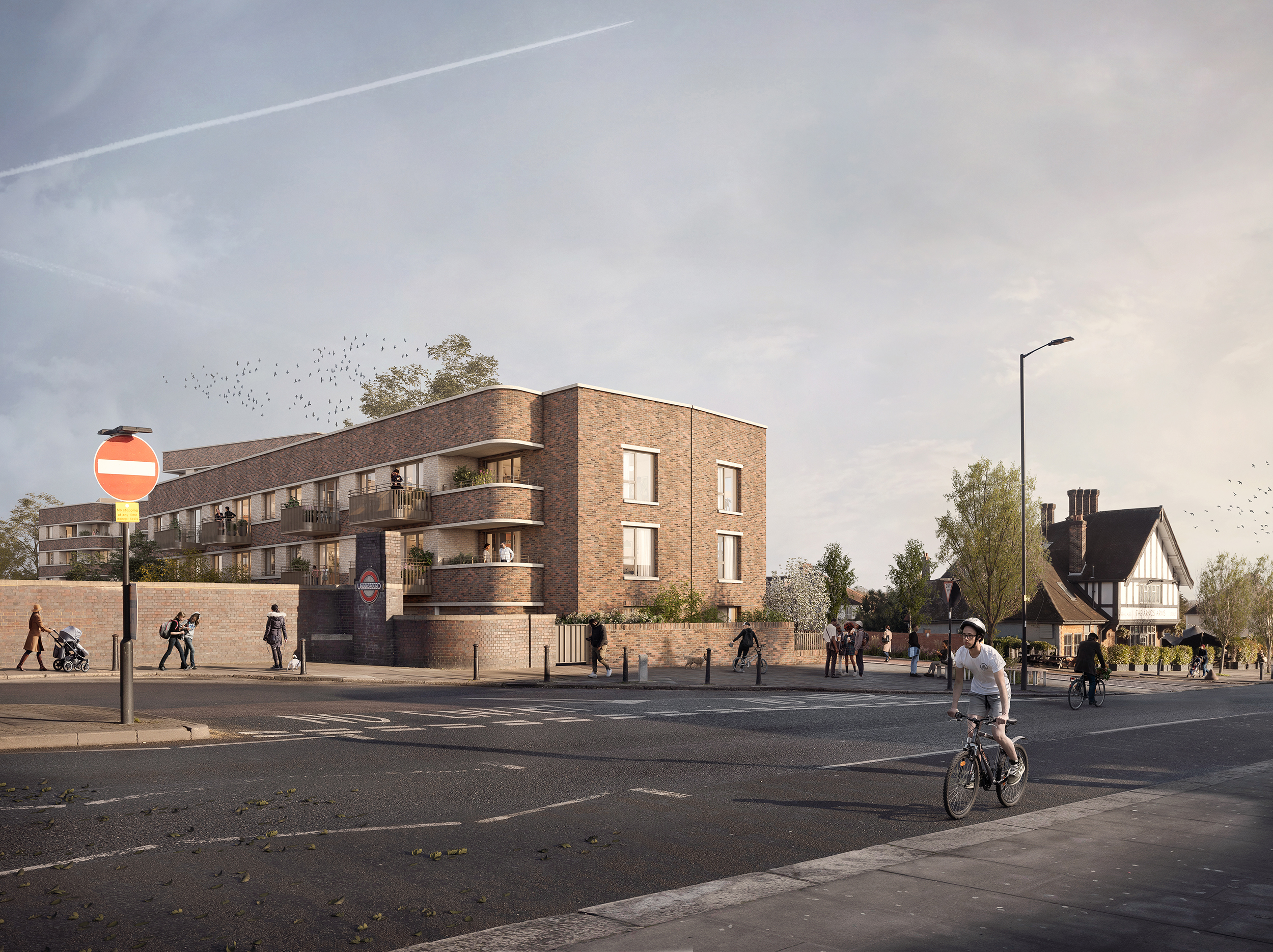
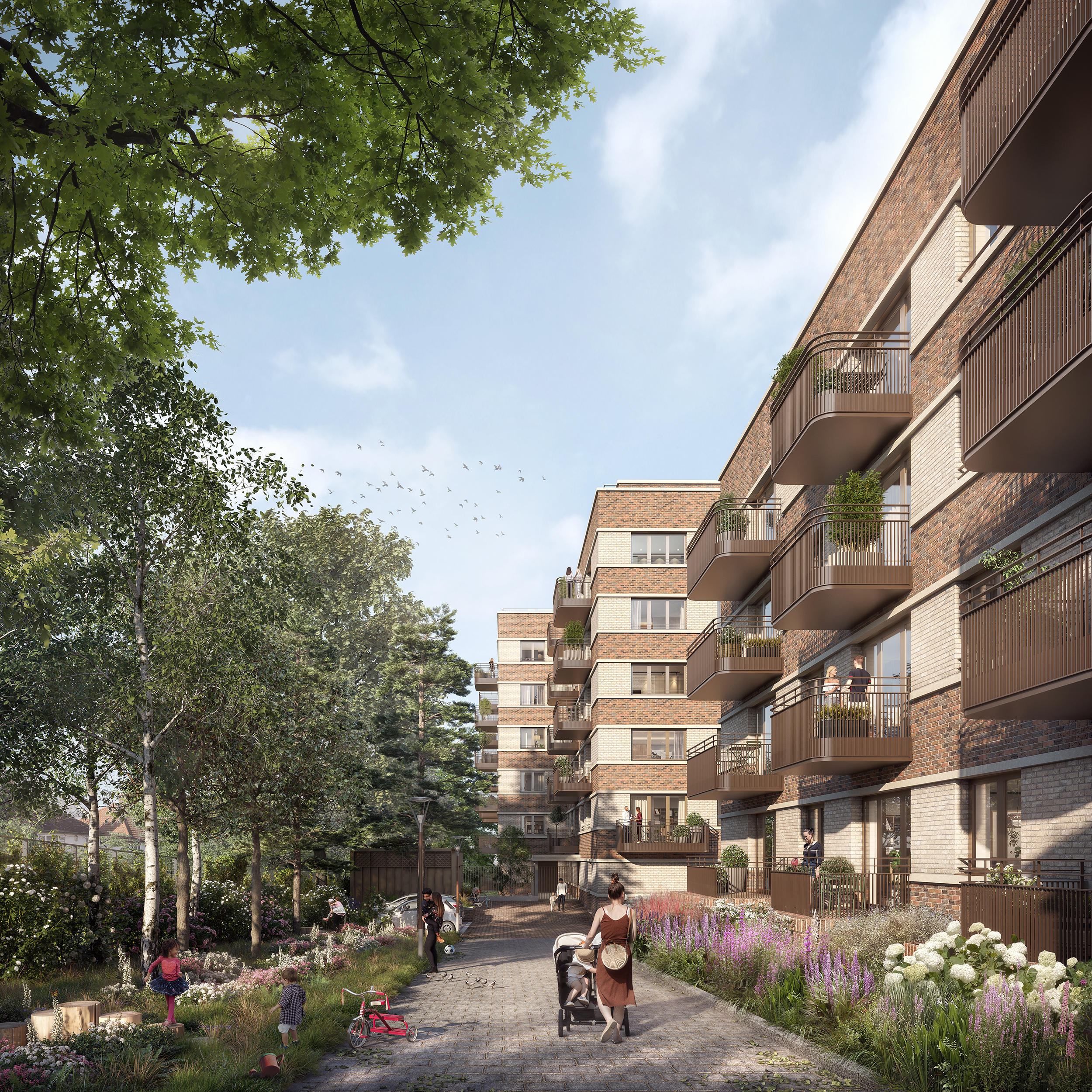
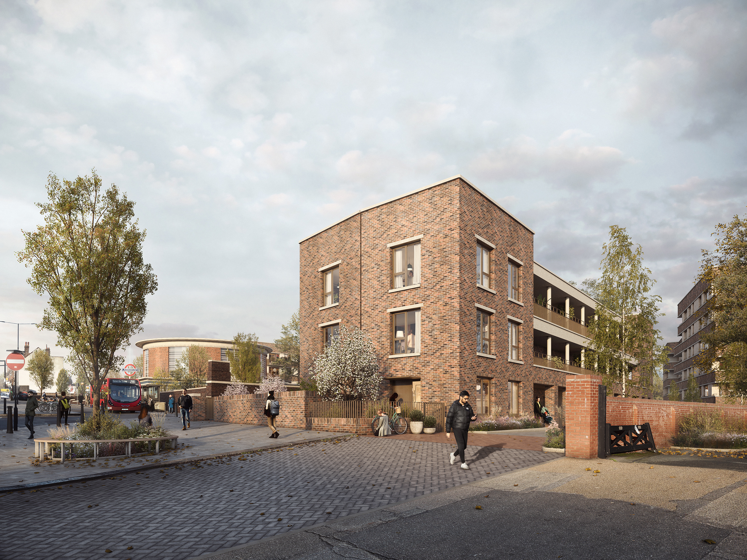
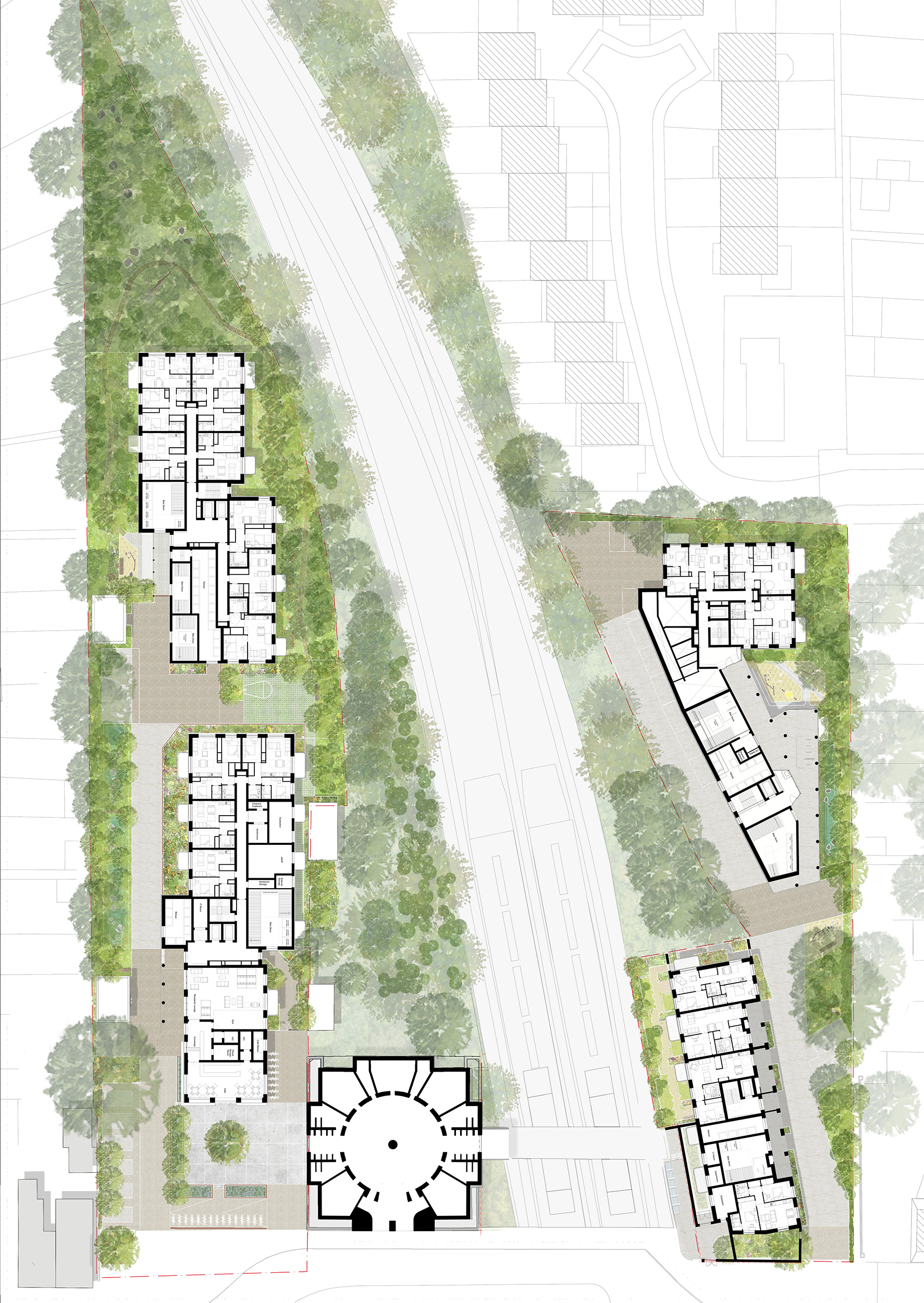
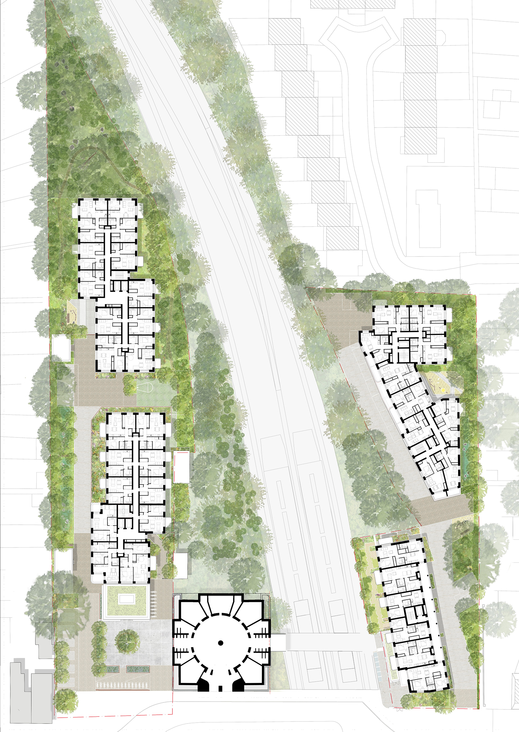
The development comprises 162 units of Build-to-Rent homes in four buildings, ranging in height from one to seven stories on two underused carparks adjacent to the Grade II* listed Arnos Grove station, designed by Charles Holden. Our primary concern was to respect the listed station and for new buildings to not encroach on the silhouette of the drum as seen against the sky, or with the backdrop trees from key locations. Buildings are kept lowest towards the southern end of the Site and when seen as a backdrop to the station from Bowes Road Extensive public realm and landscape proposals were developed by Churchman Thornhill Finch, including the design of a new public space to the west of the station, communal and private landscaped gardens, and boundary conditions. The new public square is addressed by a café space, providing a sheltered landscaped public realm adjacent to the station. Established trees have been protected and boundary conditions enhanced, providing a pleasant living environment for new and existing residents. The architectural language makes reference to residential buildings that are contemporaneous with the station, but is legible as contemporary, in its construction techniques and expression. The buildings will primarily be made of brick - a robust, timeless material which is the prevalent material in the local area. The use of the same brick types across all the buildings will provide continuity and coherence to the differently configured building forms. Projecting pre-cast banding to the head and sill are proposed to be coloured to compliment the tone of the white/buff brick. The sills are raised to provide privacy to internal bedrooms but have a deep sloping fall.
Key Features
Our primary concern is to respect the listed station and to ensure that new buildings do not encroach on the silhouette of the drum as seen against the sky, or with the backdrop trees from key locations. Extensive landscaping and public realm for the station provides communal and private gardens with a public square and small café helping to enhance the local area.
 Scheme PDF Download


