Earnley Green, Manhood Peninsula
Number/street name:
Drove Lane
Address line 2:
Earnley
City:
West Sussex
Postcode:
PO20 7JN
Architect:
John Pardey Architects and BD Landscape
Architect contact number:
01590 626465
Developer:
BRiCS Development.
Contractor:
(To be appointed)
Planning Authority:
Chichester District Council
Planning consultant:
Fellows Planning
Planning Reference:
24/01775/REM
Date of Completion:
03/2028
Schedule of Accommodation:
20 x 3 bed houses; 7 x 4bed house; 3 x 5 bed houses
Tenure Mix:
The brownfield site (a former educational institution) requires demolition of 5,026m2 of derelict buildings and significant site remediation. Consequently, Vacant Building Credit (NPPF) resulted in no requirement for affordable housing and all homes will be for market sale.
Total number of homes:
30
Site size (hectares):
Developable area 1.15ha. Overall site 1.85ha.
Net Density (homes per hectare):
26
Size of principal unit (sq m):
123
Smallest Unit (sq m):
109
Largest unit (sq m):
228
No of parking spaces:
71
 Scheme PDF Download
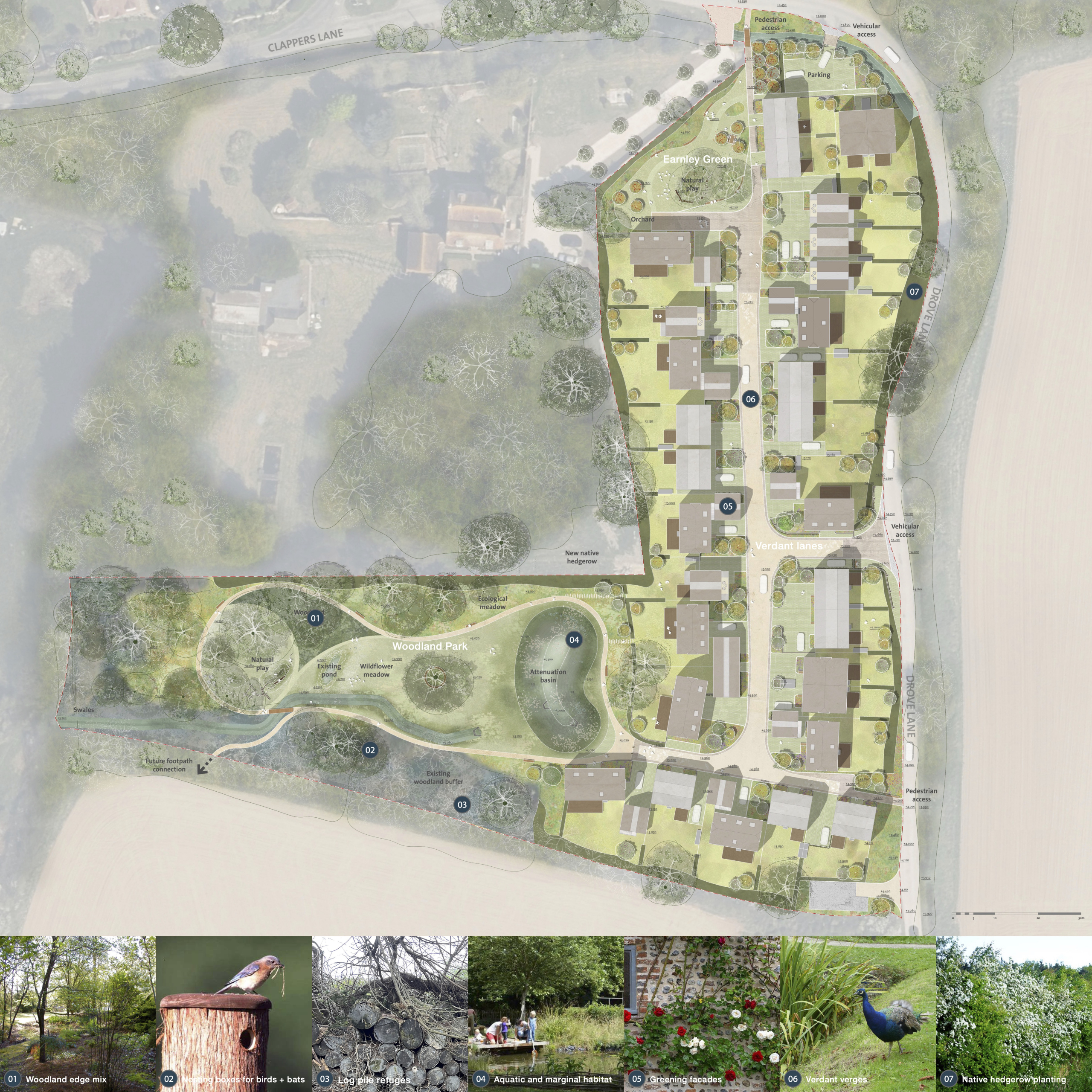
Planning History
The proposals benefited from constructive conversations with the Parish Council and Chichester District Council, both welcoming a more sympathetic village layout than the unimaginative 'anywhere' layout of the outline planning.
“The design approach enables the development to establish its own character and identity. It studiously avoids the effect of poorly executed pastiche and deferential vernacular idioms that would be easily capable of causing harm to the Conservation Area. The agricultural references, bold but traditional material palette and high-quality landscaping ensure the development relates well to its surroundings through its similarities and not solely through contrast.” Chichester’s Conservation and Design Officer.
The Design Process
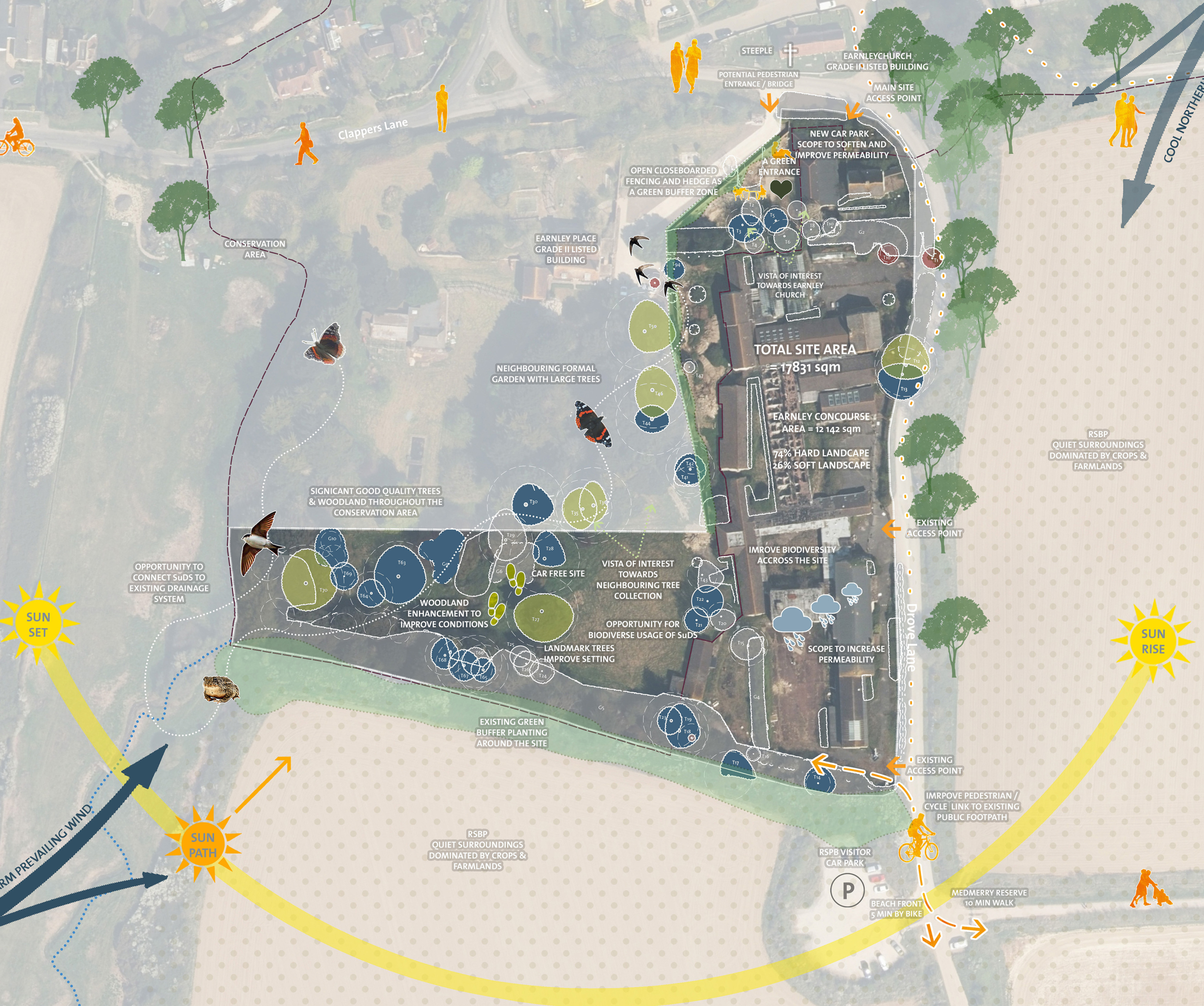
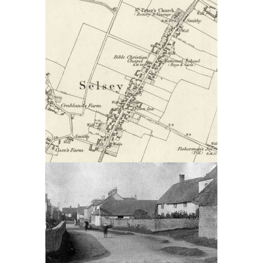
Records of Earnley date to 780AD with the historic hamlet comprising of only 15 dwellings (2.5dph). The development site is in the grounds of a Grade II Georgian property, Earnley Place, that had been repurposed as a boarding school in the 1950s with a series of unattractive institutional buildings.
An outline application won at appeal by a previous owner established the principle of 30 dwellings (26dph) but with a poor layout that offered nothing to the wider community.
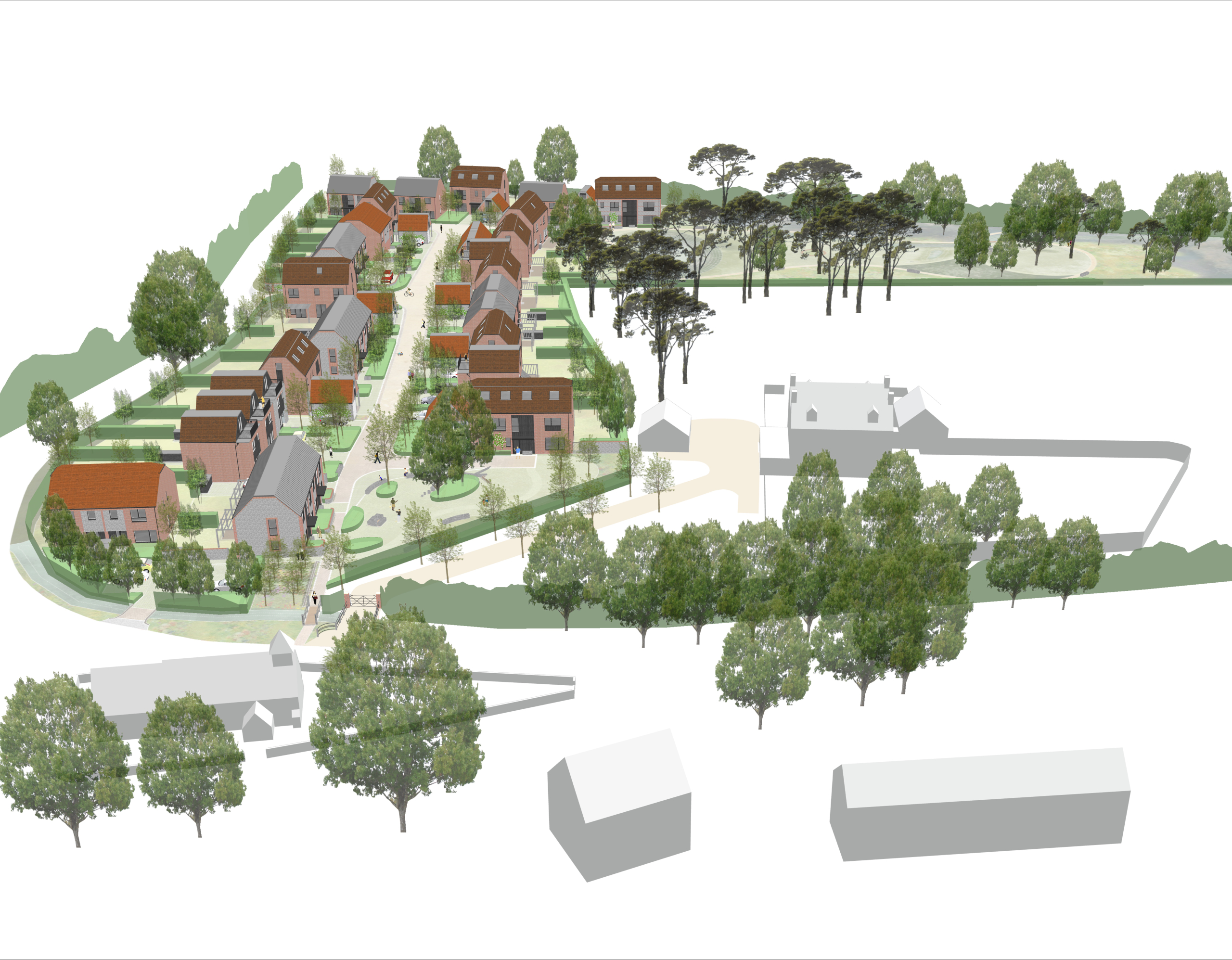
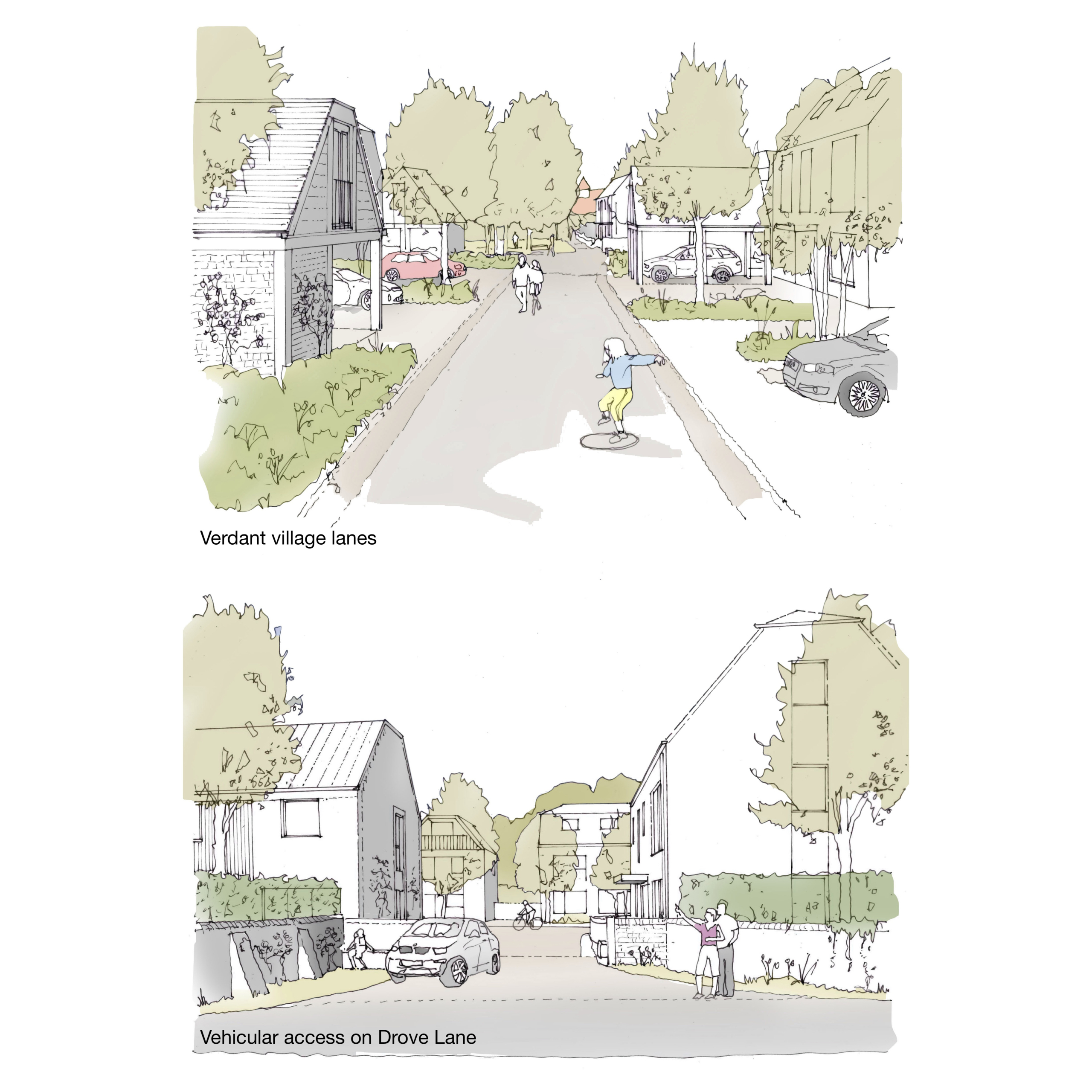
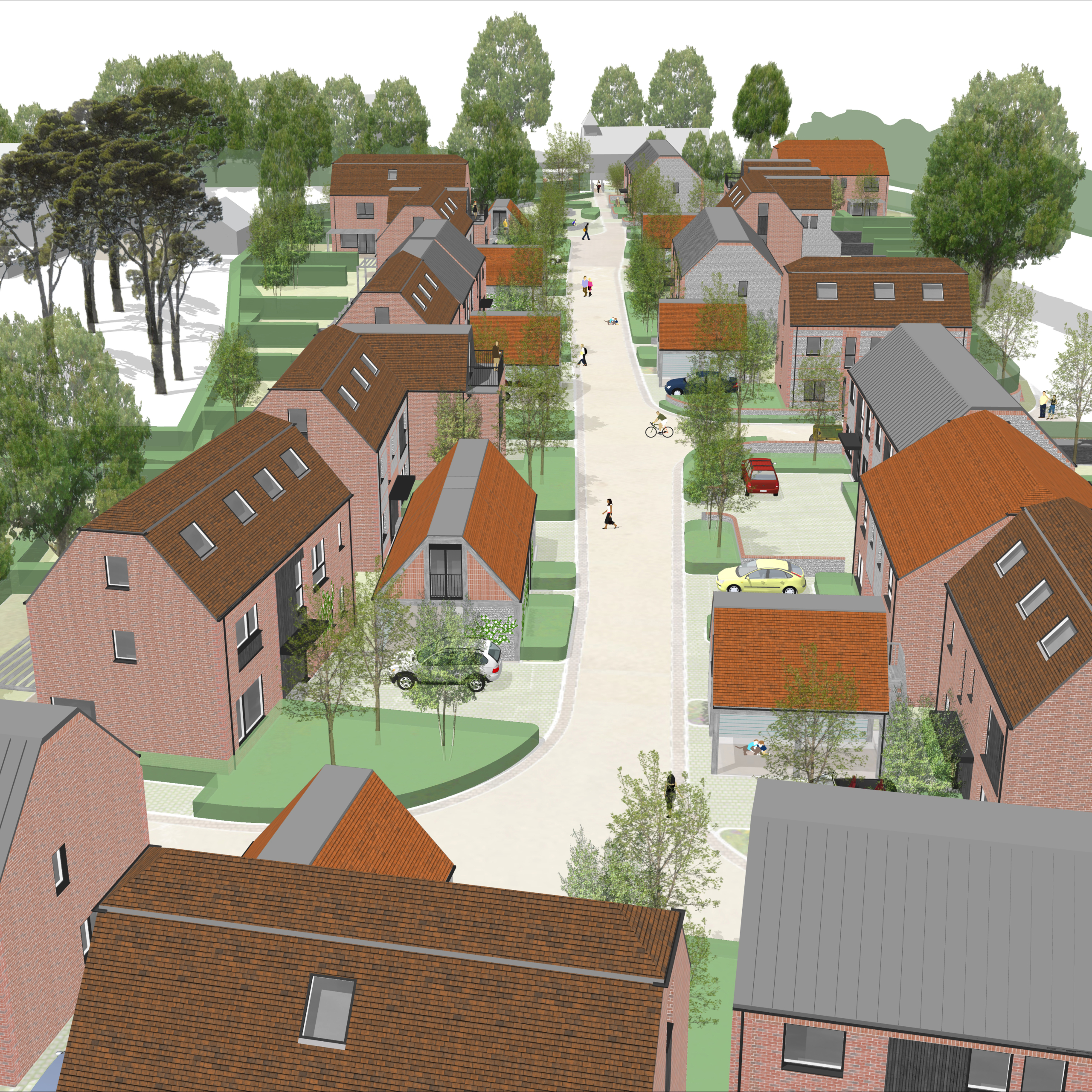
Referencing the linear settlement patterns of historic villages on the Manhood Peninsula, a relaxed shared surface lane meanders through the site creating a pedestrian and visual connection to Earnley Church (Grade II*) and a route to the Medmerry Nature Reserve and new woodland park. A village green creates both an appropriate setting for the listed buildings and a new space for the community to meet, play and hold events.
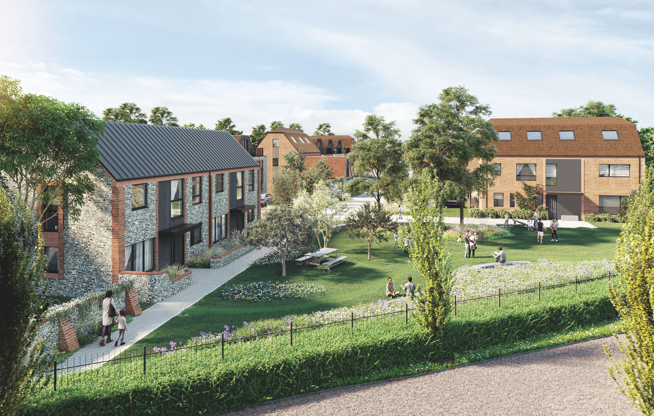
Dwellings are arranged informally along the lane with verdant verges and outbuildings (parking and storage with studio space above) creating a relaxed and distinct character while possessing familial traits of the historic hamlet. This distinct identity was key as the site accommodates twice the number of dwellings as the historic hamlet.
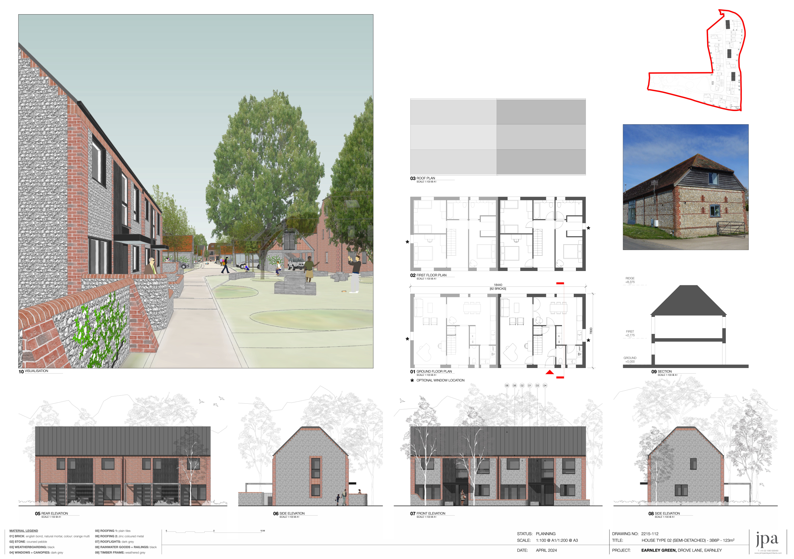
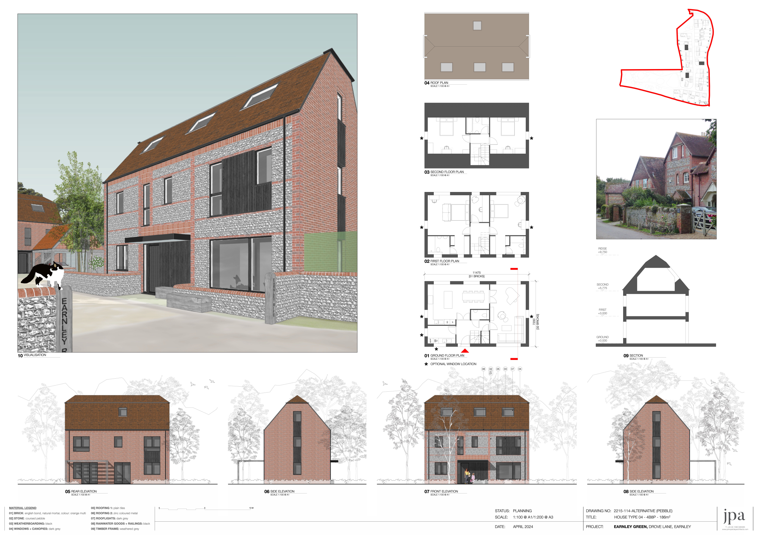
The local palette of coursed pebble walls with brick quoins and reveals is adopted in a contemporary manner and complimented by modern black windows. Zinc and clay roofs riff on the forms of local houses and barns. Native tree, hedge and verge planting along with climbing plants soften and frame views as well as providing varied wildlife habitat and aiding rainwater management.
Earnley Green creates a distinct but sympathetic extension to the hamlet with new routes and open spaces for walking, meeting and playing giving the potential of new and old residents to grow as a healthy community.
Key Features
Verdant lanes: Green verges and hedgerows create a strong local identity that continues through the proposal.
Legacy trees: An ‘arboretum’ of mature trees planted in the former school grounds are retained and enrich the scheme.
Shared surfaces: Like traditional villages, the narrow lane slows car movements creates a place for connection and play. Simple oak benches along the lane and outside front doors encourage chance meetings and conversations.
Low pebble walls with brick cappings and buttresses reference the churchyard wall designed to resist cattle on the drovers route to Chichester.


