Kensington Street, Brighton
Number/street name:
Kensington Street
Address line 2:
City:
Brighton
Postcode:
BN1 4AJ
Architect:
Baily Garner LLP
Architect contact number:
2082941000
Developer:
Brighton and Hove City Council with Guinness Partnership.
Planning Authority:
Brighton and Hove City Council
Planning Reference:
BH2016/01020
Date of Completion:
04/2024
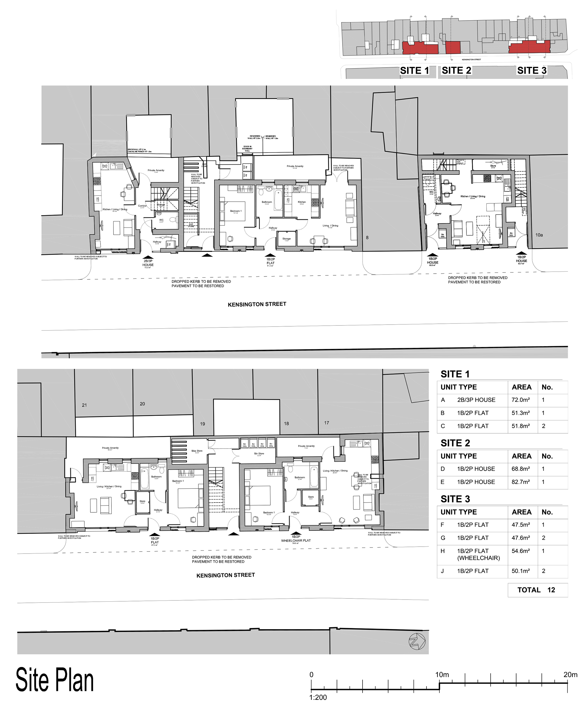
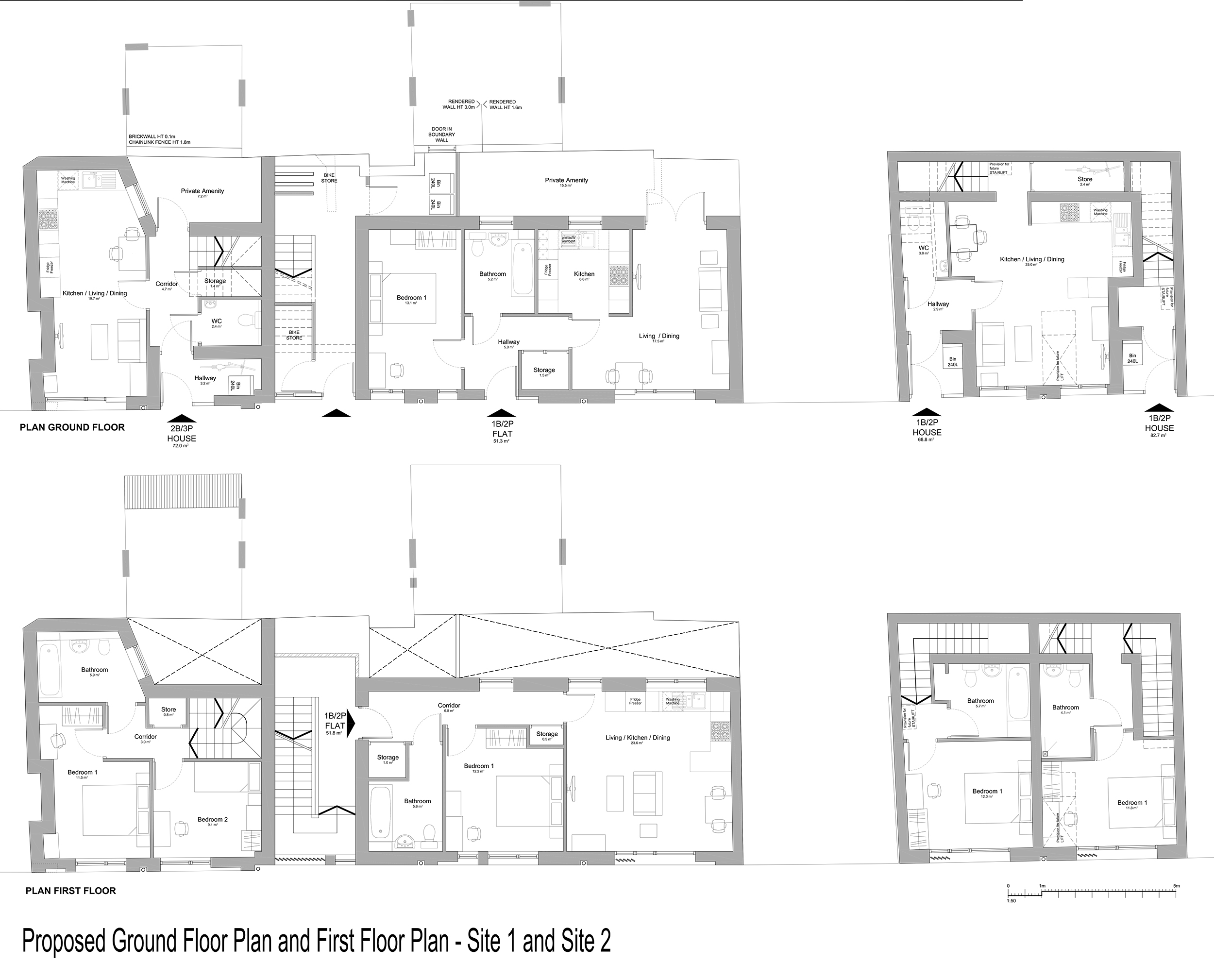
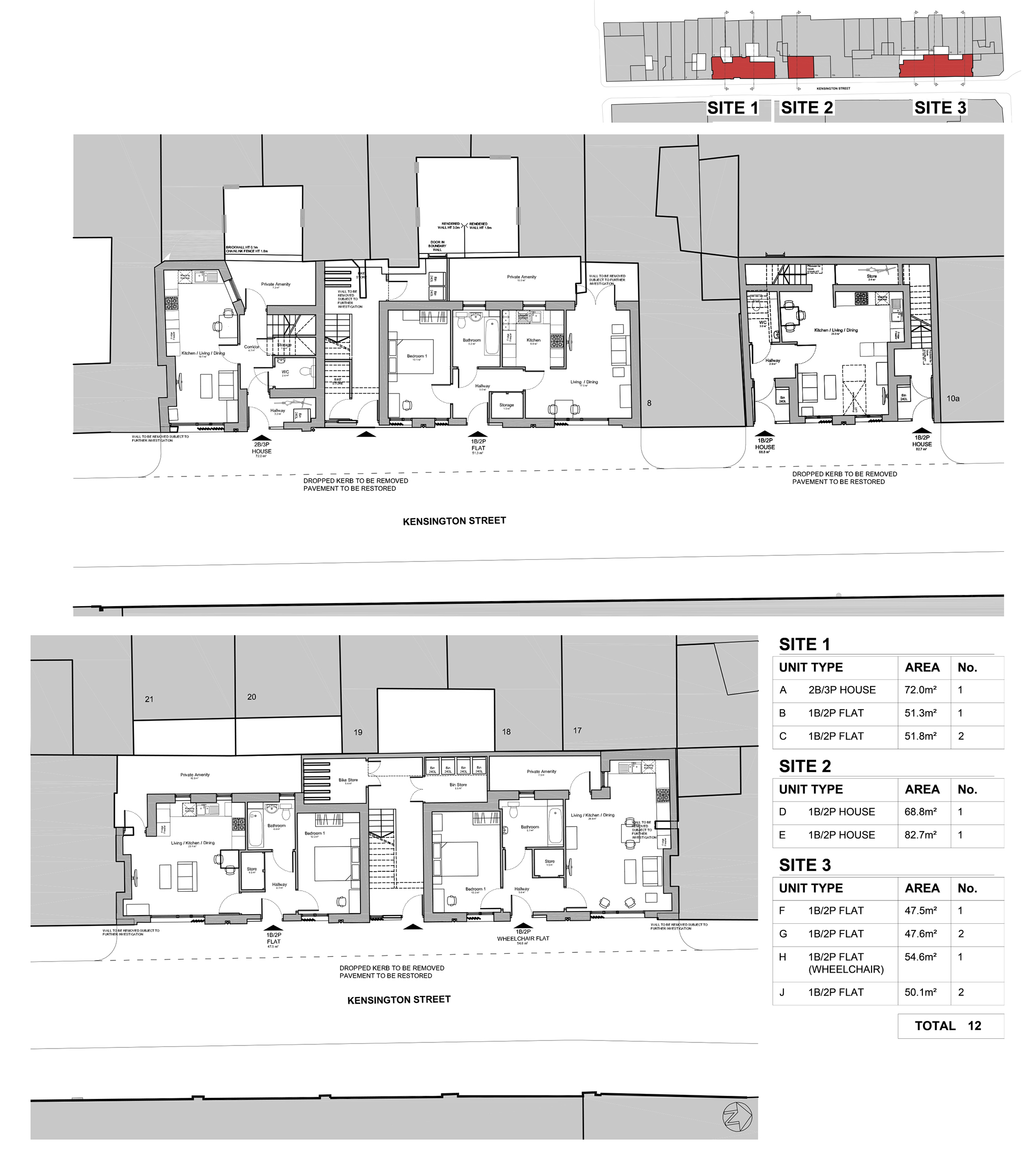
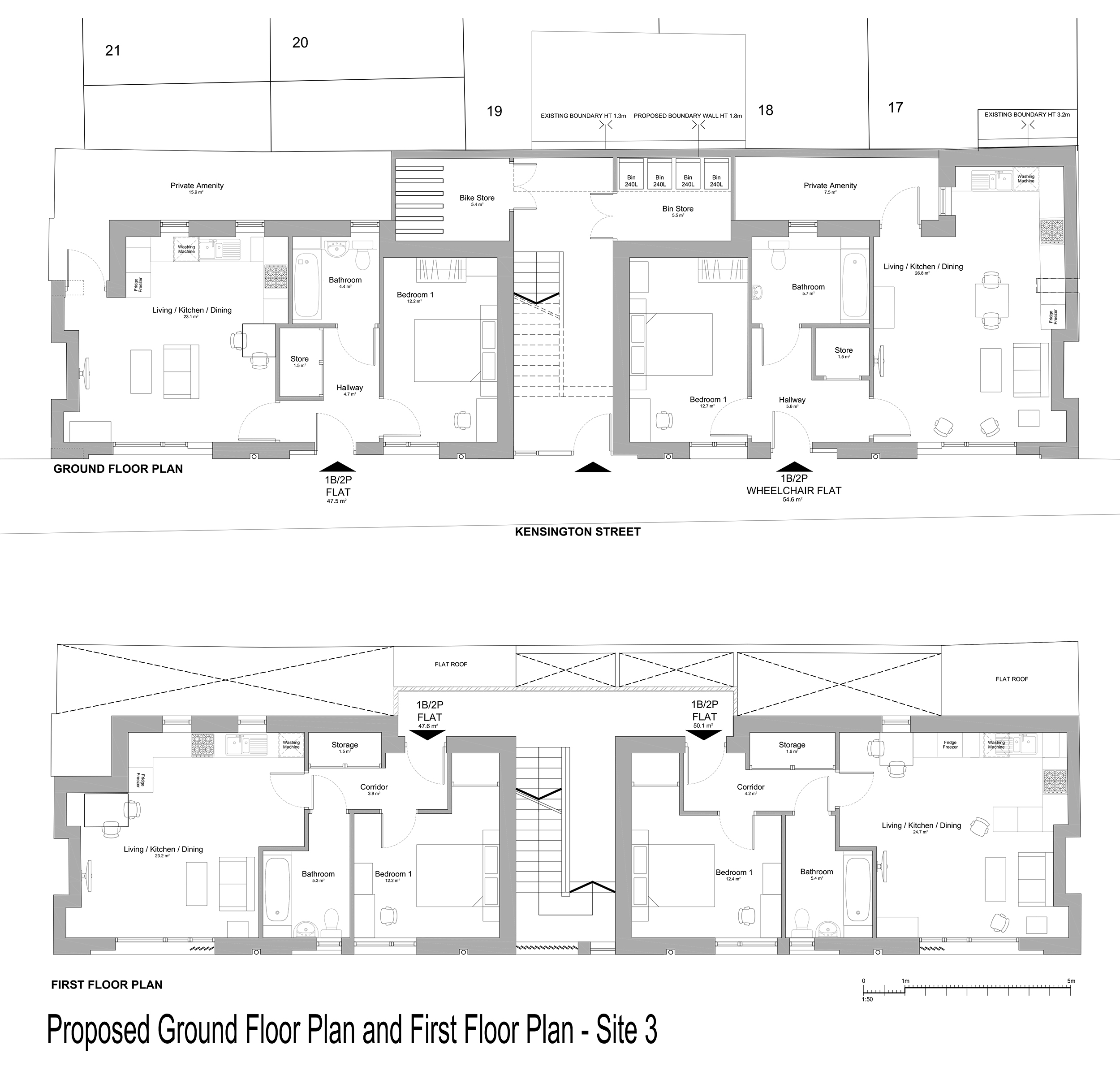
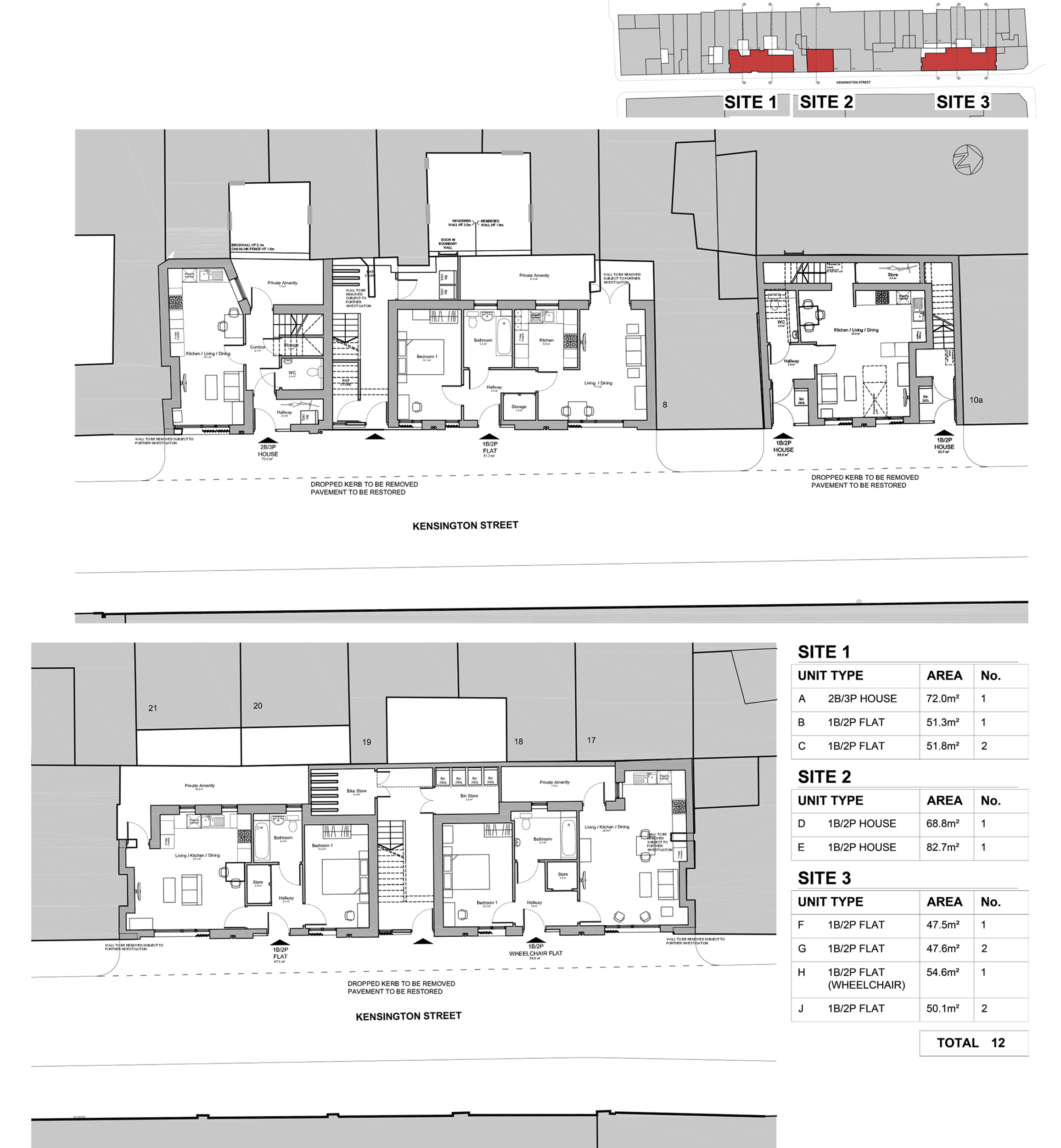
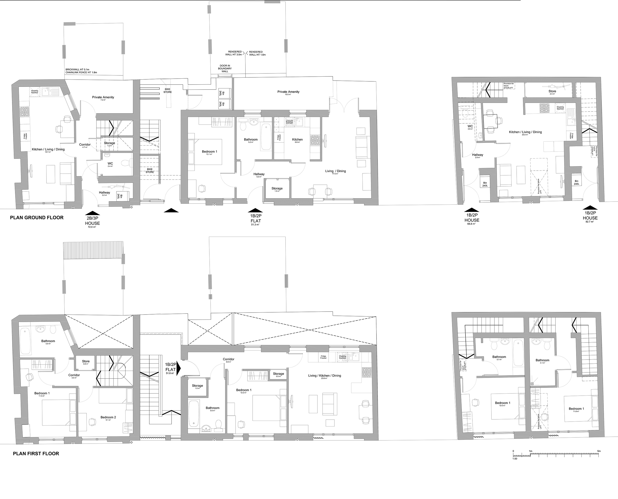
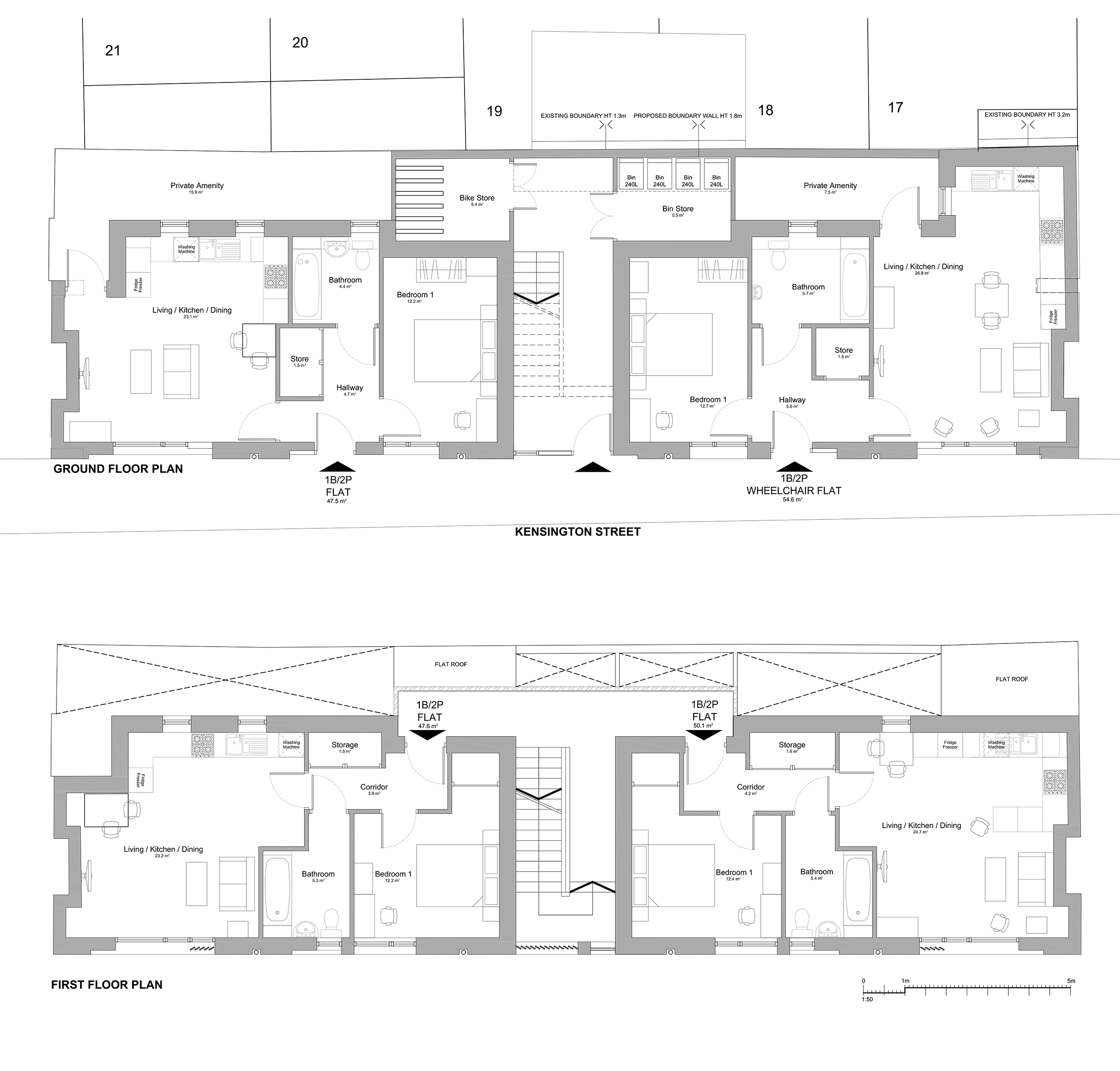
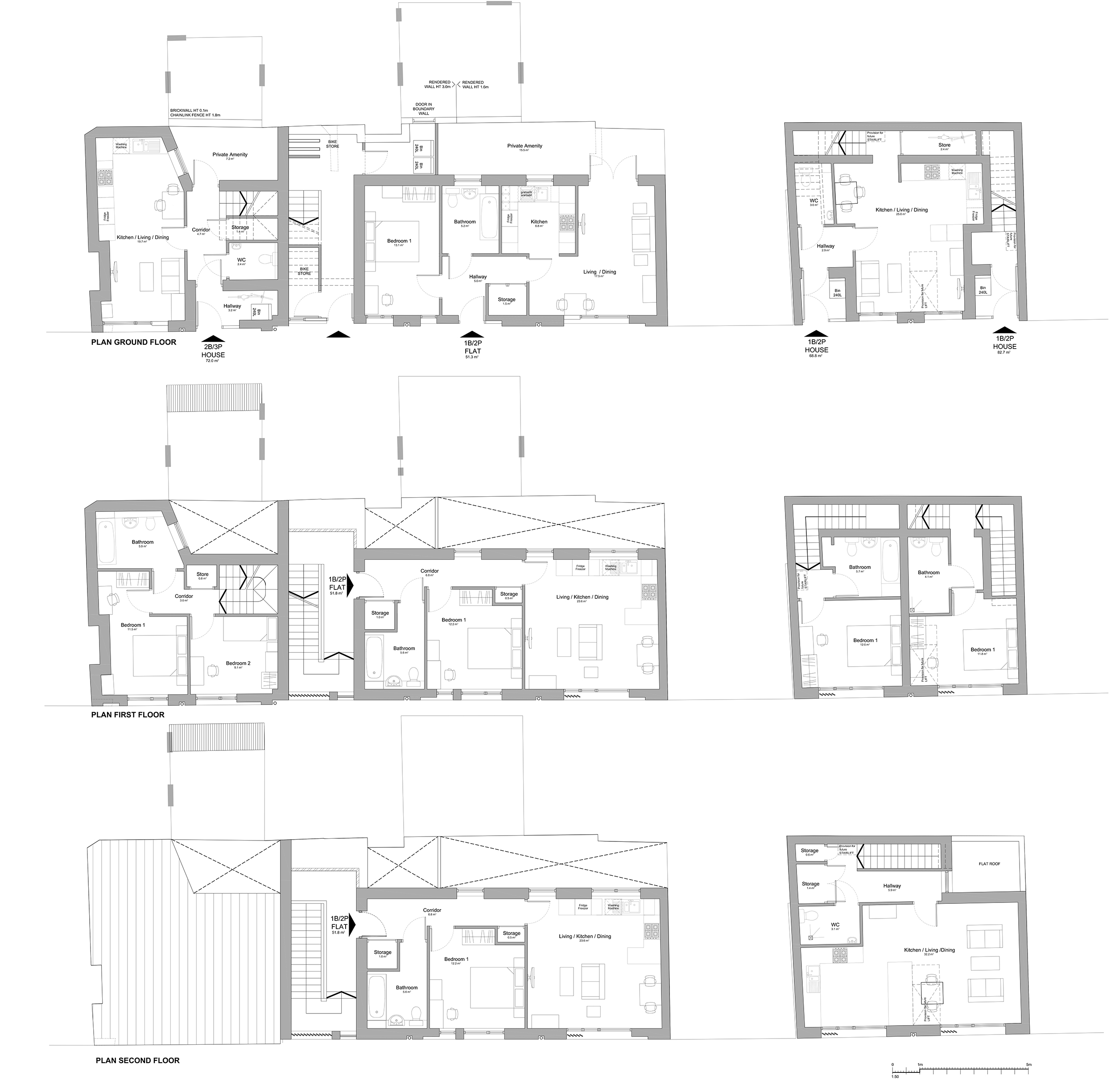
Schedule of Accommodation:
8 x 1 bed flats; 2 x 1 bed houses; 1 x 1 bed wheelchair flat; 1 x 2 bed houses
Tenure Mix:
100% affordable
Total number of homes:
Site size (hectares):
0.04
Net Density (homes per hectare):
300
Size of principal unit (sq m):
50.1
Smallest Unit (sq m):
47.6
Largest unit (sq m):
82.7
No of parking spaces:
0
 Scheme PDF Download
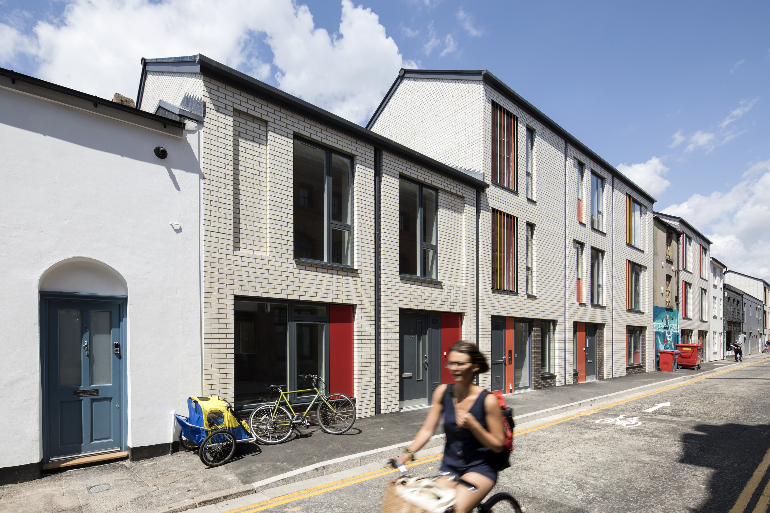

Planning History
In December 2015, revised proposals were submitted to the planning department which responded to the original pre-planning feedback. The proposals have been developed in close consultation with key stakeholders including local residents, council members, and BHCC housing and planning departments. The scheme was approved at committee in November 2016 where the committee members praised the quality of the proposals.


The Design Process
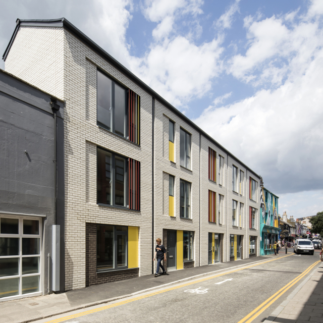
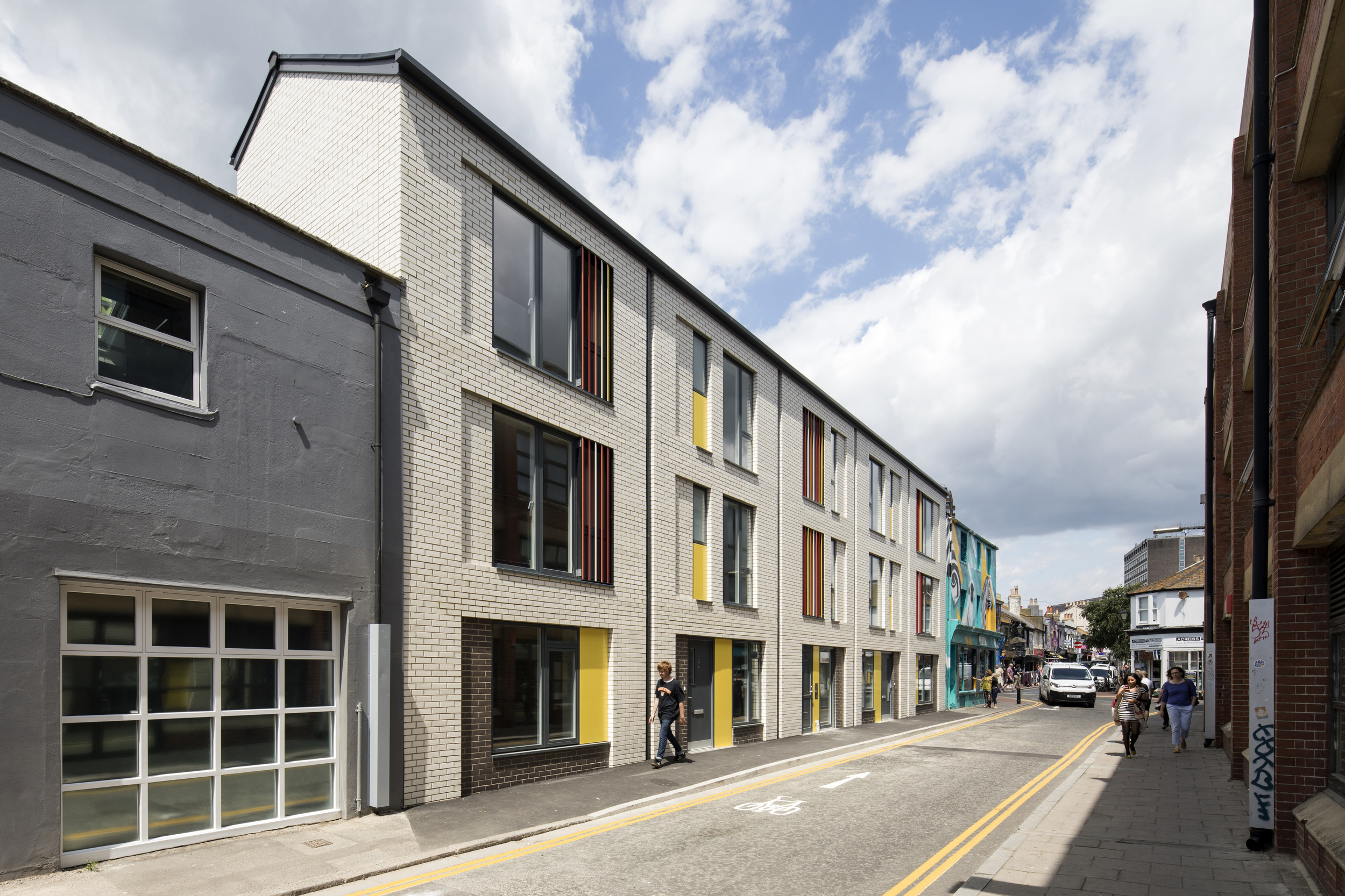
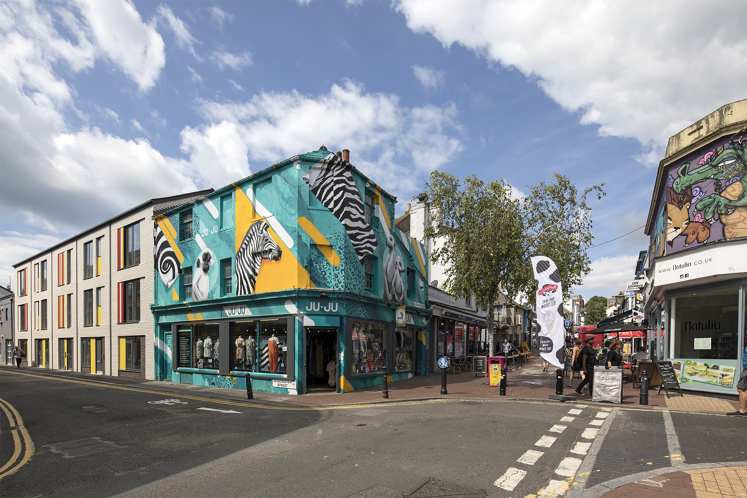
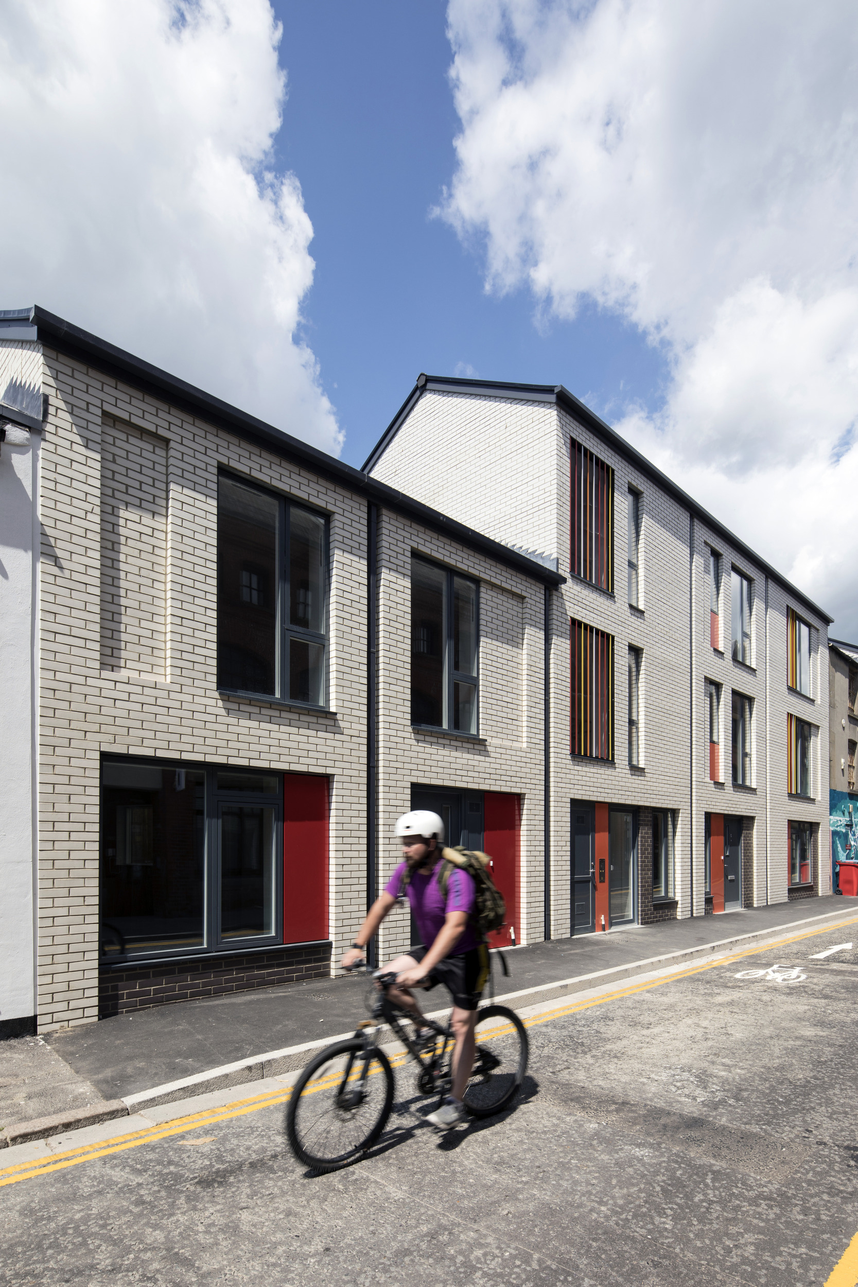
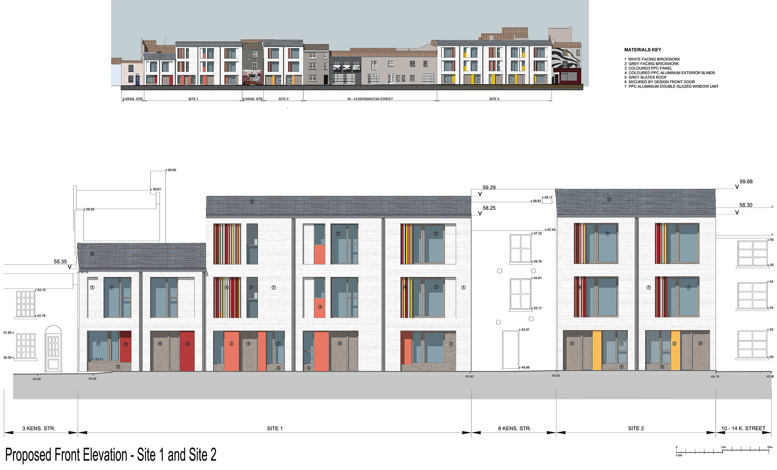
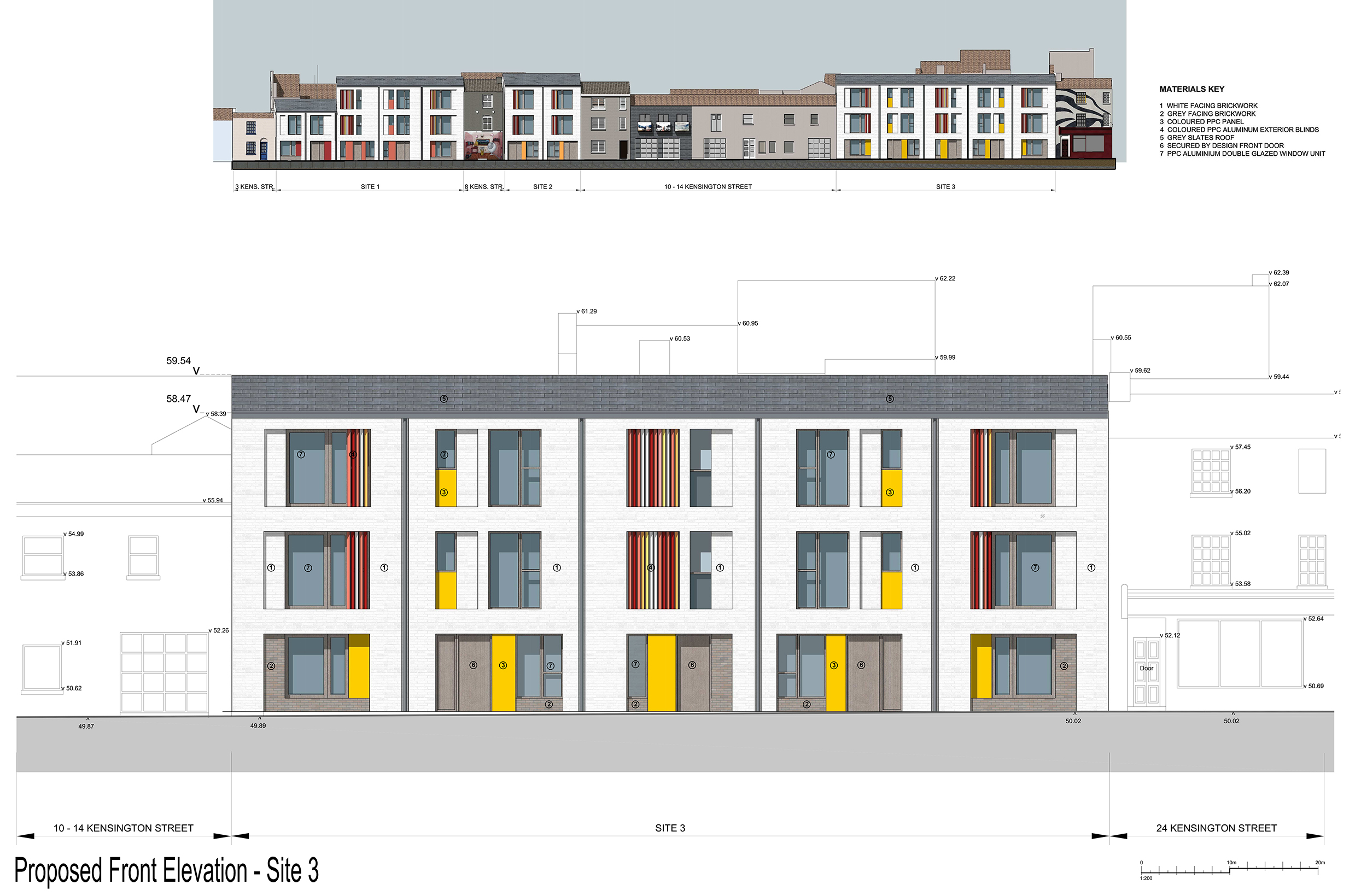
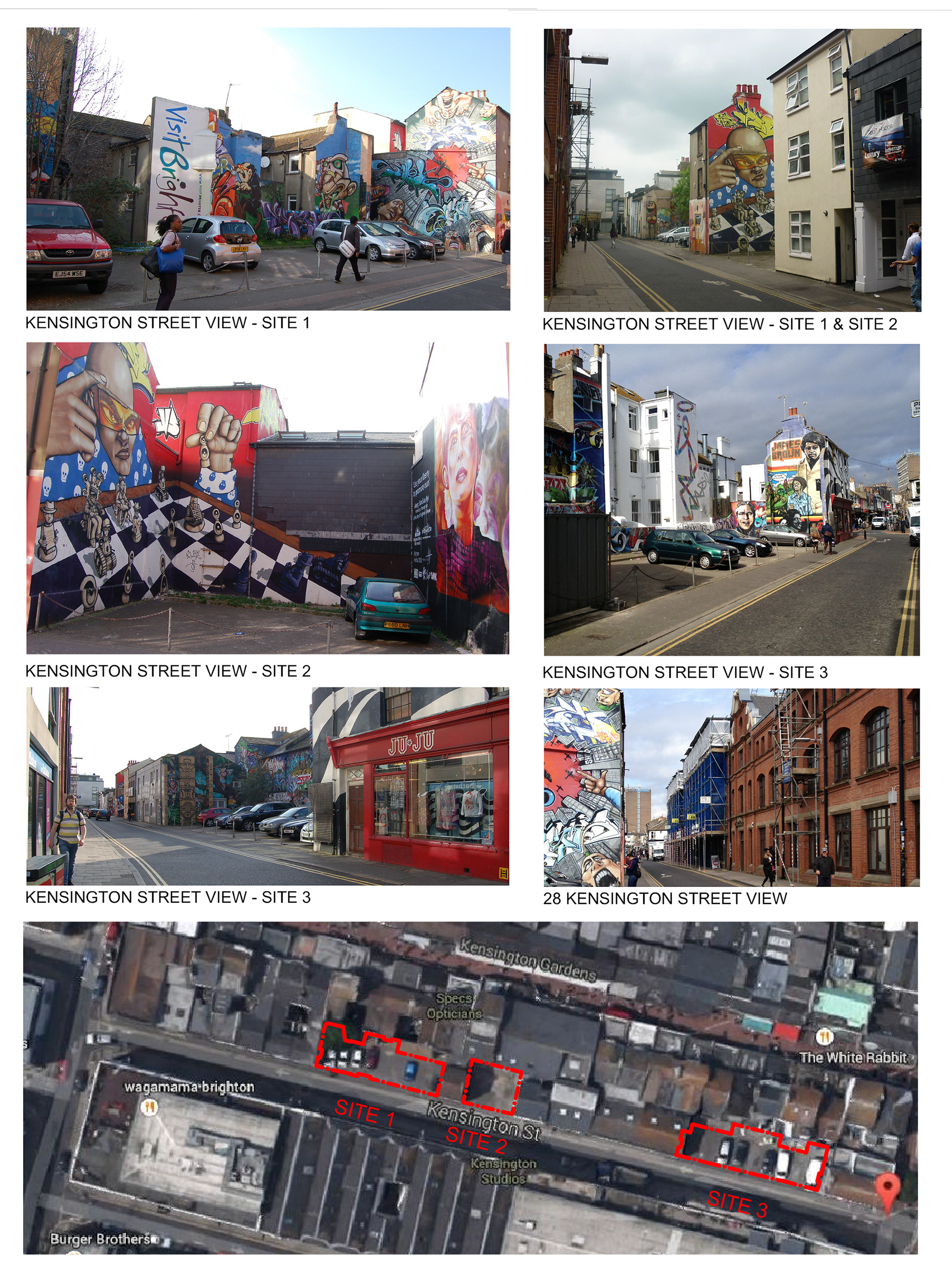
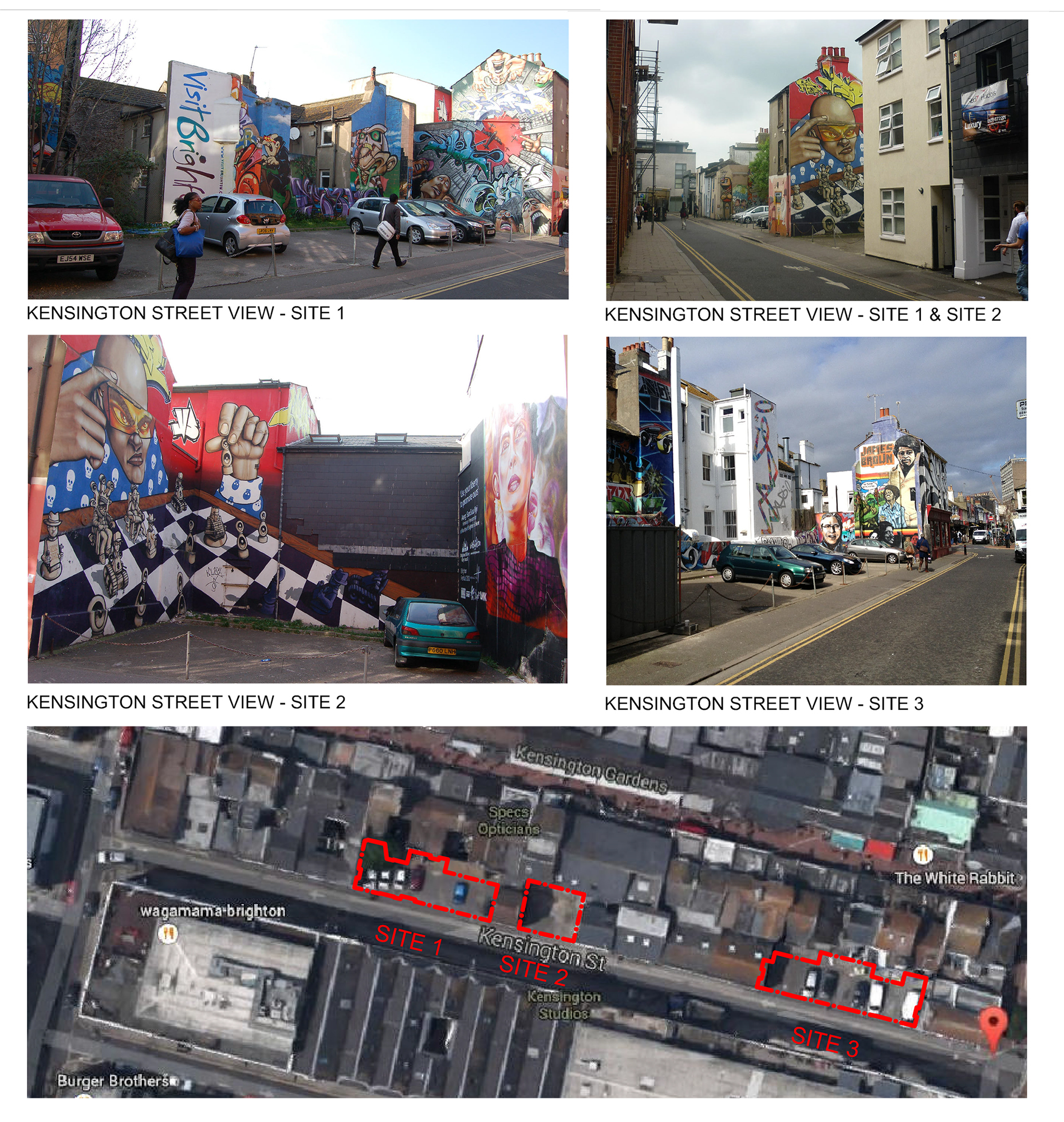
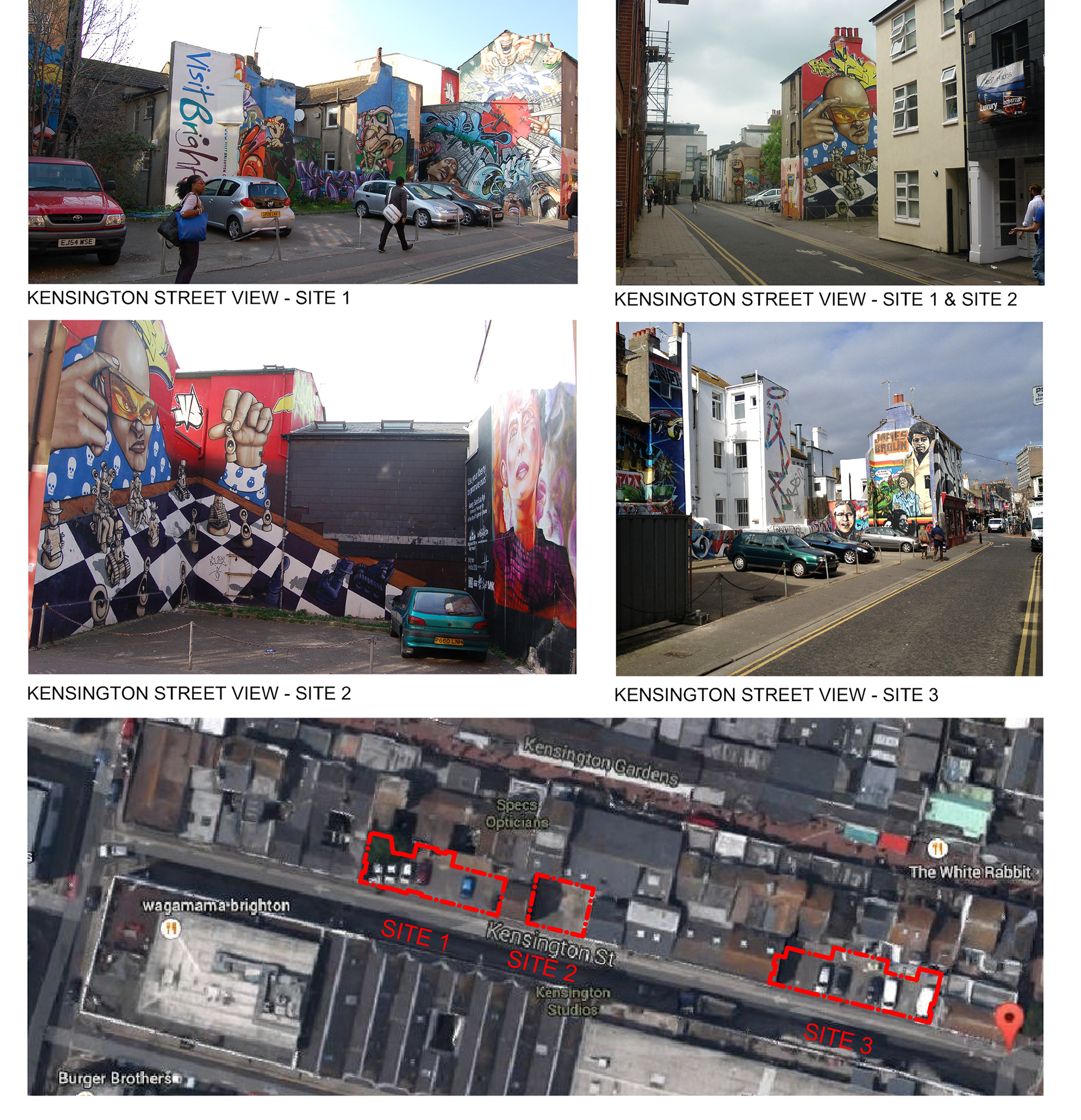
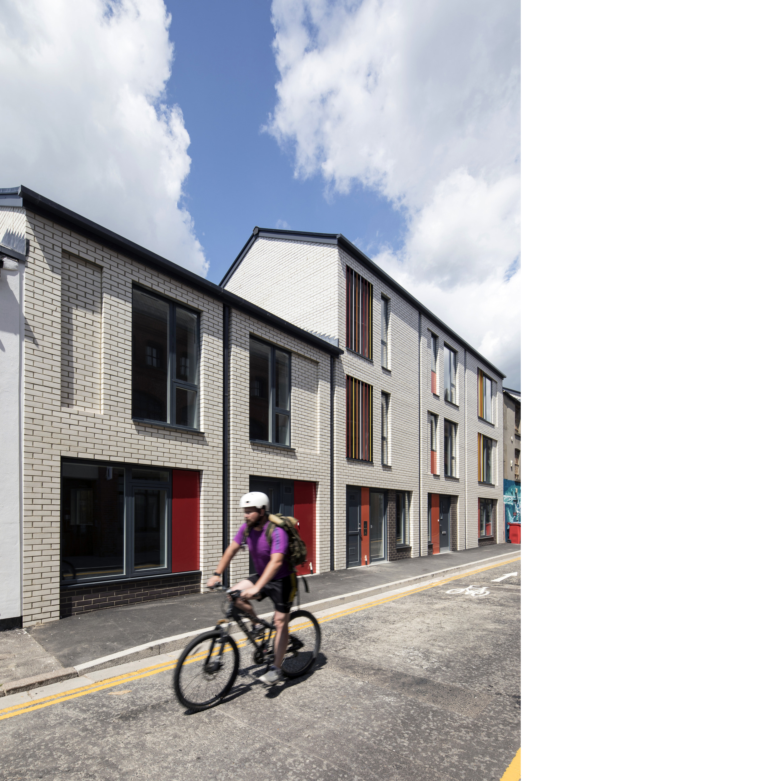
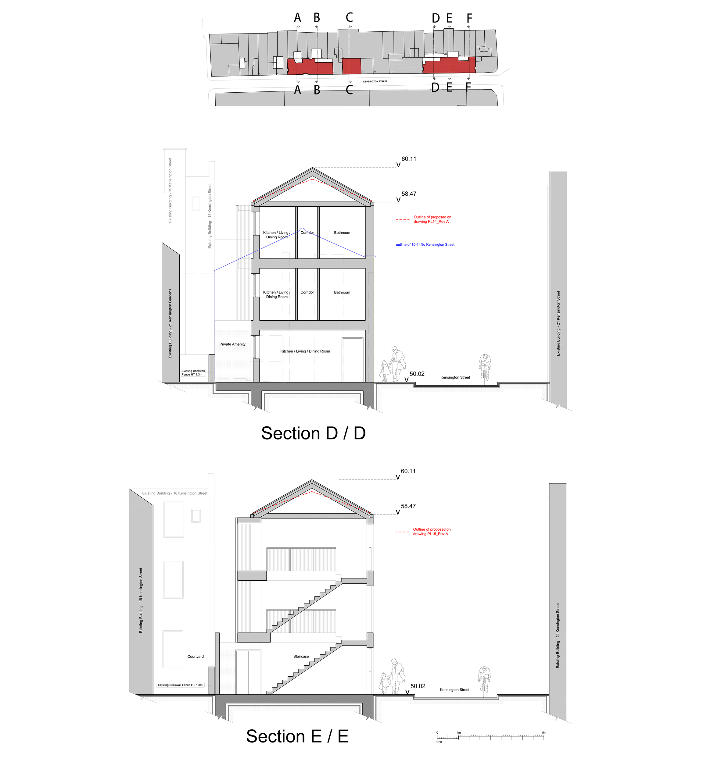
Kensington Street, a narrow street in central Brighton, runs north-south from North Road to Gloucester Road. The street was originally laid out circa 1823-30 with very small shallow plots, stretching approximately 7.5m from the back of the pavement to the rear of the plot. ‘Slum clearance’ in the late 60s and early 70s saw the removal of numbers 4-7, 9 and 11-14 Kensington Street. Vacant sites were paved over for parking, leaving three gaps along the length of the street.
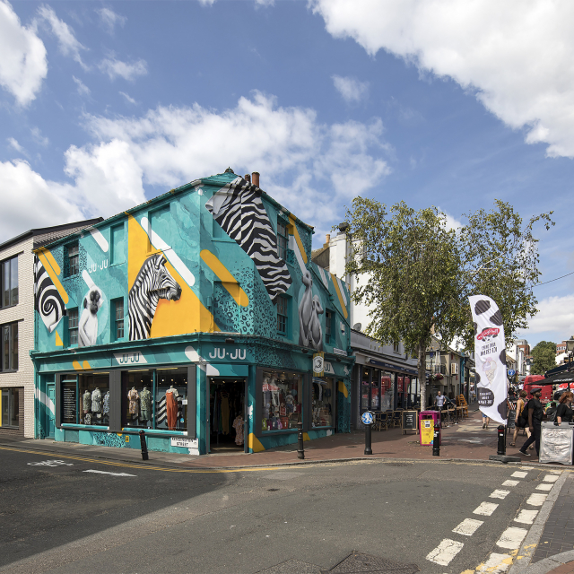
The street art within Kensington Street had become a tourist attraction and recognising the cultural importance to the city, our Client – Brighton and Hove City Council - committed to recording the street art on the sites and putting together a public display of the photographs.
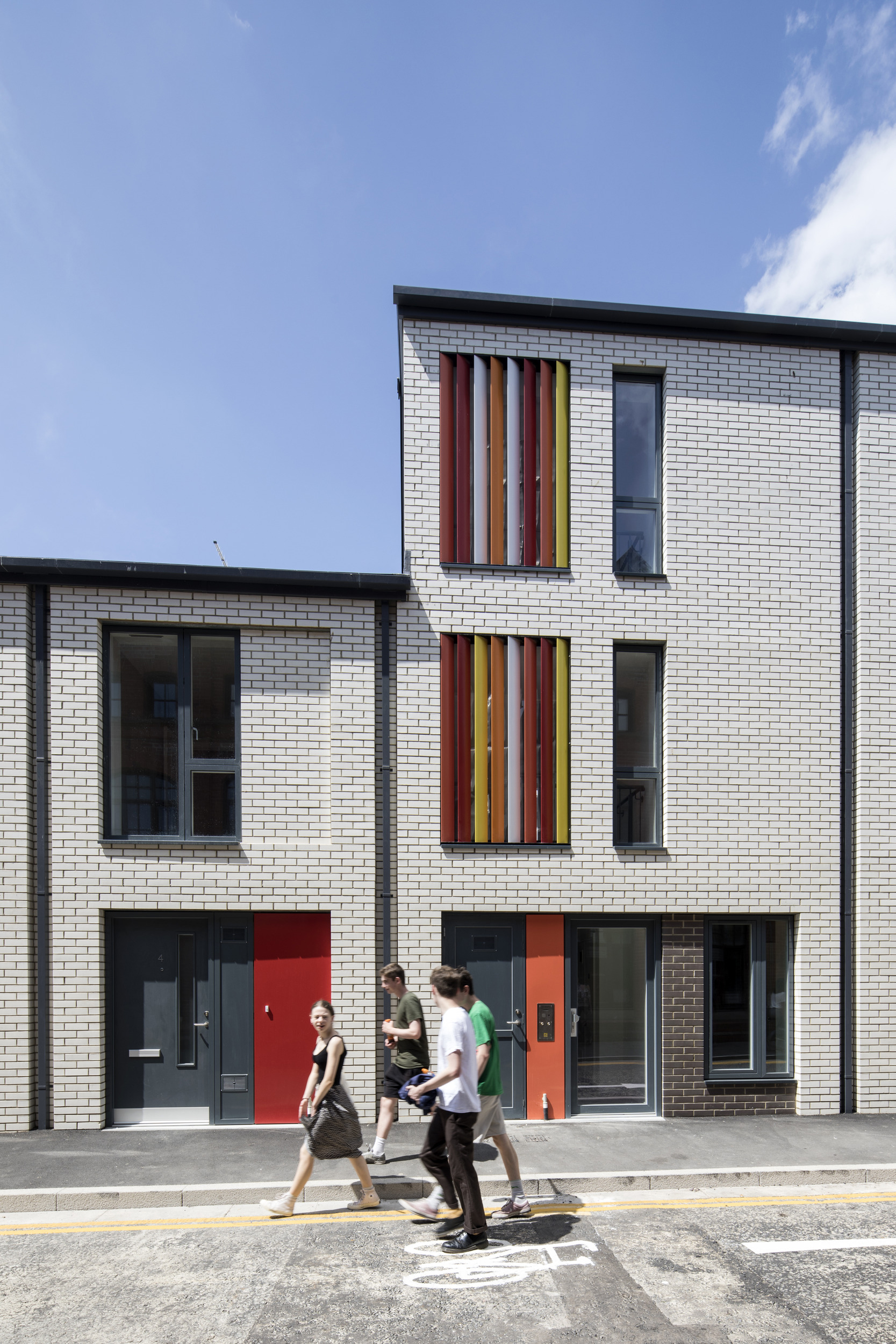
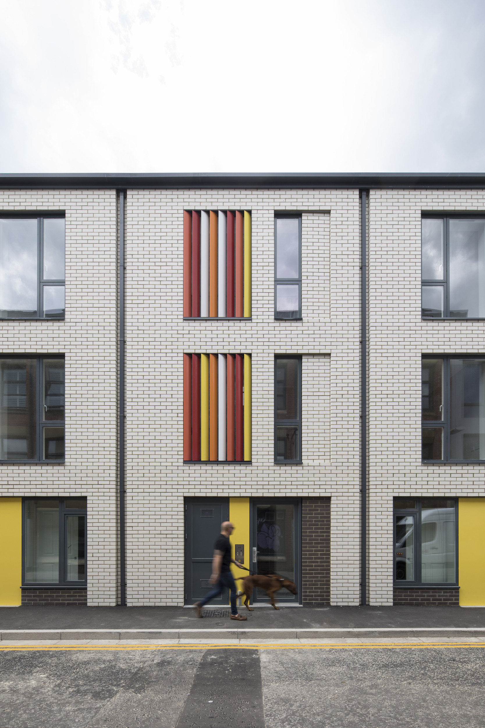
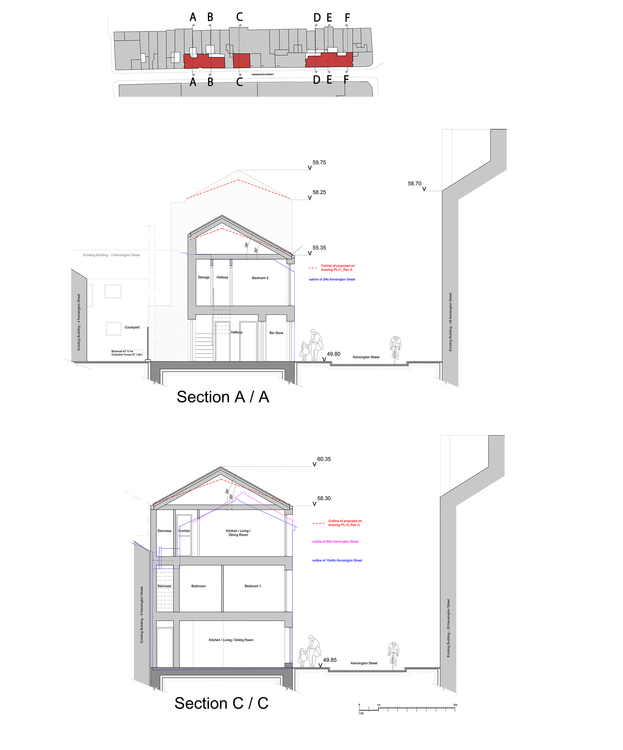
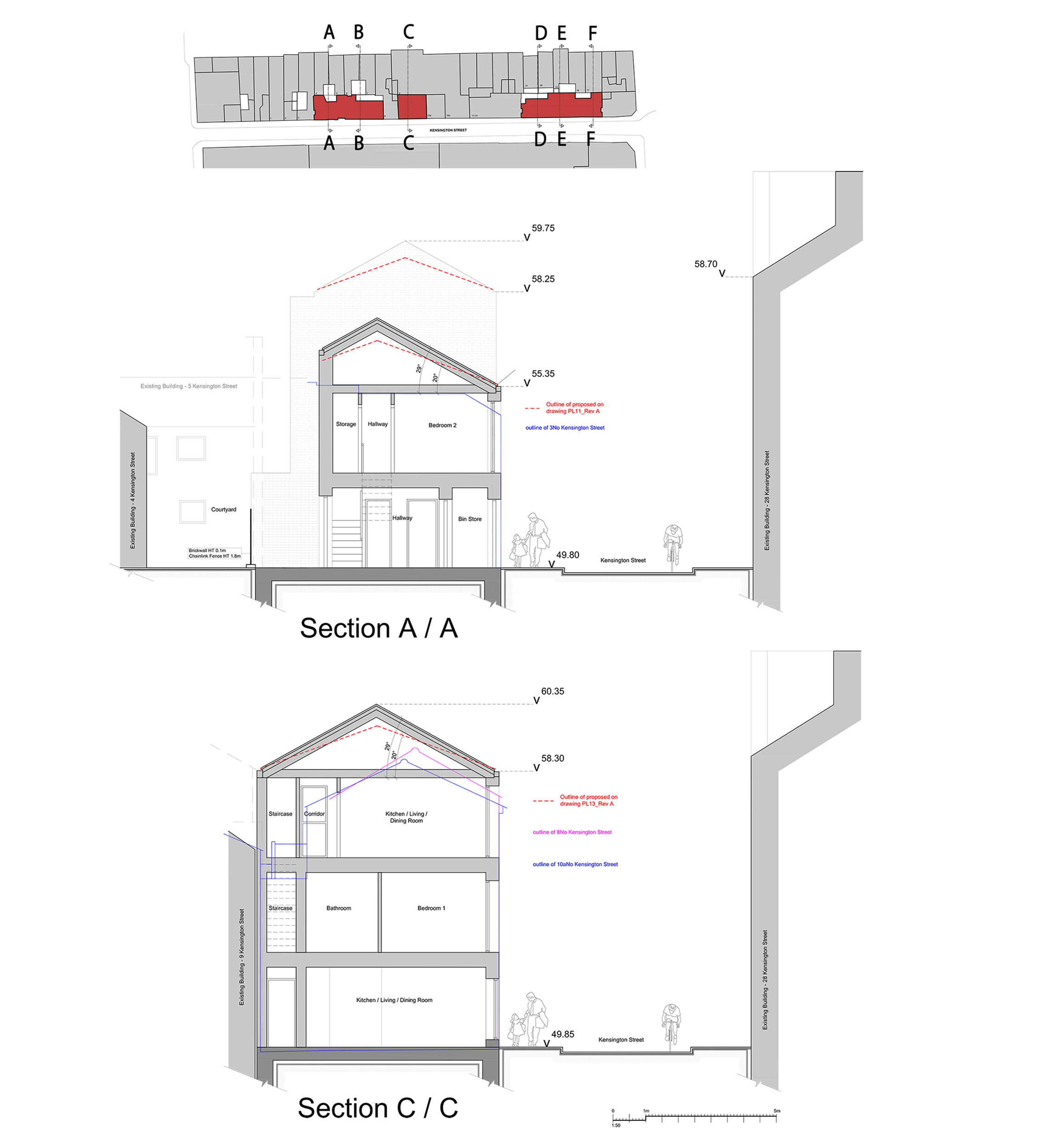
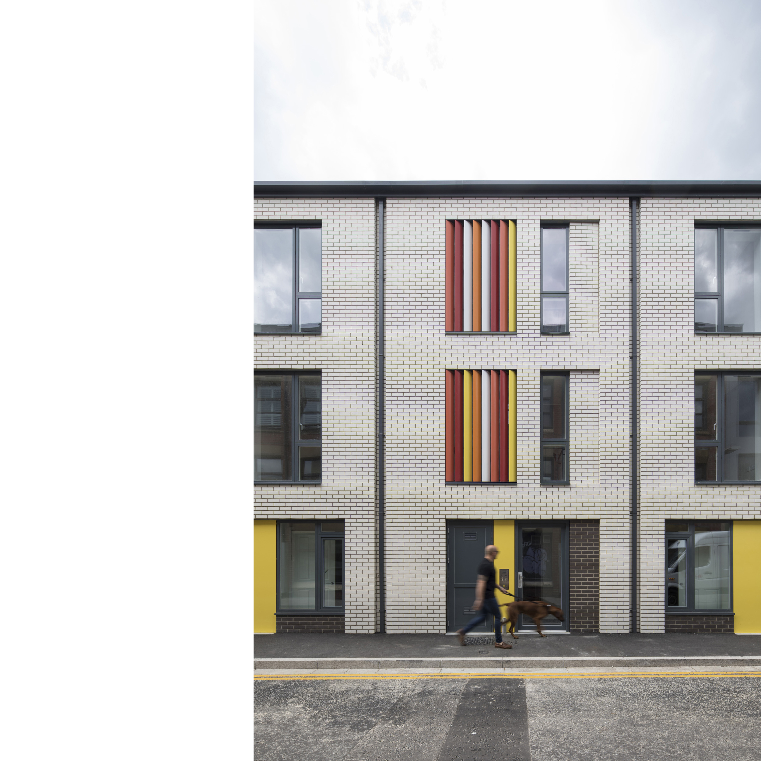
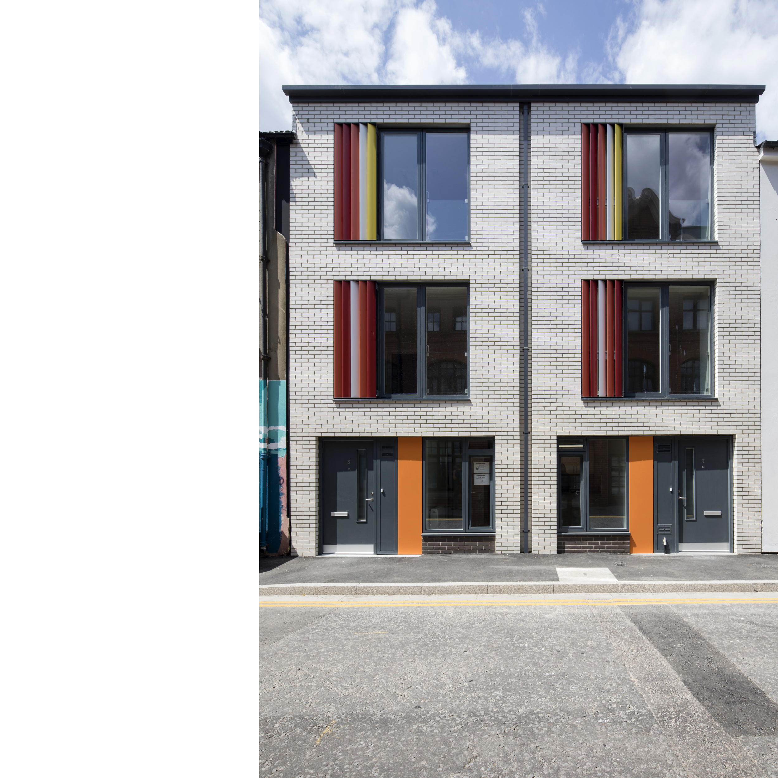
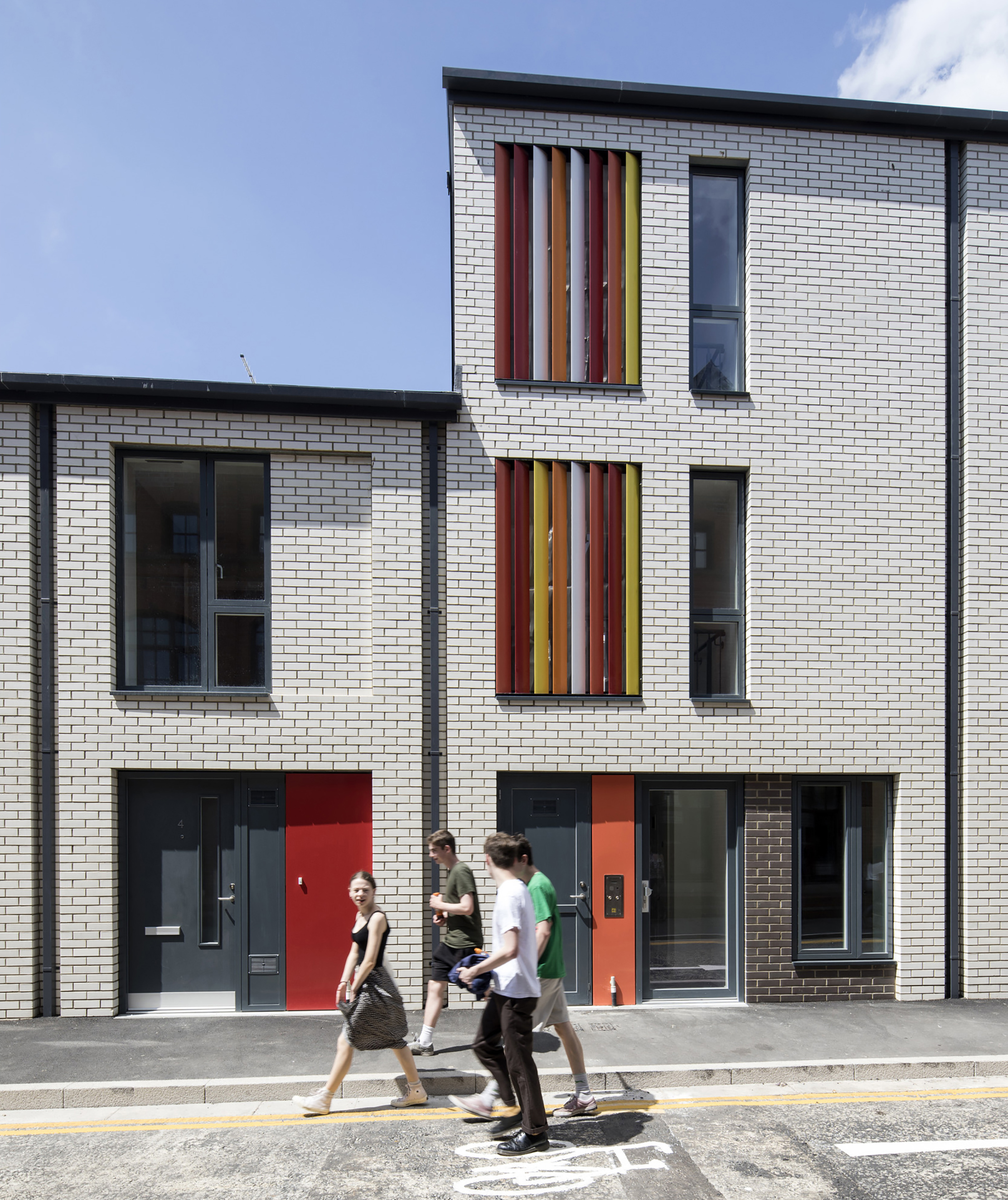
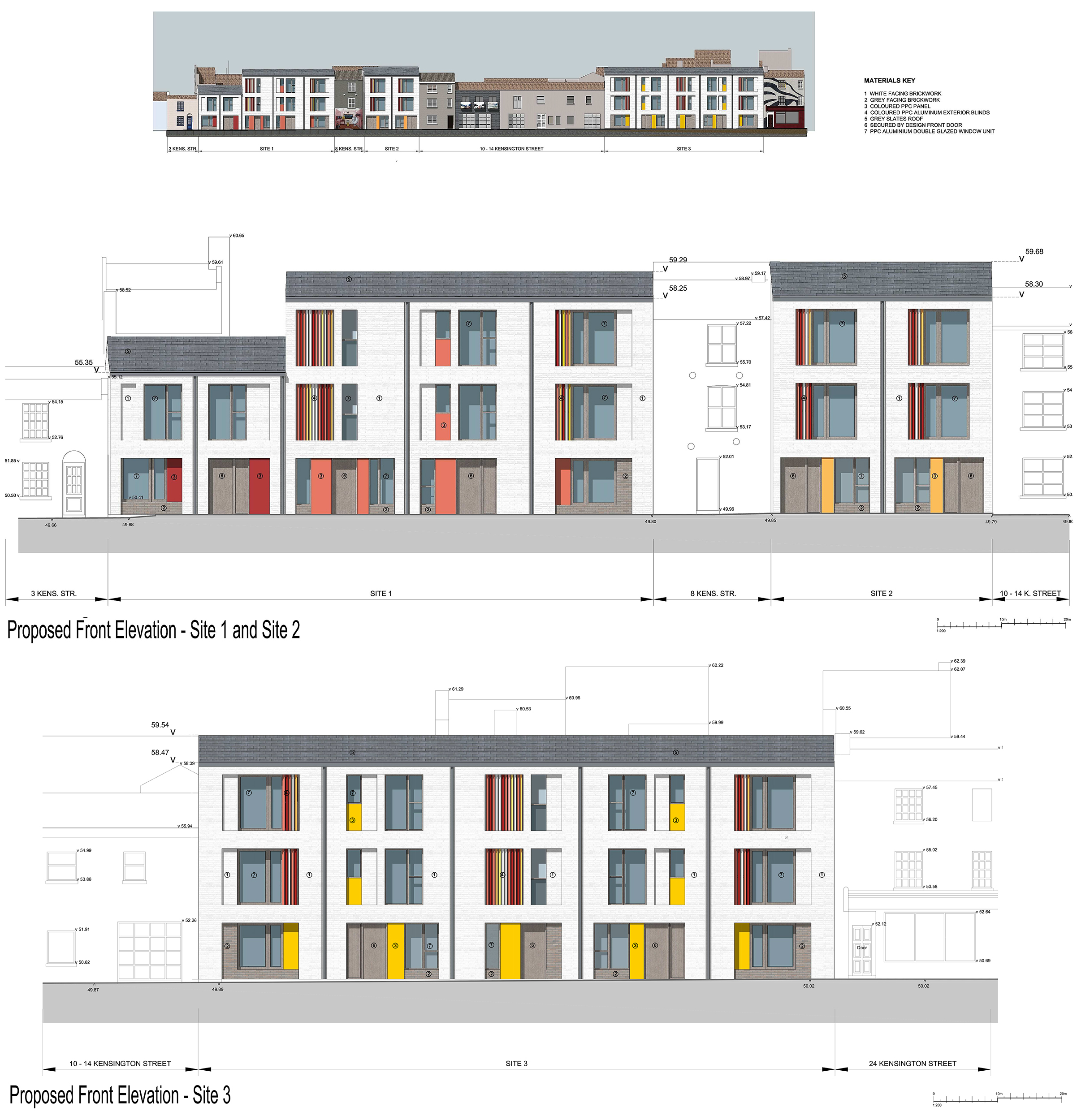
The site is located within the North Laine Conservation Area and we researched features of this and other conservation areas in order to inform the material palette and the form of development. The proposals needed to be sensitive to the scale of the adjacent 19th century fishermen’s cottages and during the design development process we demonstrated the acceptability of an alternative scale of development which met the space standards for now and the future, whilst still respecting the conservation area setting.
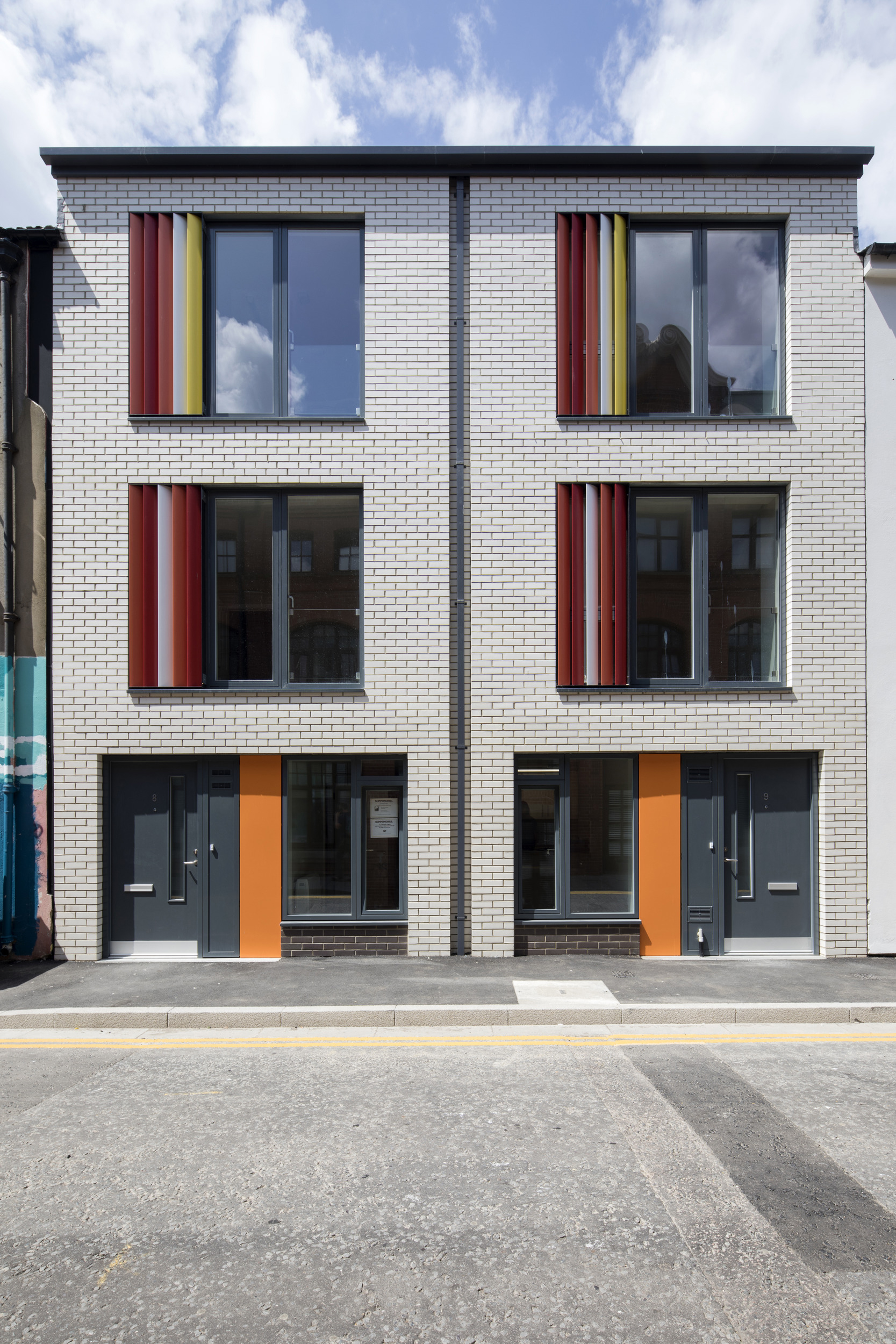
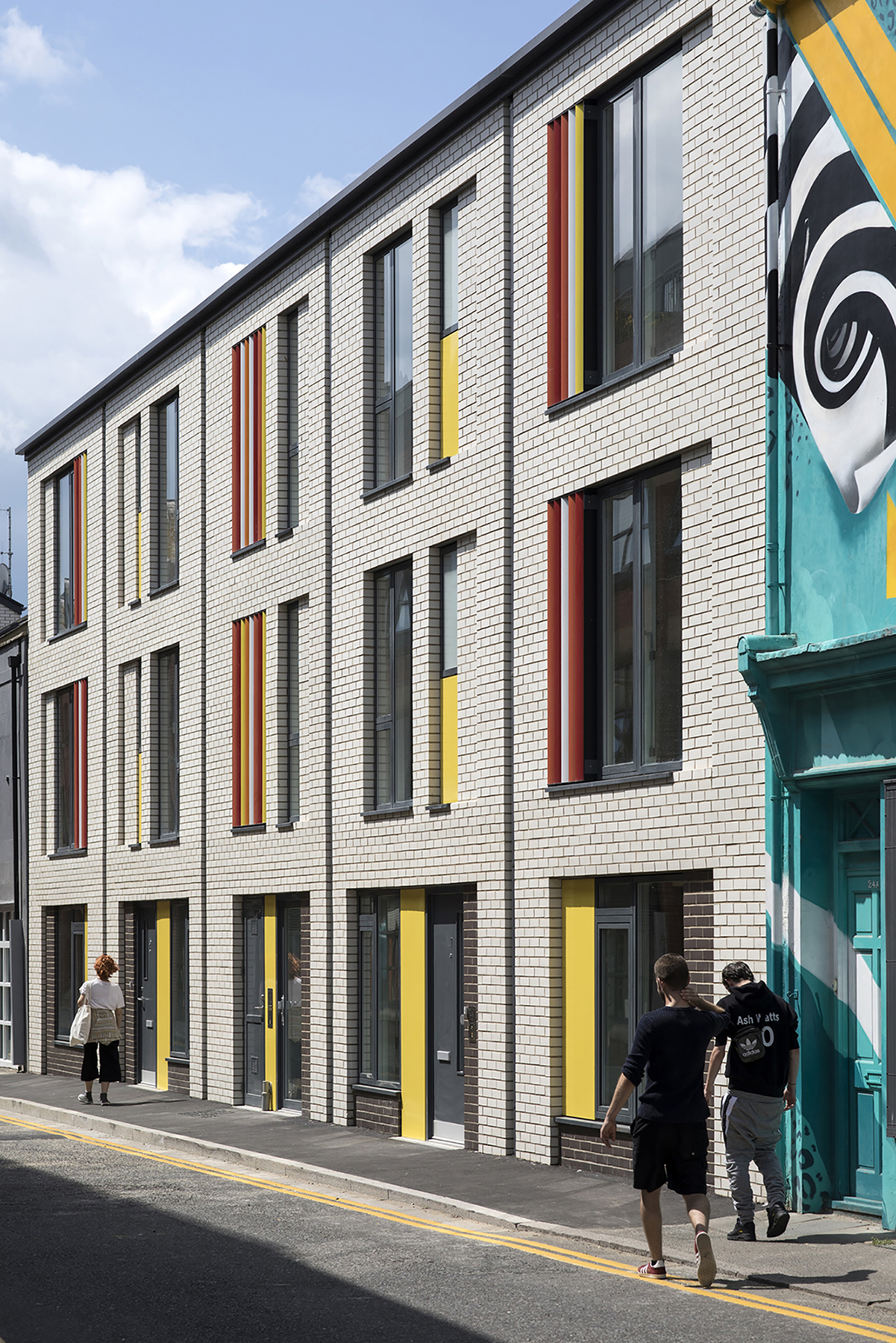
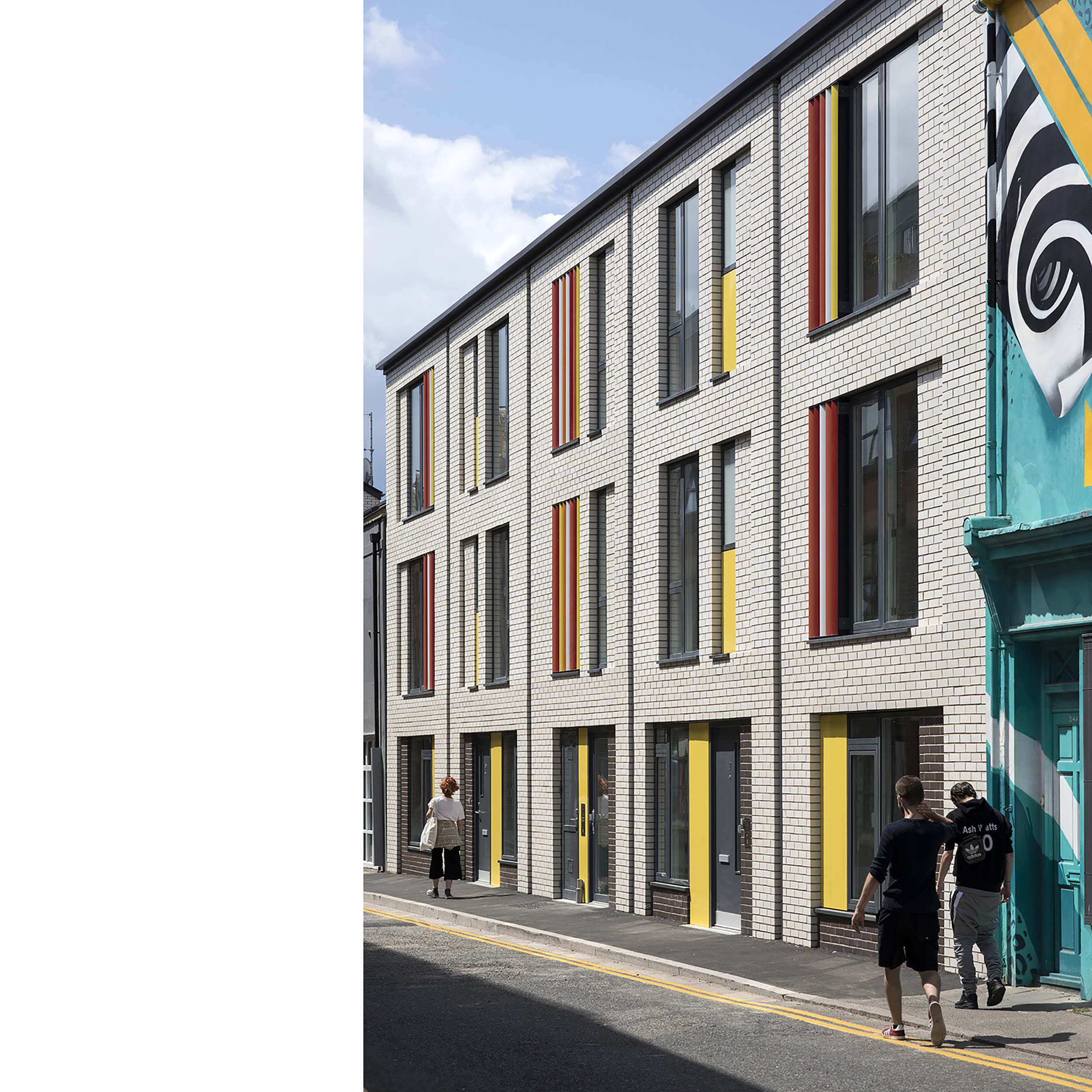
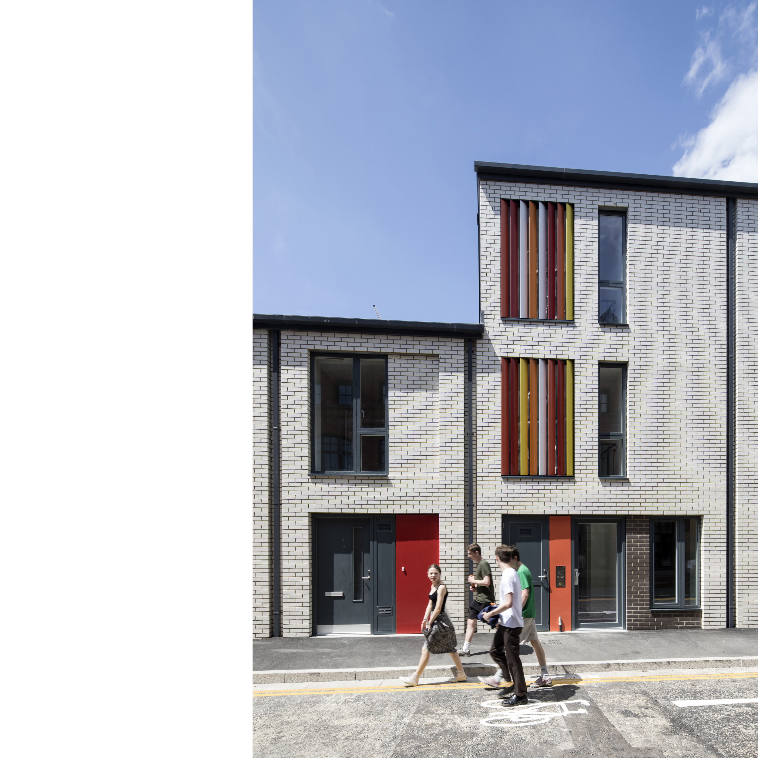
With the surrounding buildings being eclectic in style, period and materials, the opportunity therefore existed for Baily Garner to make a bold statement, without any obvious constraining features other than the tight urban nature of the site and the scale of the buildings nearby.
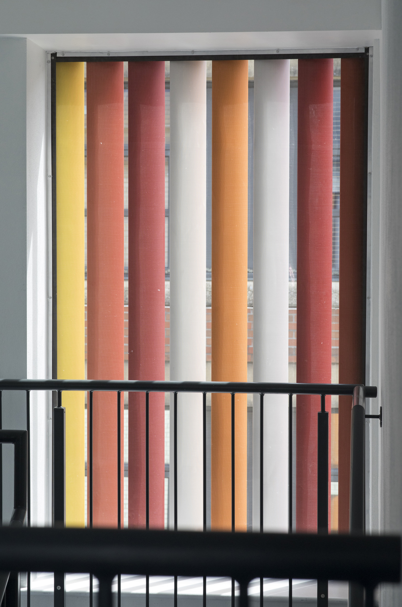
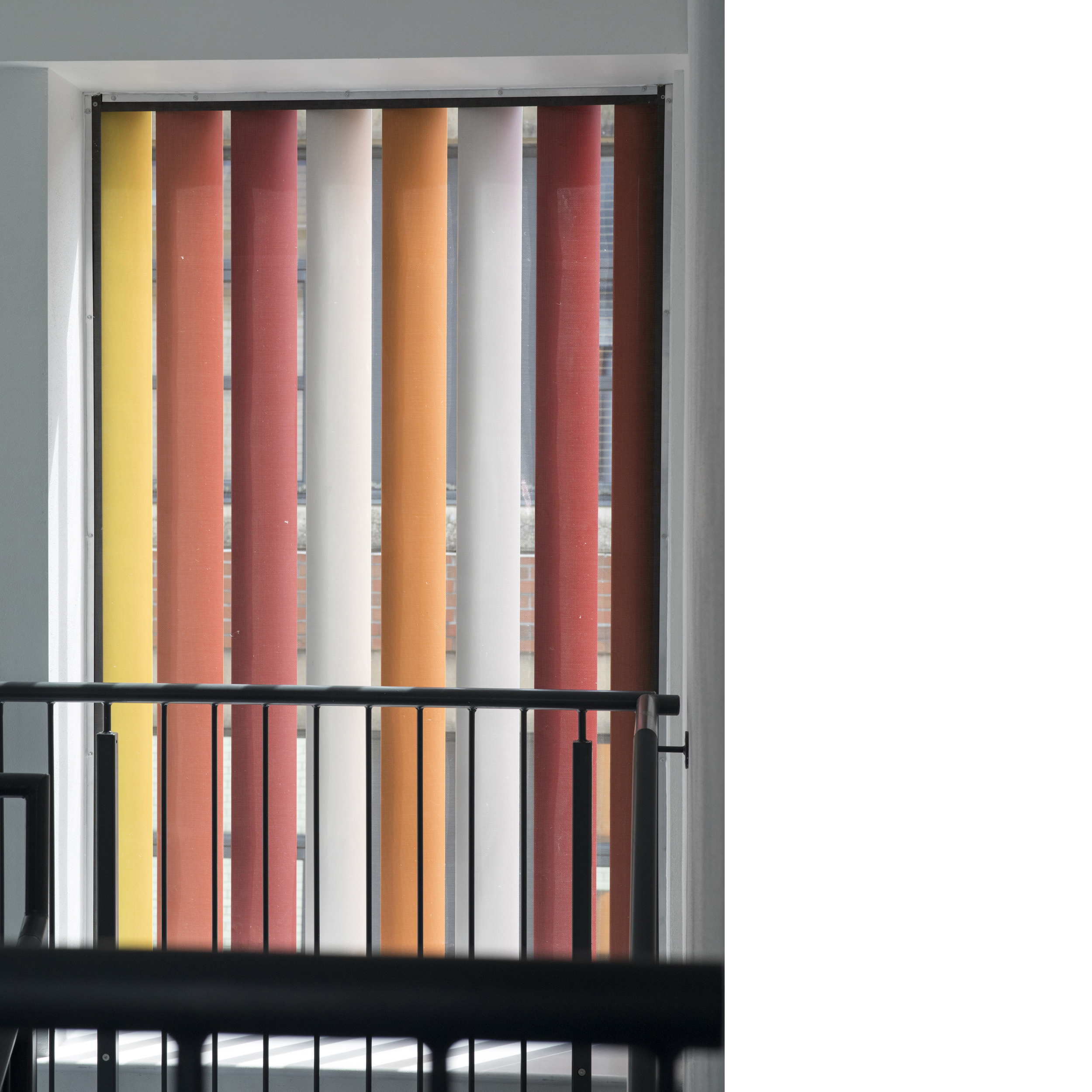
The scheme uses a repetition in the manner of the local Victorian streets to give a rhythm to the elevations. The windows were finished in a complimentary grey colour whilst the vibrant coloured panels reference the brightly painted shop fronts in the North Laine.
Choose a few key elements you want to promote
The proposal makes an important contribution to the City's housing supply and the provision of affordable housing within the central area of the City. The buildings offer a modern and contemporary design solution for what are constrained development sites but nevertheless the resulting buildings preserve the character of the North Laine conservation area making a positive and vibrant contribution to the city centre.